10 of the Best Hikes Near Grande Prairie, Alberta
My hometown might be synonymous with “big flat land,” but that doesn’t mean you can’t hike in the prairies! In remote northern Alberta, we’re used to travelling long distances, so it’s not uncommon to drive three to four hours roundtrip for a two- to three-hour hike. With the mountains only a couple of hours drive away, hiking trails are plentiful, uncrowded (except for wildlife) and full of natural beauty.
Bring bear spray, a hiking buddy and your sense of adventure.
Wapiti Nordic Ski Club Trails
Length: 35 km total
Elevation Gain: Varies
These trails are a local favourite for trail runners, mountain bikers and hikers of all levels. Pick up a $6 day pass or a seasonal or annual membership and check out the trail map before exploring the WNSC trails. In the summer, all trails are dog-friendly and multi-use.
Read more: Click here
Lost Lake Loop, Evergreen Park
Length: 9 km
Elevation Gain: 144 m
Travel through mixed forest, swamps and boardwalks just south of the Grande Prairie Golf & Country Club. Evergreen Park is known for hosting events like the Northern Spirit Light Show and the local stompede. Take care when trekking this trail, as the name “lost” isn’t a misnomer—the trail isn’t well-marked, so it’s highly recommended to download the map or keep the AllTrails app open.
Read more: Click here
Muskoseepi Reservoir Trail
Length: 3 km
Elevation Gain: Minimal
Muskoseepi is Cree for “Bear Creek.” Located next to Grande Prairie Regional College, this loop trail circles the reservoir and Muskoseepi Pond. Parking, public washrooms and a nearby playground make it a family-friendly trail. In the winter, skaters can enjoy the ice on the pond; in summer, Bear Creek Folk Festival overtakes Borstad Hill. The trails extend from the north side of town to the south with rolling hills and paved paths.
Read more: Click here
Wapiti-Dunes & Tamarack Trail
Length: 7.1 km
The county maintains nearly 30 kilometres of multi-purpose trails for Grande Prairie residents and visitors. With easy terrain to explore year-round, this paved path south of the city is accessible for strollers, mobility aids and e-bikes. It’s even plowed in the winter so you can enjoy the snowy views without getting your boots wet. Be prepared for some sections with loose gravel and steep inclines.
Read more: Click here
Mount Ambler, Grande Cache
Length: 10.9 km
Elevation Gain: 518 m
This trek is part of the Passport to the Peaks program. Follow the pink tape to the peak, watching out for snow. You’ll find yourself above the world with stunning mountain peaks spread out before you. Completing this trek might take a total of eight hours, including driving time from GP. Hiking poles and sturdy hiking boots are recommended.
Read more: Click here
Mount Stearn, Grande Cache
Length: 15 km
Elevation Gain: 1,025 m
More difficult than the previous Grande Cache hike, this trail is also part of the Passport to the Peaks program. Bring plenty of food and water to replenish while enjoying the beautiful views of wildflowers from the windy summit. Crampons or snowshoes are recommended. Embrace the serenity of nature while working up a sweat! If travelling from Grande Prairie, you should plan for a 10- to 11-hour day.
Read more: Click here
Kinuseo Falls, Tumbler Ridge
Length: 0.5 to 4 km return
Elevation Gain: Varies
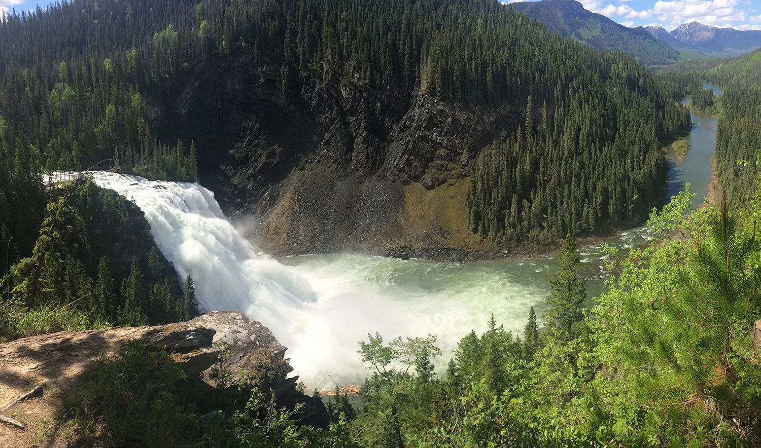
A lovely day trip from Grande Prairie, this hiking trail provides jaw-dropping views of an immense, powerful waterfall that drops 70 metres—nearly 20 metres higher than Niagara Falls! Trace the water’s edge through the trees or stay on the accessible wooden viewing platform, listening to the pounding falls. Despite the astounding beauty, this area is often quiet and uncrowded. In 1914, Samuel Prescott Fay claimed, “…tourists would travel a long distance to see” the falls. He named them “Kinueso,” Cree for fish.
Read more: Click here
Shoreline Trail, O’Brien Provincial Park
Length: 4.2 km
Elevation Gain: Minimal
Follow the rushing Wapiti River on this short loop trail through the trees. Biking is allowed, though the trail is primarily used by hikers. You might spot river boats, bonfires and cougar tracks. Afterwards, hang a hammock and enjoy lunch at the day use area in O’Brien Park. Facilities include fire pits, picnic tables and pit toilets.
Read more: Click here
Red Willow Falls, Elmworth
Length: 2.6 km
Elevation Gain: Minimal
This trail is short, steep and sweet, ending at a grey-rock waterfall. Exercise caution when swimming and be wary of the water levels. Consider enjoying a picnic at the water’s edge before hiking back up. Be aware that one section involves using a rope to navigate up and down a tricky slope.
Read more: Click here
Kleskun Hills, Bezanson
Length: 1.4 km
Elevation Gain: Minimal
This unique area features striking some of Alberta’s northern-most badlands. You might spot rare wildflowers, native grasslands, wild onions and cacti. Kids and dogs will love exploring the geographical landscape and adults might feel like they’ve stepped back in time. Visit the Kleskun Hills Museum after your hike to learn about the site’s old buildings and farming equipment historic to the area.
Read more: Click here
Read more:
                        <div class="articleLink">

                            <div class="articleImage"><a href="5-family-friendly-outdoor-adventures-near-Edmonton-AB" class="imageBox" style="background-image: url('https://explore-mag.com/wp-content/uploads/2024/02/photo_203914_max-jpg.webp');"> </a></div>

                            <a href="5-family-friendly-outdoor-adventures-near-Edmonton-AB" class="articleLinkTitle">5 family-friendly outdoor adventures near Edmonton, AB</a><br>
                            <div class="articleLinkText">LTA Ambassador Stephanie shares some kid-friendly adventure spots near Edmonton, AB</div>
                            <a href="5-family-friendly-outdoor-adventures-near-Edmonton-AB" style="float: right;">Read More ></a>
                            <div class="clearfix"></div>
                        </div>


                        <div class="articleLink">

                            <div class="articleImage"><a href="Albertas-25-Best-Hikes" class="imageBox" style="background-image: url('https://explore-mag.com/wp-content/uploads/2024/02/header_67452_max.png');"> </a></div>

                            <a href="Albertas-25-Best-Hikes" class="articleLinkTitle">Alberta's 25 Best Hikes</a><br>
                            <div class="articleLinkText">Rocky Mountain alpine - milky lakes - wide open plains - hoodoos and more</div>
                            <a href="Albertas-25-Best-Hikes" style="float: right;">Read More ></a>
                            <div class="clearfix"></div>
                        </div>


                        <div class="articleLink">

                            <div class="articleImage"><a href="Close-to-Home-Cycling-Calgarys-140-km-Rotary-Mattamy-Greenway" class="imageBox" style="background-image: url('https://explore-mag.com/wp-content/uploads/2024/02/photo_293592_max-jpg.webp');"> </a></div>

                            <a href="Close-to-Home-Cycling-Calgarys-140-km-Rotary-Mattamy-Greenway" class="articleLinkTitle">Close to Home: Cycling Calgary's 140-km Rotary Mattamy Greenway</a><br>
                            <div class="articleLinkText">The Greenway circles Calgary, but using two additional major pathways that intersect the city, we were able to cycle from a central start point and back.</div>
                            <a href="Close-to-Home-Cycling-Calgarys-140-km-Rotary-Mattamy-Greenway" style="float: right;">Read More ></a>
                            <div class="clearfix"></div>
                        </div>


