


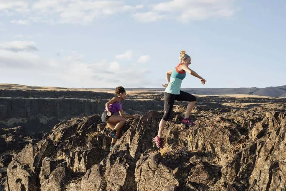
10 of Canada’s Best High Adrenaline Hikes

Another great article brought to you by
Canada’s greatest wonder is her natural beauty. From scaling cliffs to meandering through valleys, the vast wilderness and varied terrain makes our nation one of the most coveted countries in the world for hiking enthusiasts. No surprise here that we’re a nation of outdoor enthusiasts.
With the arrival of spring we wanted to celebrate the hikes that get the hearts racing; trails that include the thrill of scrambling. With routes ranging from easy through hard, here are ten of Canada’s most rewarding, adrenaline-inducing hikes.
1. Montana Mountain
Carcross, Yukon
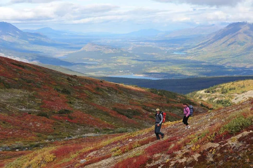
Length: 9 km
Time: 3-4 hours
Difficulty: Moderate
Elevation Gain: 618 metres
This historic mining road was built by pioneers (including the real Sam McGee, immortalized in the classic poem The Cremation of Sam McGee) in the early 1900’s to supply material for the Mountain Hero tramway. Today, the route from the Sam McGee Trail to Mountain Hero is a challenging yet rewarding hike, with loose stone, tricky climbs and steep sections. Keep an eye out for mountain bikers, who frequently utilize the trail.
Read more about Montana Mountain: http://www.yukonhiking.ca/sam_mcgee.html
2. Mount Seymour Summit
North Vancouver, BC
Length: 9 km
Time: 5 hours
Difficulty: Moderate
Elevation Gain: 450 metres
Mount Seymour’s hiking trails lead to panoramic views of the Lower Mainland. The trail is easy to navigate, with obvious signs and painted orange rocks pointing towards the summit. There are three peaks to conquer: First Pump Peak, Second Pump Peak and Mount Seymour Peak, the last of which offers the best view. Be prepared to encounter tourists in the busy summer months. This is especially the case on weekends, but getting an early morning start will help avoid the crowds.
Read more about Mt Seymour Summit: outdoorvancouver.ca/featured-trail-mount-seymour
3. Black Tusk
Garibaldi Provincial Park, BC

Length: 29 kilometres (return)
Time: 9-11 hours
Difficulty: Hard
Elevation Gain: 1,740 metres
Black Tusk is a popular yet strenuous hike. The jagged, black chimney that protrudes from the mountain is an iconic landmark, visible from Whistler and surrounding area. BC Parks strongly discourages climbers from attempting to reach the peak due to dangerous loose shale. No matter where you decide to end your hike, the stunning sight of alpine wildflowers and landscape of volcanic rock will be well worth the scramble. 29 kilometres is a tough go for most people. For a less extreme experience, camp at Elfin Lakes and conquer Black Tusk as a day trip from there.
Read more about Black Tusk: vancouvertrails.com/trails/black-tusk
4. Sea to Summit Trail
Squamish, BC

Length: 7.5 km (one way)
Time: 3-5 hours
Difficulty: Moderate-Hard
Elevation Gain: 918 metres
Once inaccessible, this newly developed route through a beautiful forest brings hikers to the summit of the Sea to Sky Gondola. The hike results in refreshing views of Howe Sound and Sky Pilot. Stay for lunch at the Summit Lodge or soak up some sunshine on the patio. Challenging aspects of this climb include fixed rope lines and extremely steep sections. It is recommended to take the gondola back down.
Read more about Sea to Summit Trail: seatoskygondola.com/sea-to-summit-trail
5. Mount Cheam
Chilliwack, BC
Length: 9.5 km
Time: 4.5 hours
Difficulty: Moderate
Elevation Gain: 700 m
Getting to the trailhead of Mount Cheam is half of the adventure. A 4-wheel drive is required to tackle the rough logging road. Once you reach the marked trailhead, you’ll have to hop over a pile of logs. Follow the trail past Spoon Lake as it zigzags around the mountain in a series of switchbacks. As you climb, the vegetation gives way to loose gravel. On a clear day, the summit of Mount Cheam rewards hikers with spectacular views across the Fraser Valley.
Read more about Mount Cheam: vancouvertrails.com/trails/mount-cheam
6. Devil’s Thumb
Banff/Lake Louise, AB
Length: 5.1 km
Time: 3-4 hours
Difficulty: Hard
Elevation Gain: 778 m

Beginning at the pristine, turquoise waters of Lake Louise, take the Lake Agnes Trail up to the rustic teahouse. Only experienced hikers should forge beyond, as the trail to Devil’s Thumb is difficult and deteriorated. The extended scramble results in a breathtaking photo-opt, with the glimmering waters of Lake Agnes and Lake Louise both visible from the peak.
Read more about Devil’s Thumb: Click here
7. Sulphur Skyline
Jasper, AB

Length: 8 km
Time: 4-6 hours
Difficulty: Moderate
Elevation Gain: 700 m
The hike to the summit of Sulphur Skyline is a relentlessly steep ascent that yields a luscious panorama of the surrounding mountain ranges. Be prepared for changing weather conditions in the high alpine meadows. After your hike, slip into Miette Hot Springs (where the hike begins and ends) to rejuvenate your sore muscles.
Read more about Sulphur Skyline: hikejasper.com
8. Trans-Canada Trail in Cypress Hills Interprovincial Park
Alberta/West Block
Length: 8.3 km (one way)
Time: 3-6 hours
Difficulty: Easy
Elevation Gain: 127 m
Cypress Hills Interprovincial Park is comprised of south eastern Alberta and south western Saskatchewan. The hills are covered in lodgepole pines, blessed with crisp, fresh air and enjoyed by hikers, naturalists and cyclists. The Trans-Canada Trail includes a moderately strenuous climb that leads to views across Alberta, Saskatchewan and Montana. The top of this plateau is the highest point between the Rockies and Labrador. If you want to up the adrenaline factor, this area is well suited to trail-running and speed hiking.
Read more about Cypress Hills’ Trans-Canada Trail: cypresshills.com/hiking-alberta
9. Top of the Giant Trail
Thunder Bay, ON

Length: 22 km (round-trip)
Time: 4-6 hours
Difficulty: Difficult
Elevation Gain: 289 m
Sleeping Giant Provincial Park has a range of hikes from easy, coastal walks to overnight adventures. One of the most popular routes is the Top of the Giant Trail. At the scenic lookout, hikers can soak up a clear view of Lake Superior. Note: weather conditions on and around Lake Superior are known to change rapidly.
Read more about Sleeping Giant: northernontario.travel/hiking-to-the-top-of-the-giant
10. Mount Carleton Trail
New Brunswick
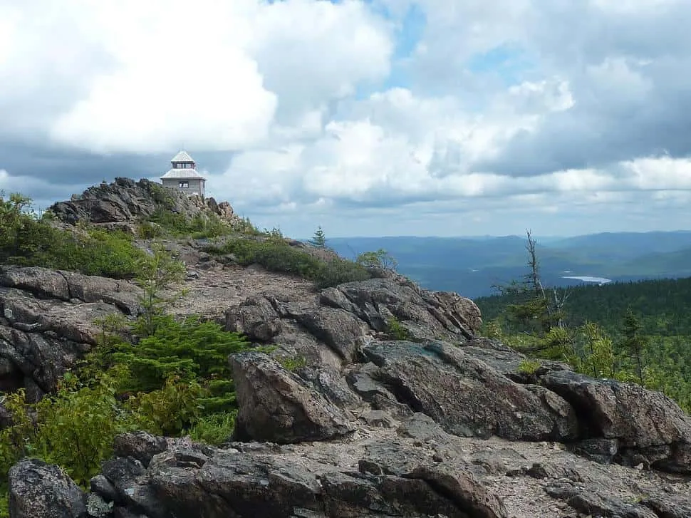
Length: 9.9 km (loop)
Time: 3-4 hours
Difficulty: Moderate
Elevation Gain: 411 m
The Mount Carleton Trail leads to the highest point in the Maritime Provinces, with views stretching into Maine and Quebec. There are two trails to get to the summit that can be combined to make a loop. Climb the ridgeline along the rocky West Trail through mixed forest and over large boulders, then loop around and take the tamer East Trail back past the old towerman’s cabin, where the men who worked at the fire tower lived in the 1900’s.
Read more about Mount Carleton Trail: out-there.com/mt_carlt
What did you think of our round-up?
Have you done any of these hikes?
Leave us a comment below or tweet us!

This article was brought to us by our friends at Merrell. Embrace your inner mountain goat in the Merrell Capra Bolt. Made for high-adrenaline hikes, its grippy outsole lets you move confidently on terrain. See more at merrell.ca
Related content on Explore
12 Summits You Can Reach This Weekend
6 Weekend-Worthy Micro-Adventures (Chosen by 6 Amazing Adventurers!)


