


15 of the Best Hiking Trails Near Whistler, British Columbia


Nearly three million people visit Whistler every year for world-class skiing, downhill mountain biking and breathtaking hiking trails. Whistler Village is the perfect starting place for a number of incredible hikes, ranging from multi-day backcountry treks to do-able day hikes.
We’ve compiled a list of 15 of our favourite trails in the Whistler area you have to see to believe. Trust us—photos barely do Whistler justice.
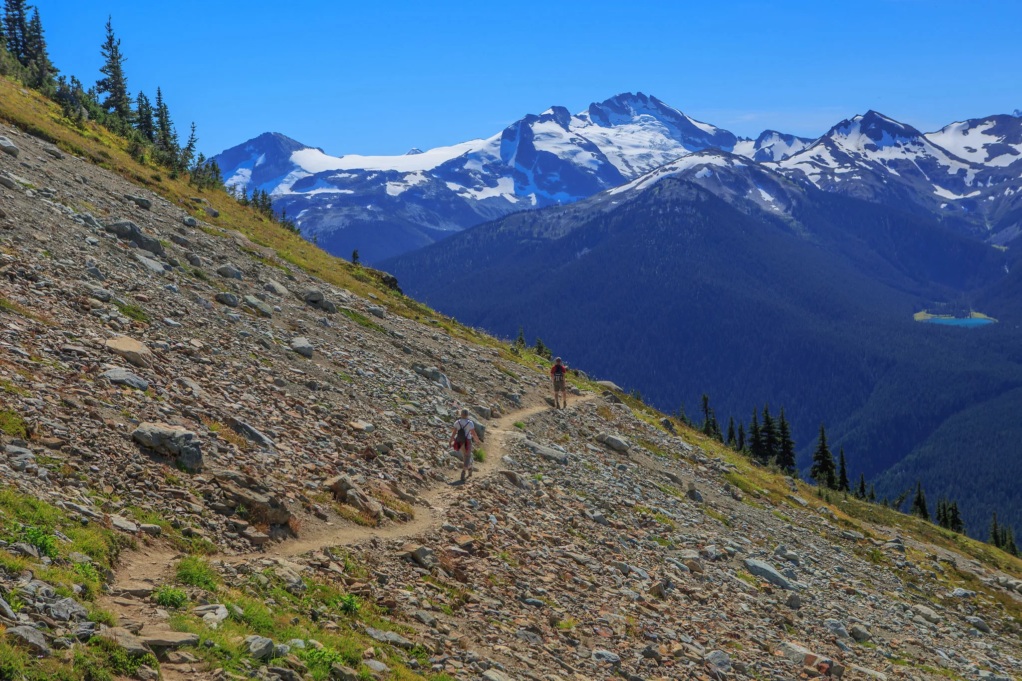
High Note Trail
Whistler Mountain
 Flickr/Murray Foubister (CCby-SA2.0)
Length: 9.4 km one-way
Duration: 3 – 4 hours
Elevation gain: 258 m
Difficulty: Moderate
Glimpse Cheakamus Lake and Black Tusk as you pass over rocky outcrops, babbling brooks and snowy mountain bike trails on this varied, scenic hike. Be prepared for steep and chain-assist sections. Dogs are not allowed.
How do I get to the trailhead? Take the Whistler Gondola and Peak Chairlift to the top of Whistler Mountain.
Day pass required? No.
Read more: whistler.com
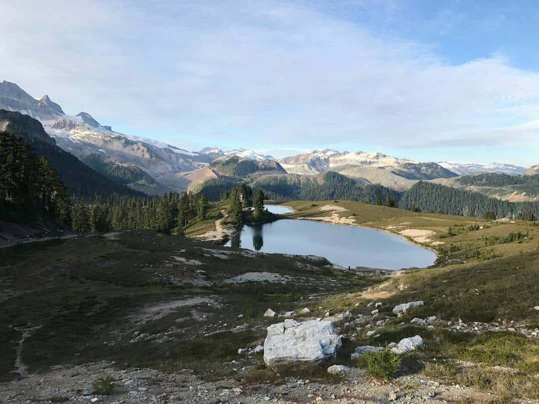
Singing Pass to Russet Lake
Garibaldi Provincial Park
Length: 29.1 km
Duration: 11 hours
Elevation gain: 1,632 m
Difficulty: Hard
This difficult trek will reward you with beautiful views. Attempt the hike in one day or spend a night to preserve your energy. Hiking to the top of this point will treat you to views of Castle Towers, Black Tusk and the rest of Garibaldi.
How do I get to the trailhead? The trailhead is located at Roundhouse Lodge in Whistler Village.
Day pass required? Yes, book one here.
Read more: alltrails.com
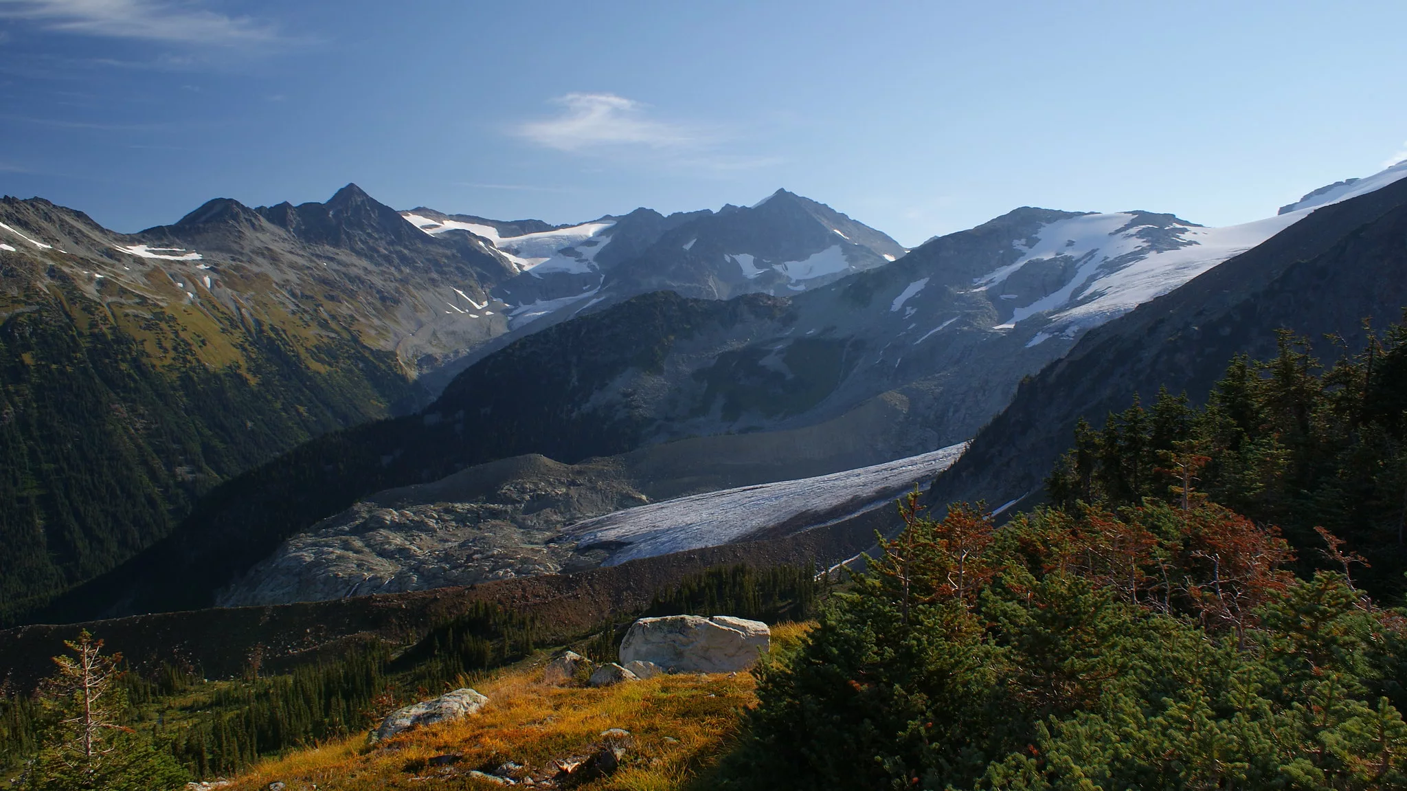
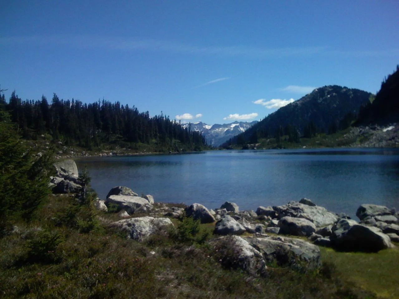
Overlord, Lakeside and Decker Loop
Blackcomb Mountain
 David Webb
Length: 9.5 km
Duration: 3 – 4 hours
Elevation gain: 545 m
Difficulty: Moderate
A must-do on Blackcomb, this iconic trail yields views of alpine wild flowers and snow-capped mountains. Sun, solitude, wildlife and flora abound in this natural paradise. As you hike this trail, you’ll come across a variety of scenic viewpoints.
How do I get to the trailhead? Take the Blackcomb chairlift up to the alpine visit. Chairlift fee applies.
Day pass required? No.
Read more: alltrails.com
Black Tusk
Garibaldi Provincial Park
Length: 28 km
Duration: 9 – 11 hours
Elevation gain: 1,740 m
Difficulty: Difficult
Recognizable even from a distance, Black Tusk protrudes off the top of the mountain like an arrowhead. Although this hike is notoriously difficult, the alpine wildflowers, mountaintop vistas and bragging rights alone are worth the trek.
How do I get to the trailhead? Hike the entire trail from the Rubble Creek parking lot, or shave it down to 14 km by leaving from Garibaldi Lake Campground.
Day pass required? Yes, book one here.
Read more: outdoorvancouver.ca
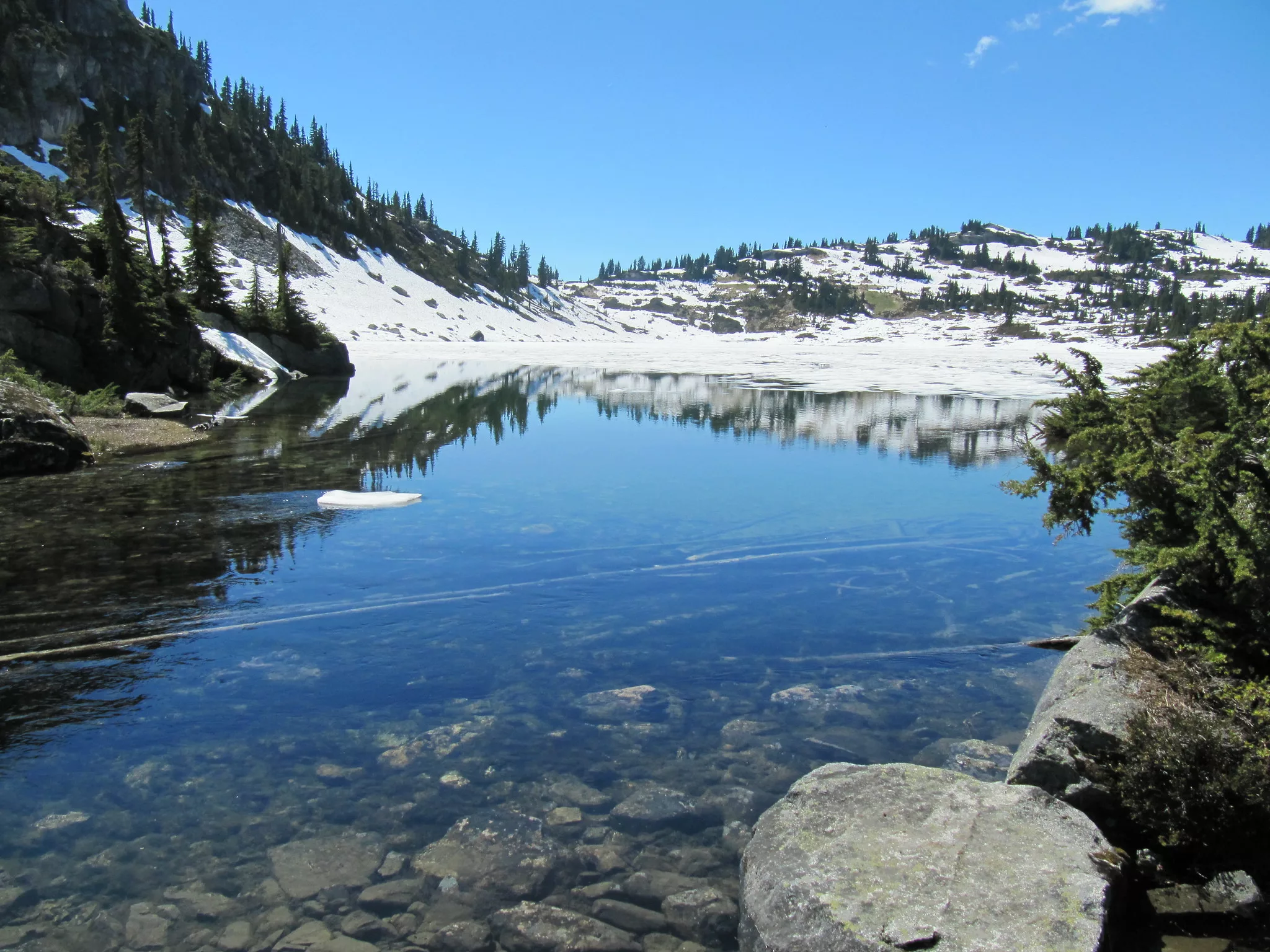
Panorama Ridge
Garibaldi Provincial Park
 Flickr/Harold Cechetti (CCby-SA2.0)
Length: 30 km round-trip
Duration: 10 – 12 hours or camp overnight
Elevation gain: 1,520 m
Difficulty: Difficult
If you’re anything like me, you hike for the views. Accurately named, Panorama Ridge bursts with scenic sights of Garibaldi Lake, Black Tusk, Mount Price and more. It’s a long, difficult trek, so many hikers opt to spread the distance over two days and camp at Garibaldi Lake Campground or Taylor Meadows.
How do I get to the trailhead? The trailhead is located at the top section of the Rubble Creek parking lot, near the wooden steps.
Day pass required? Yes, book one here.
Read more: outdoorvancouver.ca
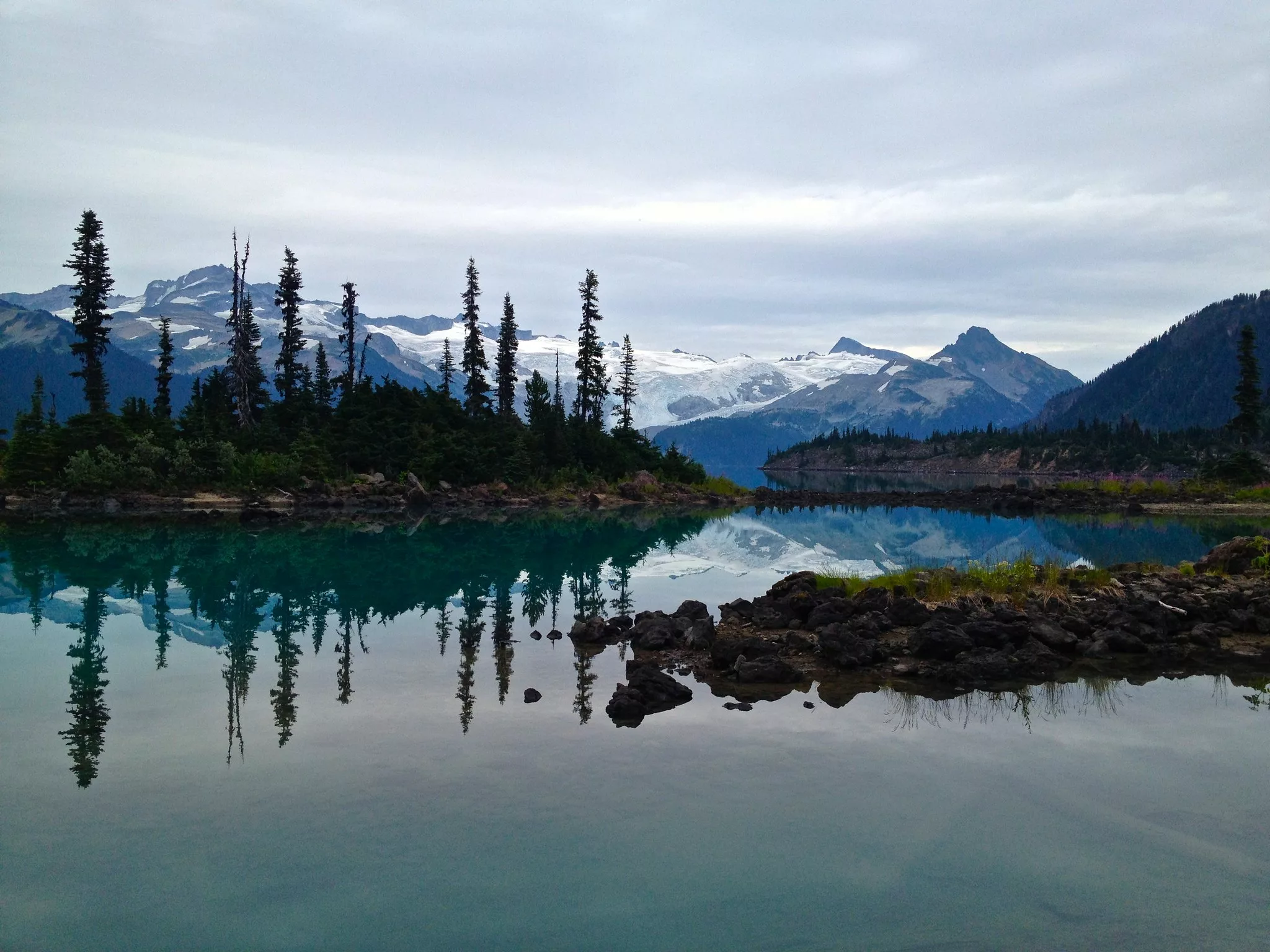
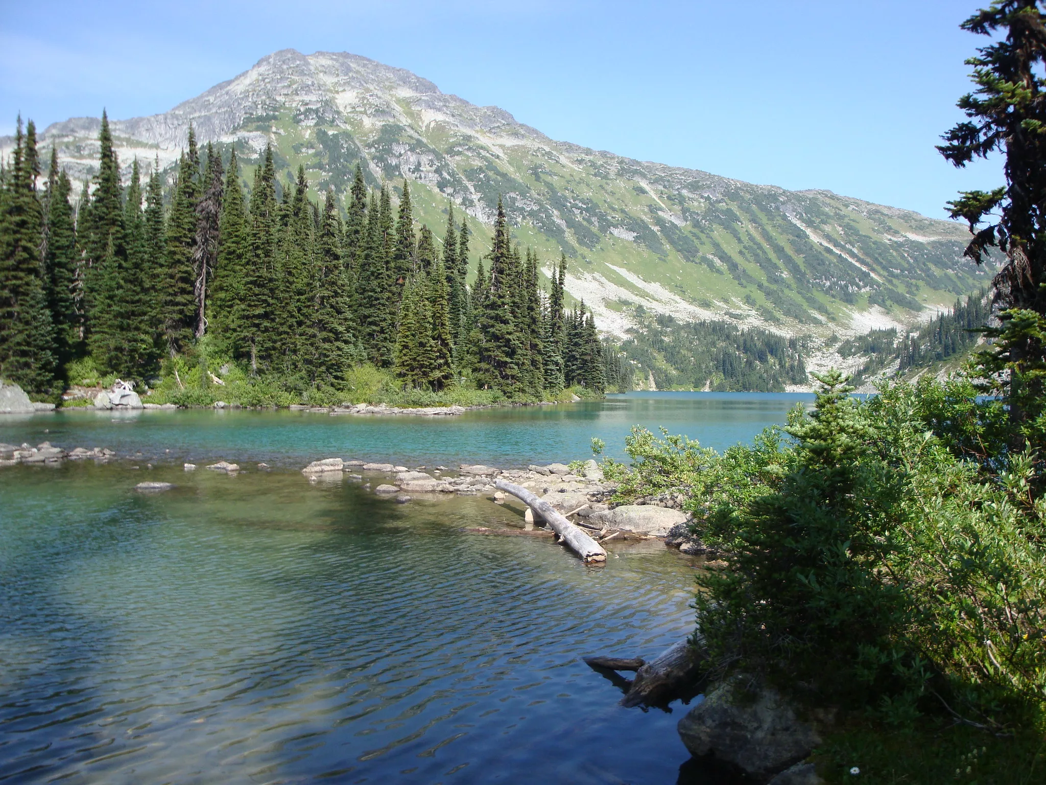
Garibaldi Lake
Garibaldi Provincial Park
 Flickr/janebelindasmith (CCby2.0)
Length: 18.2 km round-trip
Duration: 4 – 6 hours
Elevation gain: 980 m
Difficulty: Hard
Renowned as one of the most stunning spots in British Columbia, this glacier-fed lake is surrounded by mountain peaks and alpine meadows. If you want to stay a little longer (trust us: you’ll want to), reserve a tent pad in advance.
How do I get to the trailhead? The trailhead is located at the top section of the Rubble Creek parking lot, near the wooden steps.
Day pass required? Yes, book one here.
Read more: alltrails.com
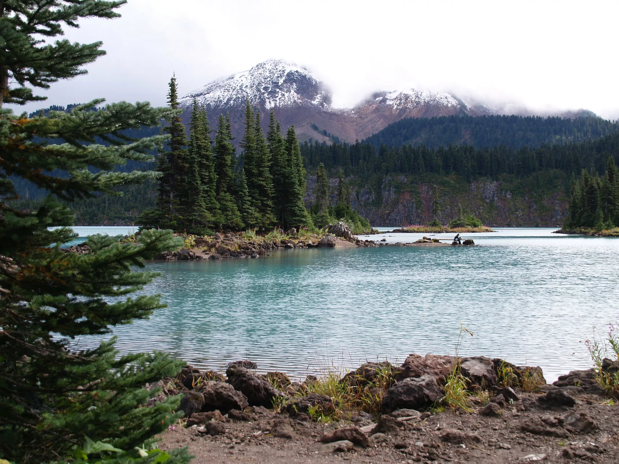
Elfin Lakes
Garibaldi Provincial Park
 Renato Lazzarini
Length: 22 km round-trip
Duration: 5 – 6 hours
Elevation gain: 600 m
Difficulty: Intermediate
Mountain bikers and hikers use this trail to access two lakes: one is safe for swimming, the other safe to drink from. Both are beautiful. The surrounding area has a well-equipped shelter, which is primarily used in the winter, and a 35-site campground.
How do I get to the trailhead? The trailhead is located in the Diamond Head lot, past the yellow gate.
Day pass required? Yes, book one here.
Read more: vancouvertrails.com
Semaphore Lake
Pemberton Valley Alpine
 Flickr/Barbara Guida (CCby2.0)
Length: 5.8 km round-trip
Duration: 2 – 3 hours
Elevation gain: 400 m
Difficulty: Hard
This alpine lake is a great destination for hike-in campers that don’t want to carry their gear an absurd distance. Trek around Locomotive and Face Mountain for beautiful views of the lake and valley.
How do I get to the trailhead? Continue along the road until you see the fork to Hurley. Drive up past the 14-kilometre mark and park at the pullout to the left.
Day pass required? No.
Read more: alltrails.com
Joffre Lakes
Joffre Lakes Provincial Park
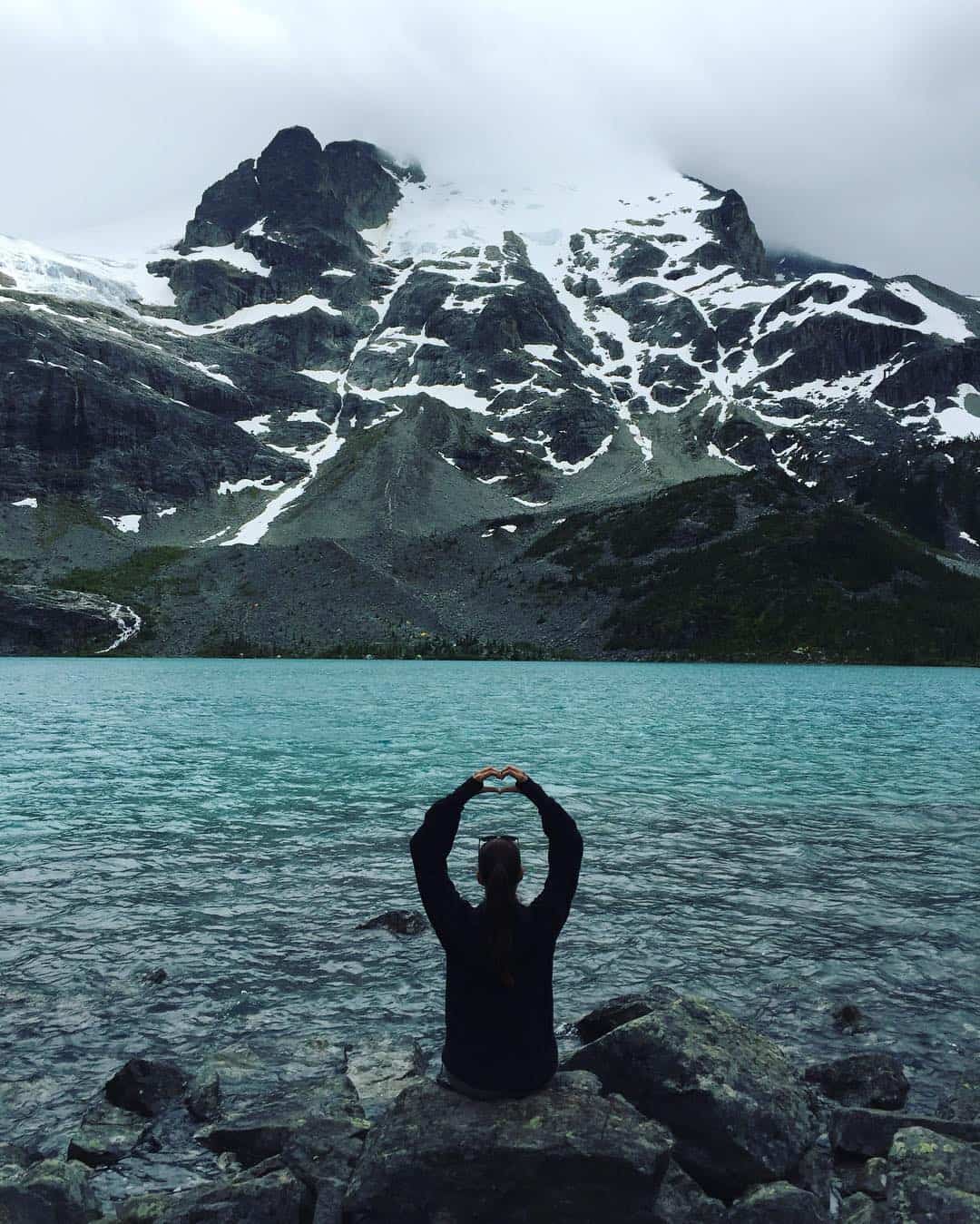
Length: 10 km
Duration: 3 – 5 hours
Elevation gain: 370 m
Difficulty: Intermediate
Not one, not two, but three stunning glacial lakes have given this excellent hike Instagram-fame. Climb onto the log at Middle Joffre Lake for a classic photo-opt or pop up a tent along the rocks at the summit, overlooking Upper Joffre Lake. There is a urine diversion toilet and a bear-proof food storage unit, but carry-in carry-out camping rules apply.
How do I get to the trailhead? Drive north of Whistler, past Pemberton, and pull off when you see the sign for Joffre Lakes Provincial Park.
Day pass required? Yes, book one here.
Read more: vancouvertrails.com
Rohr Lake
Duffey Lake
Length: 10.5 km
Duration: 6 – 7 hours
Elevation gain: 1,826 m
Difficulty: Difficult
Hike next to glaciers and trek through forest to Rohr Lake. Then, if desired, continue into the alpine of Rohr Mountain. Be prepared for snowy sections along this very steep incline.
How do I get to the trailhead? This trail starts from the highest point on Duffy Lake Road.
Day pass required? No.
Read more: outdoorvancouver.ca
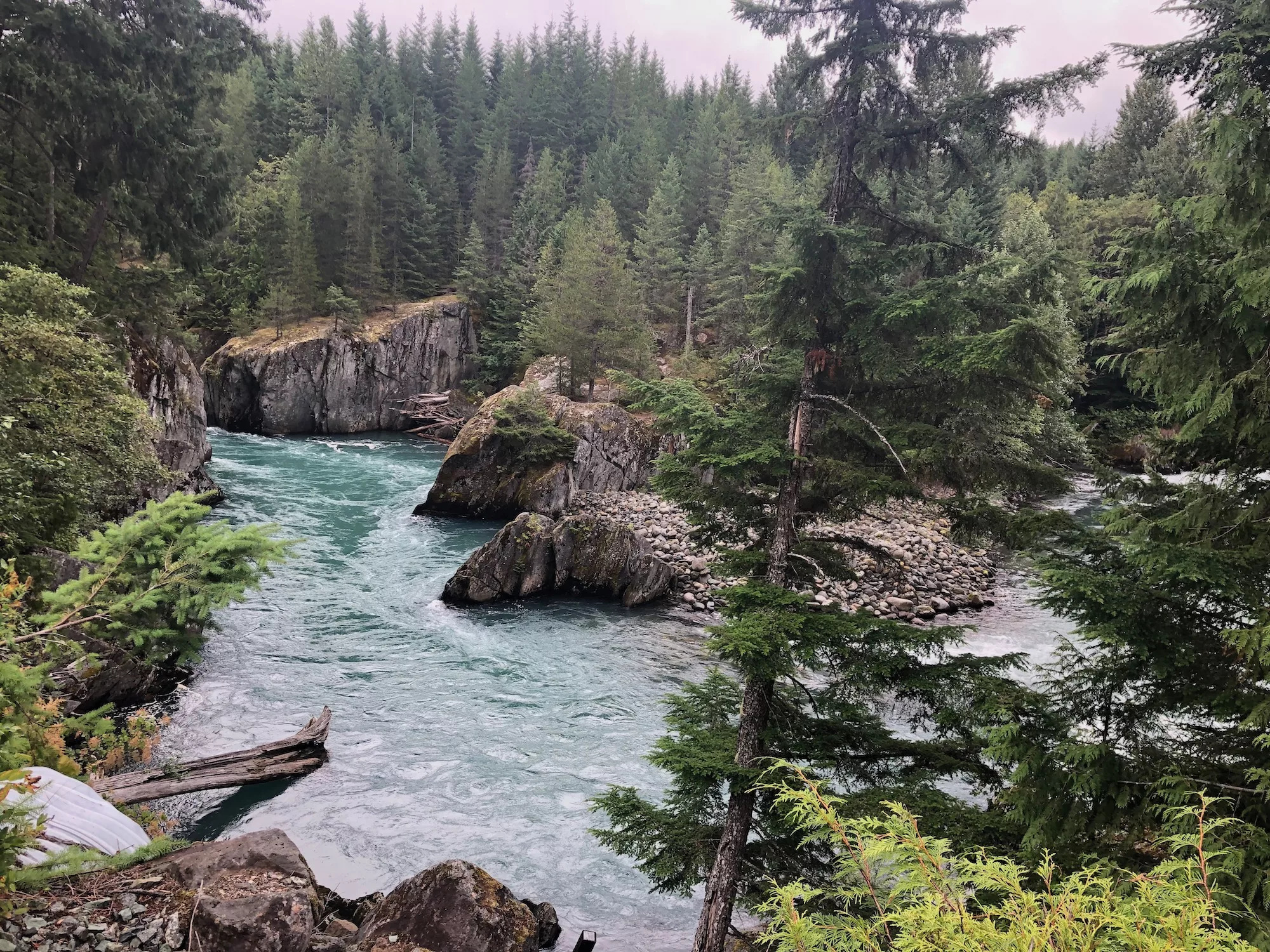
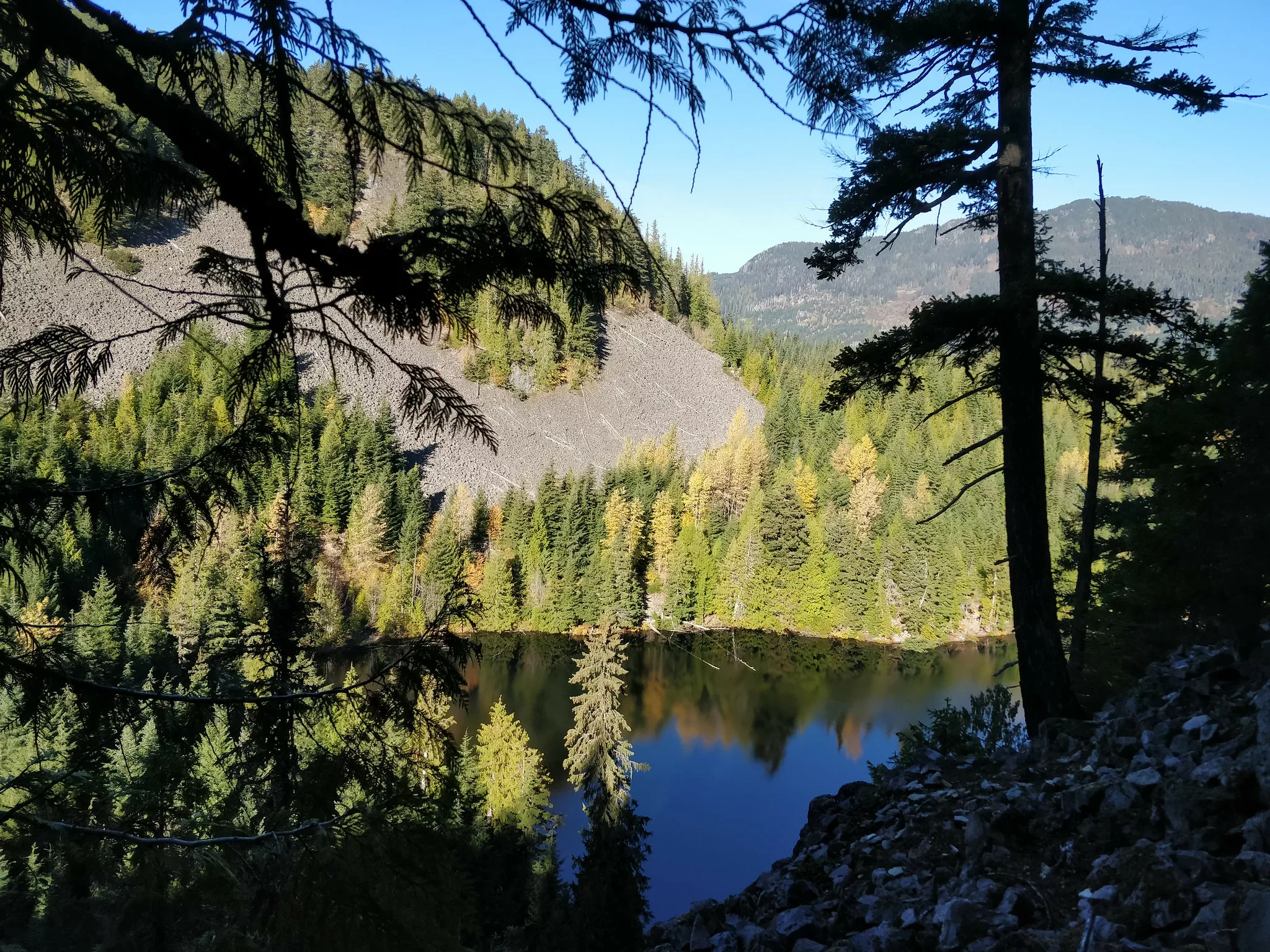
Whistler Trainwreck and Millar Creek Trail
Whistler Interpretive Forest
 Izzy Cheung
Length: 5.8 km
Duration: 1 – 2 hours
Elevation gain: 109 m
Difficulty: Easy
This quick, easy hike is open year-round for Whistler visitors to enjoy at all times. While on this trail you’ll encounter the site of a derailed train covered in graffiti, beautiful glacial waterfalls and a glimpse at the mighty Cheakamus River.
How do I get to the trailhead? Accessible from the parking lot.
Day pass required? No.
Read more: alltrails.com
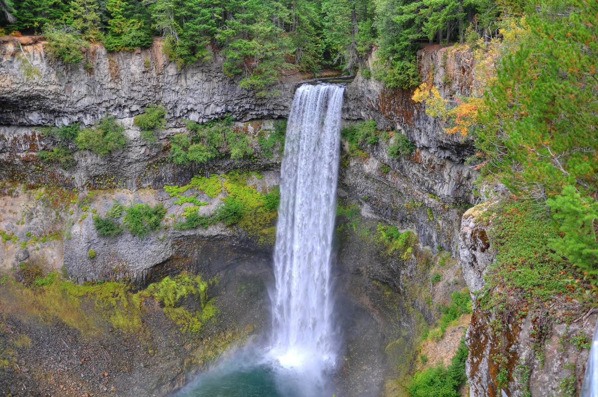
Brandywine Trail
Brandywine Falls Provincial Park
 Flickr/Kyle Pearce (CCby-SA2.0)
Length: 5.8 km
Duration: 1 – 2 hours
Elevation gain: 154 m
Difficulty: Easy
Brandywine Trail has a little bit of everything: majestic mountain views, wide waterfalls and train tracks. This trail will also take you to Whistler bungee jump and bridge, where outdoor adventure thrill-seekers can get their blood pumping to their heart’s content.
How do I get to the trailhead? Accessible from the parking lot.
Day pass required? No.
Read more: alltrails.com
Rainbow Lake Trail
Whistler, British Columbia
Length: 15.6 km
Duration: 5 – 6 hours
Elevation gain: 872 m
Difficulty: Hard
Depending on timing, Black Tusk and blooming flowers are both visible from Rainbow Lake Trail. On the way to the lake, this trail stops by Rainbow Falls, then takes you through the shaded forest.
How do I get to the trailhead? Accessible from the parking lot.
Day pass required? No.
Read more: alltrails.com
Iceberg Lake via 19 Mile Creek Trail
Cheakamus Community Forest
 Flickr/Andre Charland (CCby2.0)
Length: 15 km
Duration: 7 – 8 hours
Elevation gain: 870 m
Difficulty: Moderate
This out-and-back trail lets hikers enjoy the scenic views twice. While the initial trek is a gradual incline, returning from the lake treats those who hike it to a less-strenuous journey. True to its name, you may see some icebergs floating around the lake.
How do I get to the trailhead? From the cul-de-sac at the top of Mountain View Drive, turn left at the trail sign for Lower 19 Mile Creek.
Day pass required? No.
Read more: vancouvertrails.com
Crater Rim Trail
Whistler Interpretive Forest
Length: 4.5 km
Duration: 2 hours
Elevation gain: 230 m
Difficulty: Moderate
Crater Rim Trail takes hikers past Loggers Lake, which is situated in an extinct volcano. The trek continues throughout the forest and offers views of the mountains as well as Garibaldi Provincial Park.
How do I get to the trailhead? Accessible from the parking lot.
Day pass required? No.
Read more: vancouvertrails.com
Did we miss your favourite Whistler-area hike?
Be sure to tell us—comment below!
Related content on Explore:
25 Incredible Hiking Trails in British Columbia
13 Caves to Explore in British Columbia
The Best Hidden Hot Springs in British Columbia


