


15 of the Best Hiking Trails near Squamish, British Columbia


Sixty-four kilometres from Vancouver, on the far side of some of the most stunning highway scenery this side of the 49th parallel is Squamish—one of BC’s most famous natural playgrounds.
For the wilderness lover, Squamish has it all: mountains, rivers, lakes, endless trails and good coffee. Presiding over it all is the weather-streaked monolith of the Chief. If you’re looking for some hiking, Squamish is a great place to go. Here are 15 of our favourite trails to get you started.
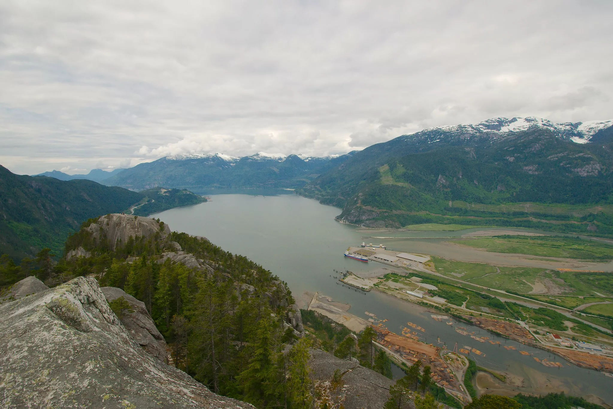
Al’s Habrich Ridge Trail
Sea to Sky Gondola
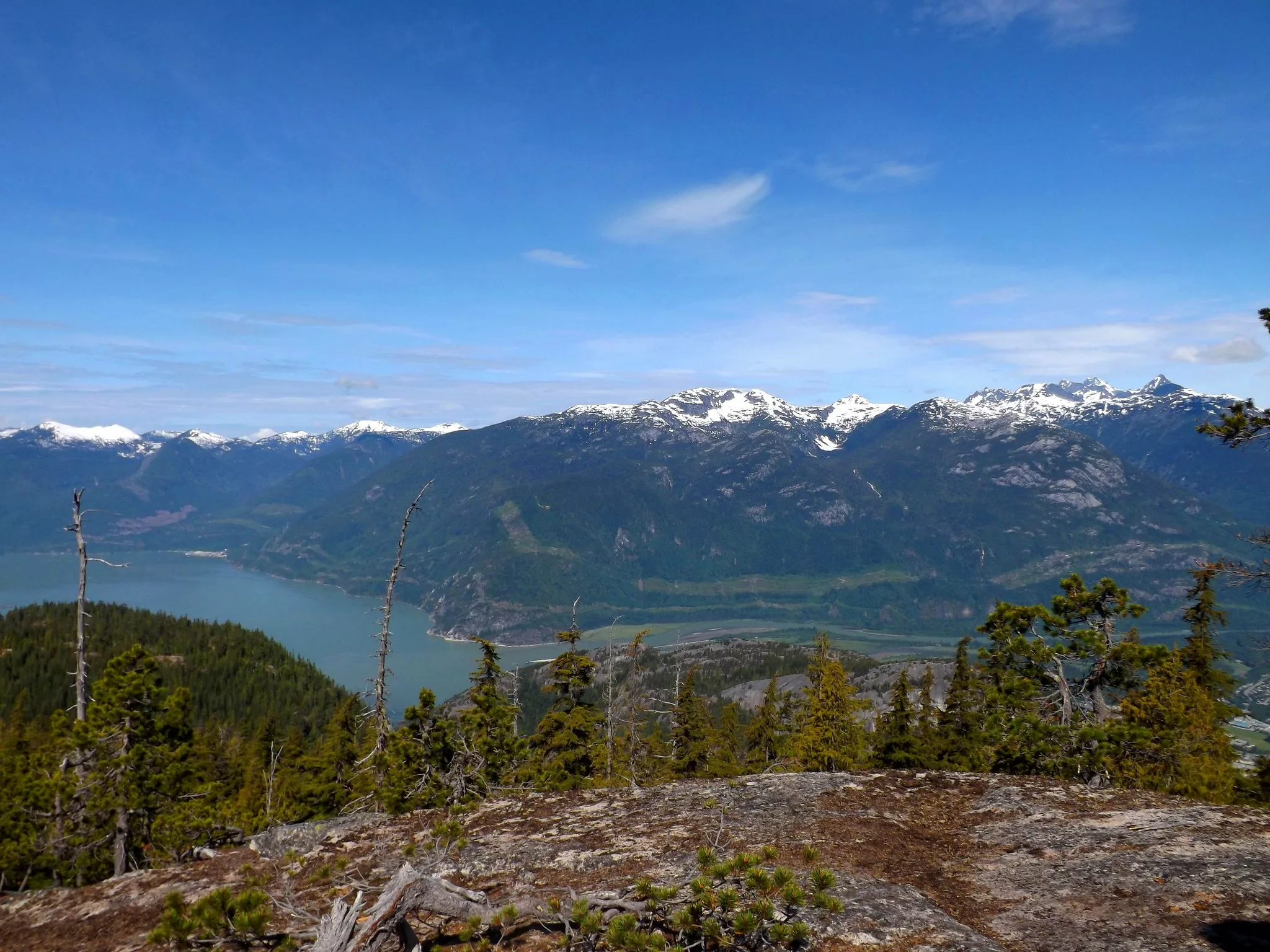
Length: 7 km
Duration: 4 – 5 hours
Elevation gain: 440 m
Difficulty: Moderate
How do I get to the trailhead? The trailhead for this hike is at the top of the Sea to Sky Gondola, so prepare to pay for a round-trip ticket.
The elevation gain-to-view ratio on this hike makes it a worthwhile pursuit since the gondola ride covers the bulk of the elevation. From the top of the gondola, climb upwards among big, widely-spaced trees before topping out on the bare granite slab that characterizes many Squamish hikes, and enjoying a view of the town, the river, and the impressive mountain ranges behind it. Follow the trail past the lookout for a few hundred meters and you’ll find a little lake marking the end of the hike.
Read more about this hike: vancouvertrails.com
Sky Pilot Valley Trail
Sea to Sky Gondola
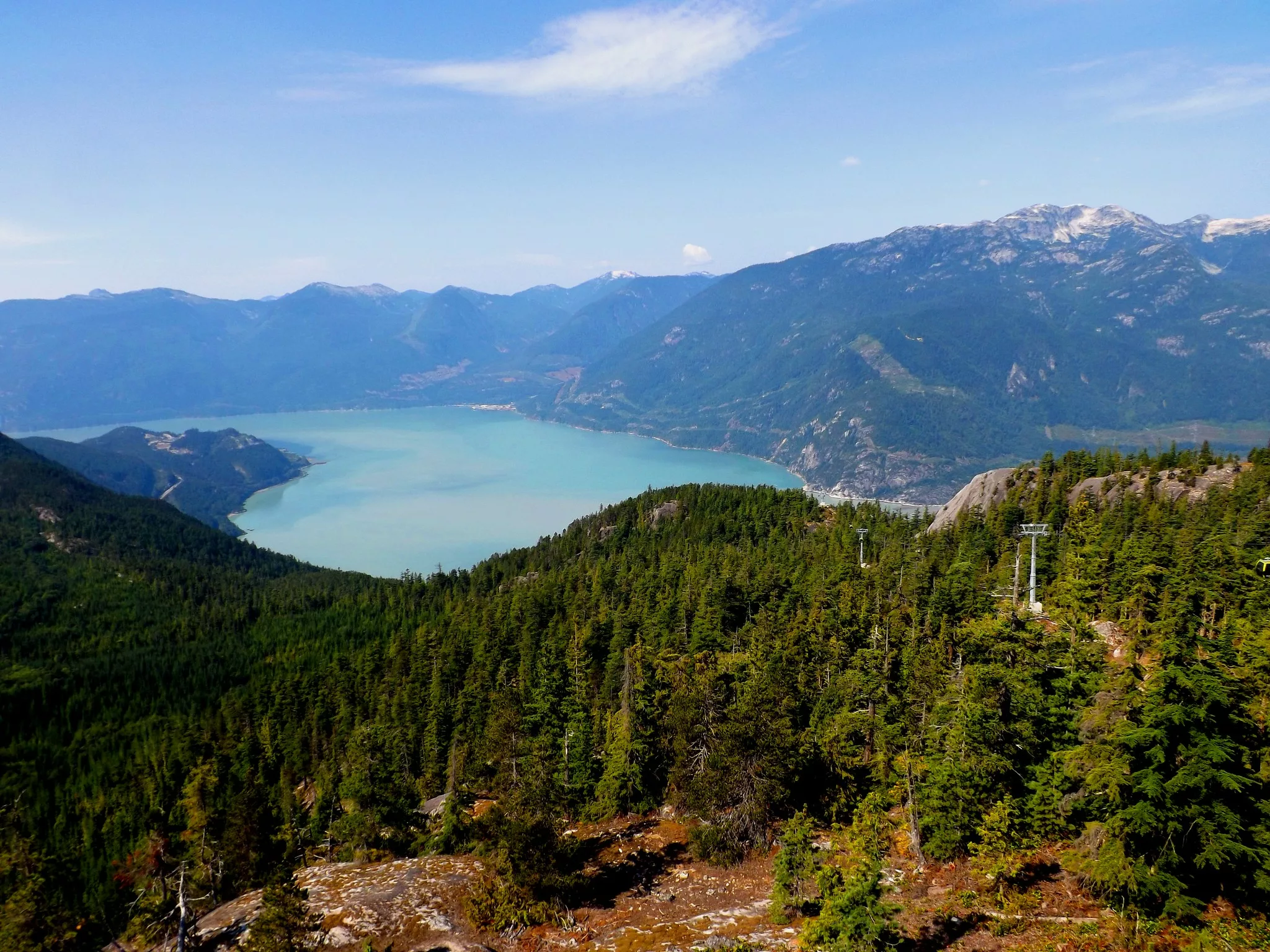
Length: 10 km
Duration: 3 – 4 hours
Elevation gain: 350 m
Difficulty: Moderate
How do I get to the trailhead? This trail also starts at the top of the Sea to Sky Gondola.
Get up close and personal with Mt. Habrich and Sky Pilot. This trail ascends gently from the Summit Lodge to the base of Sky Pilot, offering much more intimate views of both mountains than lodge visitors enjoy. As you approach Sky Pilot, look out for waterfalls—but don’t go past the end of the marked trail, as the terrain beyond should only be attempted by experienced mountaineers with the appropriate gear.
Read more about this hike: seatoskygondola.com
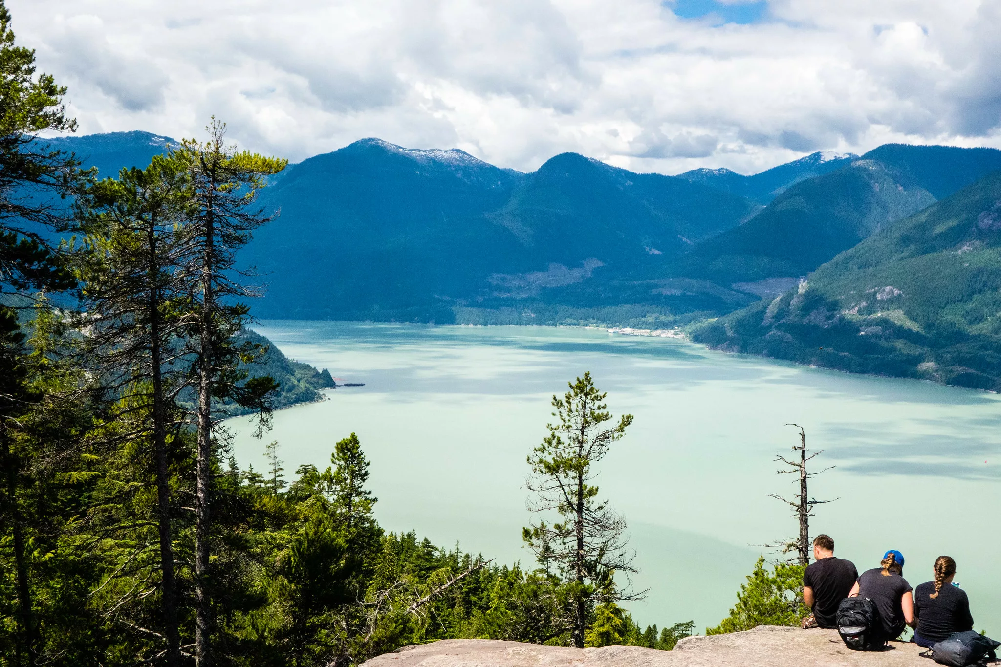
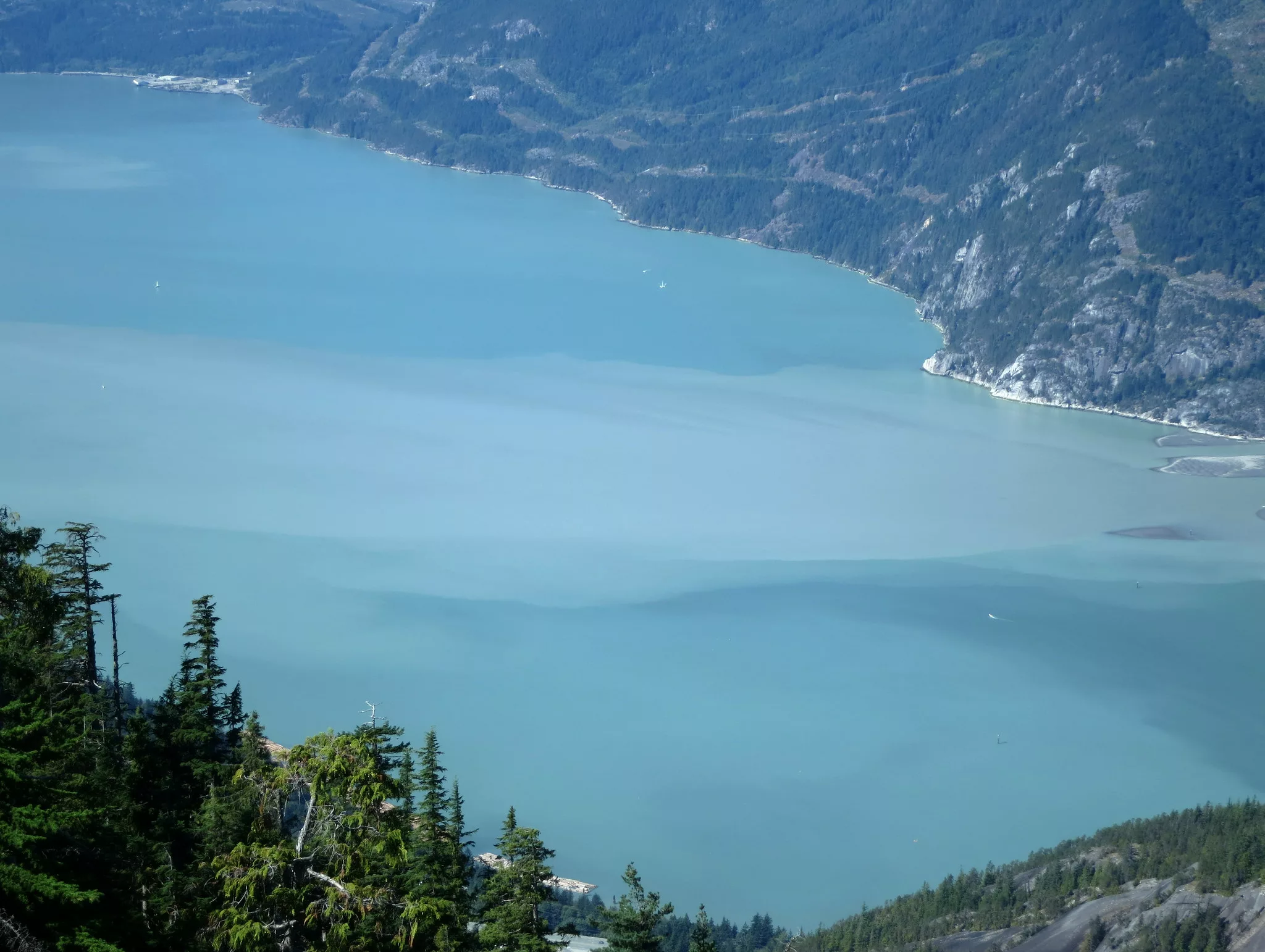
Sea to Summit Trail
Sea to Sky Gondola
 Flickr/Imogene Huxham (CCby2.0)
Length: 6.5 km (one way)
Duration: 3 – 5 hours
Elevation gain: 918 m
Difficulty: Hard
How do I get to the trailhead? The official entrance to this trail is at the Sea to Sky Gondola parking lot. However, the Sea to Summit hike can also be accessed from the Chief trail. Hikers are encouraged to take the Gondola down.
The Sea to Summit trail’s mossy evergreens, granite lookouts and steep climbs will feel very familiar to hikers who have hiked the Chief. But this hike is longer and more varied, with flatter sections and patches of deciduous trees. The reward at the top is the Sea to Sky Gondola’s patio, where you can purchase refreshments, put up your feet and enjoy the panoramic view of Squamish, Howe Sound and the Tantalus Mountain Range.
Read more about this hike: seatoskygondola.com
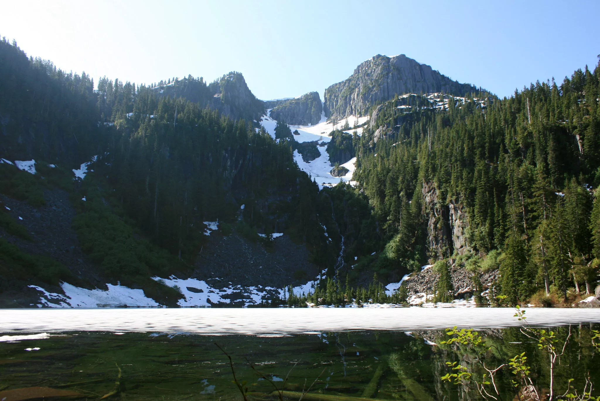
Skyline Ridge Trail
Sea to Sky Gondola
Length: 24 km (return)
Duration: 6 – 8 hours
Elevation gain: 700 metres
Difficulty: Hard
How do I get to the trailhead? The Skyline trail begins from the Backcountry Access Road at the top of the Sea to Sky Gondola. You’ll need to purchase a ticket to access this hike.
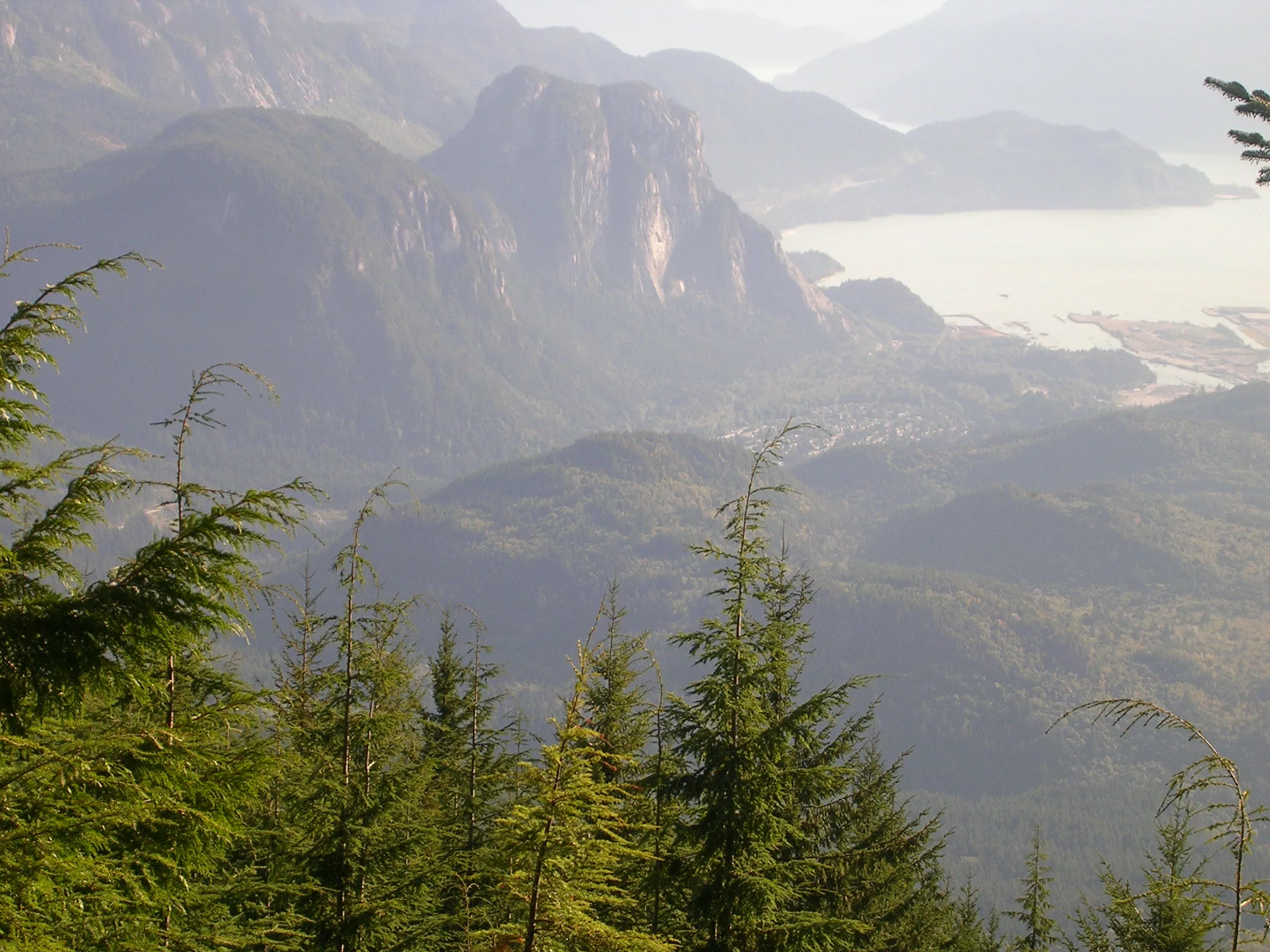
Forest road, cut-blocks, old-growth and alpine meadows all feature in this varied and beautiful hike. The ridgeline offers stunning views of the surrounding peaks, including Mt. Habrich and Sky Pilot.
Read more about this hike: seatoskygondola.com
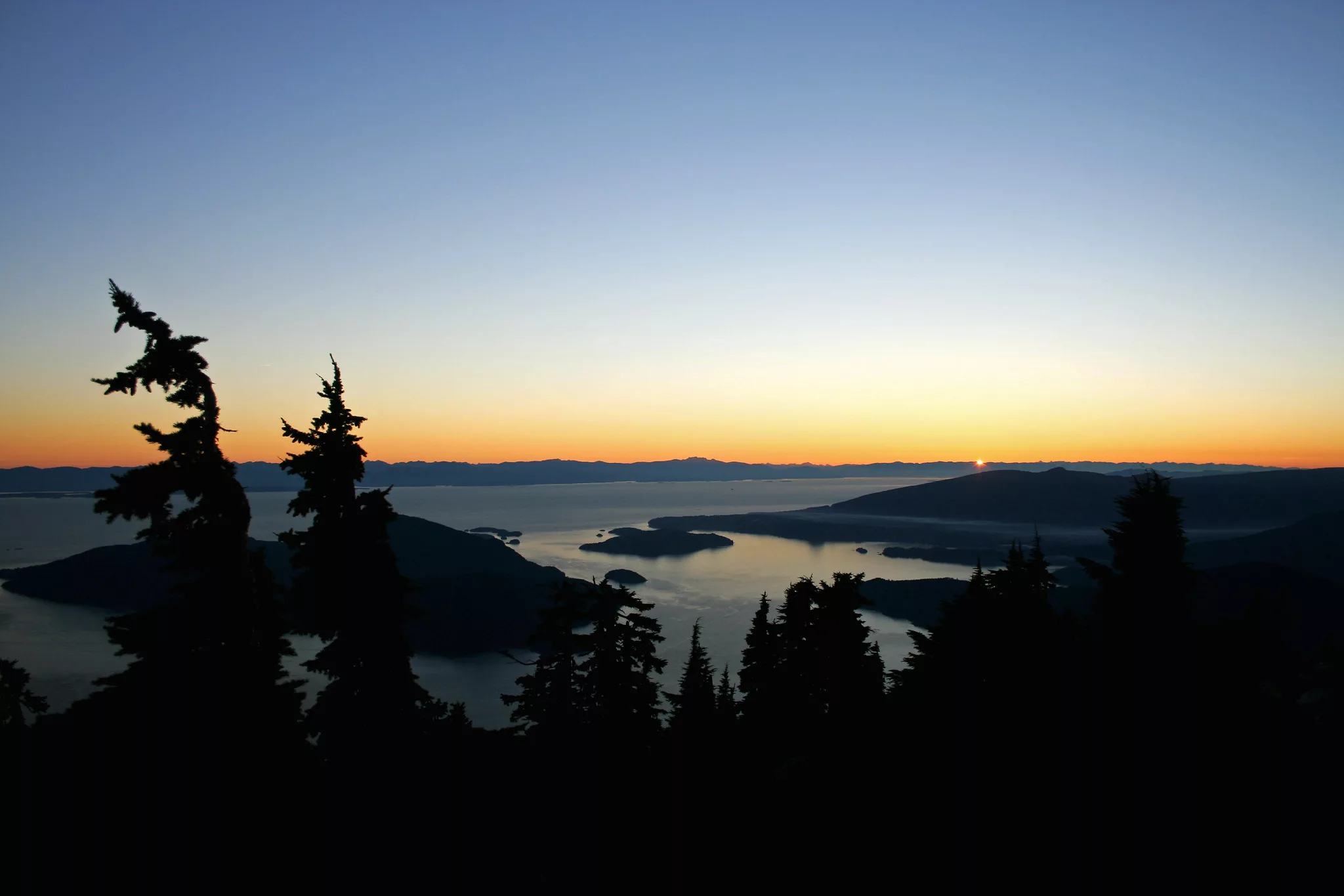
Howe Sound Crest Trail
Cypress Provincial Park
 Flickr/Bradley Davis (CCby2.0)
Length: 29 km
Duration: 1 – 2 days
Elevation gain: 2,502 m
Difficulty: Challenging
How do I get to the trailhead? The HSCT can be completed in either direction. The southerly trailhead is located at the Cypress ski hill parking lot. The northerly trailhead is in Porteau Cove. Most hikers complete in one direction and shuttle between parking lots.
Maintaining an elevation many hundreds of meters above Howe Sound, the HSCT offers stunning views and varied terrain. The trail passes through lush meadows and alpine lakes, summiting several peaks along the way.
Read more about this trail: alltrails.com
The Stawamus Chief, First Peak
Stawamus Chief Provincial Park
 Flickr/Sébastien Launay (CCby2.0)
Length: 3.7 km
Duration: 2 – 3 hours
Elevation gain: 535 metres
Difficulty: Hard
How do I get to the trailhead? The trailhead is at the Chief parking lot. On sunny weekends and any summer day, the lot can fill up quickly. Head out early to avoid taking multiple laps to find a spot.
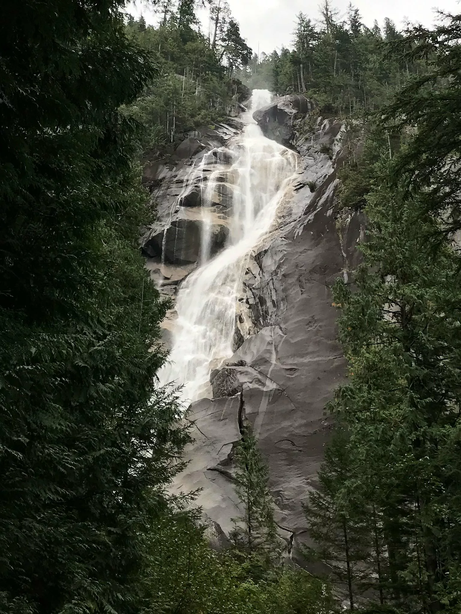
Roots, rocks and a solid uphill climb make this short hike challenging, but the granite playground and panoramic views at the top make it worthwhile. Take a break from the (literal) staircase at the start of the hike to check out lower Shannon Falls. For a longer, less crowded adventure, follow the signs for the third peak instead.
Read more about this trail: alltrails.com
Slhanay Peak Trail
Stawamus Chief Provincial Park
Length: 7 km
Duration: 5 – 6 hours
Elevation gain: 625 m
Difficulty: Moderate
How do I get to the trailhead? This hiking trail is accessible from the Chief’s backside.
Past the typical Chief peak trails, Slhanay Peak leads into rocky terrain. The trail is steep and scrambly in sections. However, the view of the Chief, the inlet and the valley from the top is second-to-none.
Read more about this trail: outdoorvancouver.ca
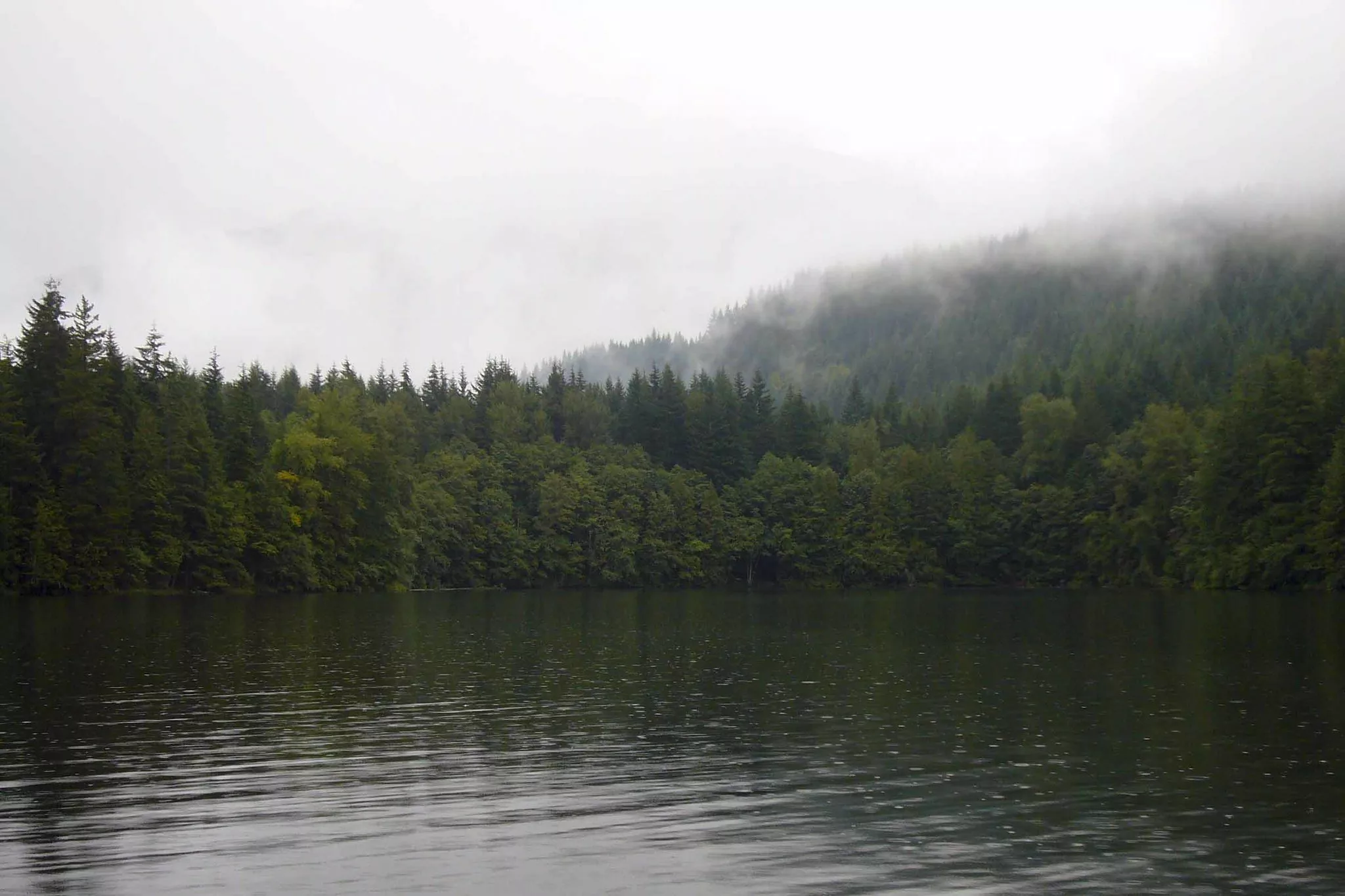
Beth Lake via Furry Downing Road
Squamish, British Columbia
Length: 17.2 km
Duration: 5 – 7 hours
Elevation gain: 1,009 m
Difficulty: Hard
How do I get to the trailhead? From highway 99, take the Furry Creek Drive exit to Sea View Drive and turn left. The trailhead is at the bottom of the road.
This trail follows a logging road for about seven kilometres before ducking up into the trees past Beth Creek. Some people opt to take a mountain bike up this portion for a speedier descent. The trail climbs up through cut block and old growth trees, finally reaching Beth Lake—a pretty mountain lake framing a rocky peak beyond.
Note: For a more challenging adventure, continue past Beth Lake for another eight kilometres or so (and another 600 metres of elevation gain) to reach Capilano Mountain and a stunning 360-degree panorama. Be prepared to do some navigation as the trail is poorly marked in some spots.
Read more about this hike: alltrails.com
Four Lakes Trail
Alice Lake Provincial Park
Length: 6.5 km
Duration: 2 – 3 hours
Elevation gain: 146 m
Difficulty: Easy
How do I get to the trailhead? Alice Lake Provincial Park is located about 12 kilometres north of Squamish on the Sea-to-Sky Highway. The trailhead for Four Lakes Trail can be accessed from the Stump Lake Parking Lot or the Alice Lake South Beach lot.
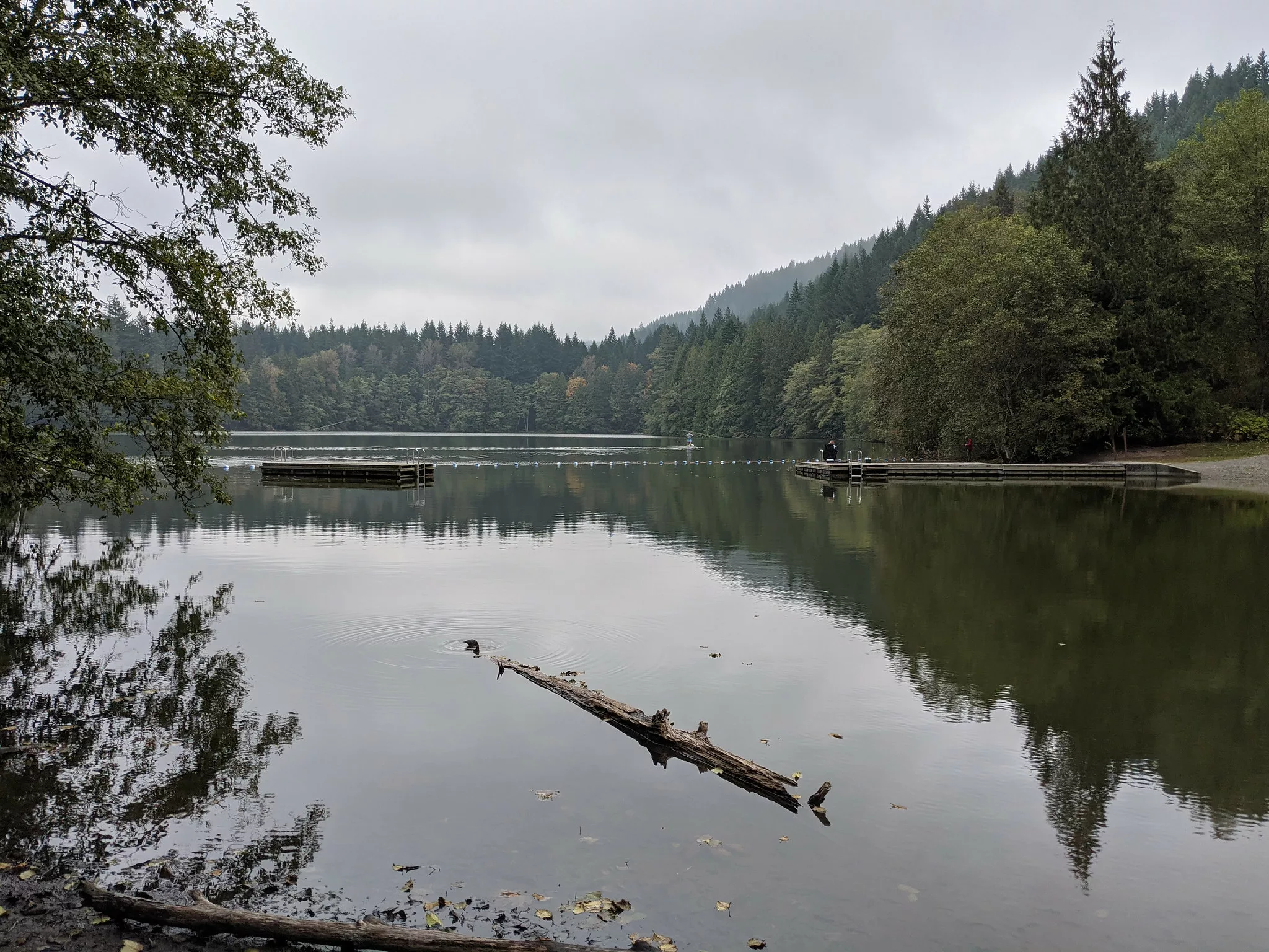
Cross creeks, wander among the trees and stop to take in the lakes. The Four Lakes Trail is a picturesque, family-friendly experience that offers a taste of what Squamish is famous for, and the option of a dip in any of the lakes to cool off. This loop also makes a great trail run. Be on guard for bears and cougars, both of which have been spotted in the area.
Read more about this trail: exploresquamish.com
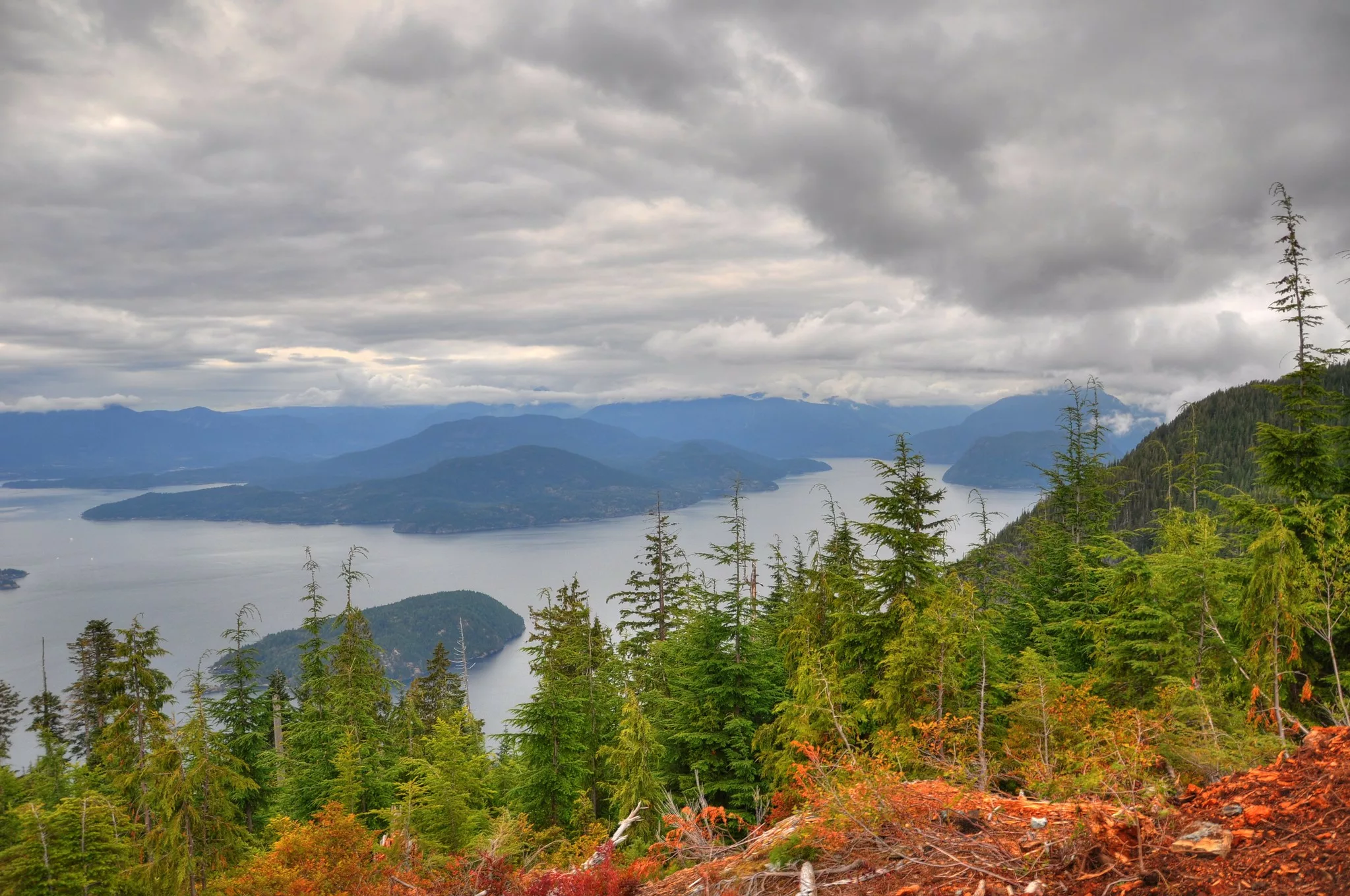
Tunnel Bluffs Lookout
Lions Bay
 Flickr/Kyle Pearce (CCby-SA2.0)
Length: 11.5 km
Duration: 4 – 6 hours
Elevation gain: 470 metres
Difficulty: Moderate
How do I get to the trailhead? A short distance north of Lions Bay, the Tunnel Point rest area is the main parking lot for the Tunnel Bluff hike. The trailhead is across the highway, so be careful crossing.
While the first portion of the Tunnel Bluff hike is an uphill battle akin to the Chief trail, it eventually evens out along a pleasant old logging road flanked with deciduous trees. The view of Howe Sound from the bluff is a stunning piece of eye candy, and well-worth the effort.
Read more about this trail: vancouvertrails.com
Brohm Lake Interpretive Forest
Brohm Lake Day Use Recreation Site
Length: 8.5 km
Duration: 3 – 4 hours
Elevation gain: 407 m
Difficulty: Moderate
How do I get to the trailhead? Accessible from the parking lot.
Hiking at Brohm Lake Interpretive Forest comes with more than just the trek. While some may visit to get their fill of trail exploration, you can also spend time at the lake cooling off after your trek.
Read more about this hike: alltrails.com
Mount Crumpit
Squamish, British Columbia
 iStock
Length: 6 km
Duration: 3 – 4 hours
Elevation gain: 260 m
Difficulty: Moderate
How do I get to the trailhead? The trailhead can be found on Westway Avenue.
Located next to the Stawamus Chief is Mount Crumpit. While not as popular as its next-door neighbour, this peak still treats visitors to stunning views of the Howe Sound. Come prepared for this hike by downloading trail maps as the trail signs throughout are not overly clear.
Read more about this hike: vancouvertrails.com
Shannon Falls Pools Trail
Shannon Falls Provincial Park
Length: 2.4 km
Duration: 1 – 2 hours
Elevation gain: 243 m
Difficulty: Hard
How do I get to the trailhead? Accessible from the parking lot.
Come prepared for this hike by wearing proper hiking shoes. Due to the close proximity to the falls, the trail can get wet and slippery, making this hike more challenging. For those looking to test their strength, parts of this trail include climbing walls with ropes. There are also trails you can take (marked with an orange ribbon) if you don’t want to climb.
Read more about this hike: alltrails.com
Round Mountain
Squamish, British Columbia
Length: 11.4 km
Duration: 4 – 5 hours
Elevation gain: 663 m
Difficulty: Moderate
How do I get to the trailhead? The trail is accessible from the upper parking lot. You can also park two kilometres lower and add four kilometres to the hike.
This trek cuts into the Elfin Lakes Trail and gradually inclines until you reach the top. You’ll catch scenic views of the mountains, water and forest on the way up the trail. Make sure your vehicle has chains if you decide to park at the upper parking lot.
Read more about this hike: alltrails.com
Garibaldi Highlands and Alice Lake
Alice Lake Provincial Park
Length: 12.9 km
Duration: 3 – 4 hours
Elevation gain: 348 m
Difficulty: Moderate
How do I get to the trailhead? Park at Alice Lake and access the trail through there.
You can stick to this trail or follow various other paths throughout Alice Lake. Either way, enjoy the sights and sounds of the lake and forest. Be careful when walking on the trails as these routes are also frequently used by mountain bikers.
Read more about this hike: alltrails.com
More Sea-to-Sky corridor hikes on Explore:
25 Incredible Hiking Trails in British Columbia
20 Dog-Friendly Hiking Trails Near Vancouver, BC
10 of the Best Trails Near Port Moody BC


