


23 Kayak and Canoe Routes in British Columbia

Another great article presented by

Water, water everywhere. An expansive coastline dotted with islands, sounds, channels and fjords, British Columbia is a paddler’s paradise. And if saltwater expeditions don’t suit your fancy, there’s a web of rivers and lakes blanketing our province. Chief among our favourite ways to explore B.C. is by kayak and canoe. We love the remote corners and serene pockets that waterways lead us to. We love spying bears scavenging on shorelines, whales breaching at sea and blooms of pulsating jellyfish. Whether you’re seeking a leisurely half-day paddle, overnighter or multi-day expedition, we’ve assembled a collection of 23 routes and water trails to get you started.
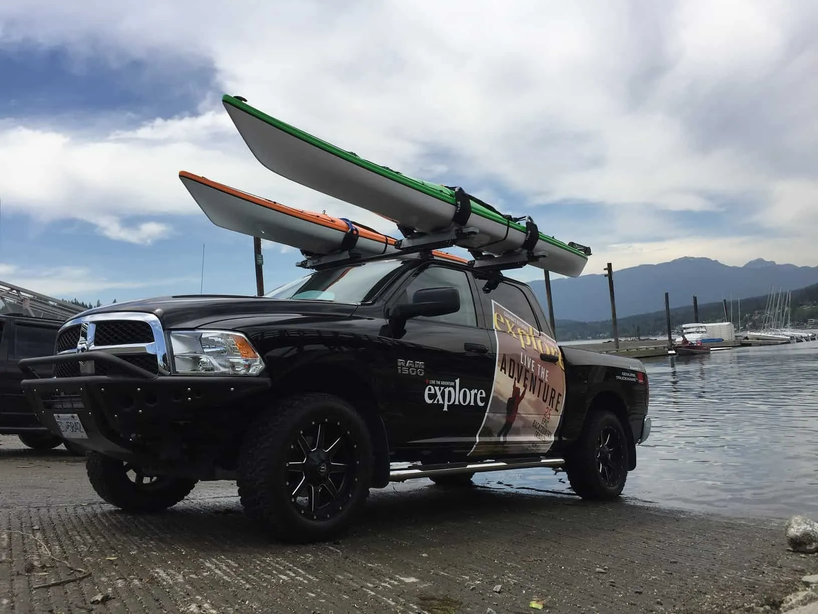
Pictured above is My Passion Media’s official truck, customized by Cap-It. It’s fitted with two Thule Hullavator Pro Kayak Racks.
Kayak & Canoe Trips on Vancouver Island

Johnstone Strait

Location: Telegraph Cove, along the Johnstone Strait, is about 210 kilometres northwest of Campbell River. The community is home to about 20 residents and serves as a launch point for kayakers and whale watchers.
How to get there: Travel via road to Telegraph Cove and launch your kayak from there.
Description: One of the main reasons people kayak in Telegraph Cove is to spy orcas. This is a world-renowned spot to paddles amongst the whales and, in fact, was ranked as the No. 2 on the Lonely Planet’s top 10 list of Canadian adventures.
Distance: The strait itself is 110 kilometres long and between two-and-a-half and five kilometres wide.
Difficulty: Novice kayakers will need to go with a tour group. If you’re intending to cross the strait, know that it is defined as class four and meant for only the most experienced kayakers.
Quadra Island
Location: Quadra Island sits on the north end of the Salish Sea and is one of the dozen islands that make up the Discovery Archipelago. This island is the commercial hub and transportation centre for the residents and workers in the area.
How to get there: Start at Campbell River and take the ferry over.
Description: On Quadra Island, you’ll find stunning beaches and, looking over to Vancouver Island and the mainland, mountain peaks.
Distance: The island itself is about 35 kilometres from end to end, if you wish to paddle around the island or down one of its coasts.
Difficulty: The calm waters around Quadra Island make this place a paddler’s haven.
Denman & Hornby Islands
Location: These northern Gulf Islands are located in the calm waters of the Strait of Georgia, between mainland BC and Vancouver Island.
How to get there: To access Denman and Hornby Islands, you need to catch the ferry out of Buckley Bay, on Vancouver Island. You’ll get to Denman Island first, and a second ferry will take you over to Hornby Island.
Description: Situated in calm waters makes for ideal kayaking, and you’ll get a chance to spot a wide variety of wildlife, including whales, seals, sea lions and birds. Hornby Island offers spectacular white sand beaches.
Distance: If you’re looking to paddle around Hornby Island, the distance is about 25.5 kilometres. From Denman Island, you can paddle to Sandy Island Marine Provincial Park, three small islands known as the Seal Islets, Chrome Island or all the way to Hornby Island when the winds are calm.
Difficulty: In terms of ocean kayaking, paddling around these islands is relatively easy going.
Gabriola Island

Location: An island laying just off the coast of Nanaimo/Cedar, Vancouver Island.
How to get there: Take a 20-minute ferry ride from Nanaimo.
Description: Hidden coves, sandstone coastlines, rainforest, sea life and sandy bays are just some of the reasons paddlers gravitate to Gabriola Island. You can take in the majestic Malaspina Galleries, paddle to the Flat Top Islands off Silva Bay or over to DeCourcy Island and Pirates Cove Marine Park. There’s also Mudge Island and the Northumberland cliffs.
Distance: The island is about 14 kilometres long.
Difficulty: Paddling around Gabriola Island offers something for everyone – from calm waters and ventures to other islands, to more tricky trips, such as the Gabriola Passage at the island’s north end where the currents can run fast and create whirlpools and rip curls.
Salish Sea
Location: The Salish Sea includes the Strait of Juan de Fuca, the Strait of Georgia, Puget Sound and all of the surrounding channels and adjoining waters. There are also several small islands in this area.
How to get there: The Salish Sea stretches from Desolation Bay to Oakland Bay. You can access this area from Vancouver, Seattle, Tacoma, Bellingham, Port Angeles and Victoria.
Description: Kayaking the Salish Sea provides plenty of opportunities to see wildlife and take in the beautiful scenery. If you’re kayaking around the Gulf Islands, part of the Salish Sea group, this area offers a mild climate, sheltered waters and amazing scenery – perfect for kayakers of all levels.
Distance: The Salish Sea extends about 18,000 square kilometres around the southeast end of Vancouver Island.
Difficulty: According to the water classification map of BC waters, from the Sea Kayak Guides Alliance of BC, the Salish Sea routes range from a class two to a class three, until you hit open ocean on the other side of the island. There are many tour groups that operate in this area.
D’Arcy Island
Location: D’Arcy Island is one of the southern most islands in the Gulf Islands group.
How to get there: There are several different location where you can launch your kayak, but the easiest and most direct route would be from Island View Regional Park in Saanich. However, this starting point will require you to cross open ocean for about six kilometres, so weather and skill will be a determining factor.
Description: D’Arcy Island attracts many paddlers, with its beautiful beaches, stunning Gulf Island scenery and sheltered campground. It also has a rich and interesting history.
Distance: About 36 kilometres from Island View Beach and back again.
Difficulty: Opposing current and wind conditions can create dangerous wave conditions. This paddle would not be for beginners.
Discovery Island
Location: South of Oak Bay and downtown Victoria.
How to get there: There are several put-in points, including Cattle Point, Willows Beach, Gyro Park and Telegraph Cove.
Description: Discovery Island is perfect for those looking for a quick paddle without going too far from home. There are also campgrounds available for an overnight stay. You’ll feel far away from the city, but be close to home.
Distance: Distances from the following points to Discovery Island: Cattle Point, 5.3 kilometres; Oak Bay Marina, 5.8 kilometres; Gyro Park, 6.98 kilometres; Telegraph Cove, 7.5 kilometres.
Difficulty: Although this paddling destination is close to the city, don’t be fooled – the currents in Baynes Channel can be strong and have stranded many an unprepared paddler over the years. Be sure of your skill and strength.
The Broken Group Islands

Location: This group of islands is located in Barkley Sound, between Ucluelet and Bamfield.
How to get there: Launch points include Toquart Bay, Bamfield and Ucluelet. You can also drive to Port Alberni and ride the MV Lady Rose to Sechart Lodge and launch from there. However, there is a cost to launch at the lodge.
Description: The Broken Islands offer something for everyone – from flat, calm waters on windless days between the islands, to challenging and potentially dangerous when you’re on the exposed waters when the swells are high. The islands each have campsites available, as well as sandy beaches that are sheltered from the roaring surf. There isn’t a lot of fresh water on the islands, so be sure to bring your own.
Distance: An example of distances from Toquart Bay to the islands: Hand Island, 8.5 kilometres; Dodd Island, 11.7 kilometres; Willis Island, 12.1 kilometres; Turret Island, 15.3 kilometres; Clarke Island, 14.1 kilometres; Gilbert Island, 16.9 kilometres; Gibralter Island, 14.1 kilometres.
Difficulty: Paddlers that don’t have a lot of experience will need to stay in the calm waters between the islands. Those looking for an adventure could travel to the ocean side of the group.
Vargas Island
Produced by Tofinohiatus.com – check out their site for more aerials and regional activities
Location: Vargas Island lies northwest of Tofino, Vancouver Island.
How to get there: Put in at Tofino’s government wharf/First Street dock.
Description: A relatively sheltered route that skirts along smaller islands, Vargas Island makes for a great weekend trip. It’s a short 3 kilometres to reach the island’s southeastern shoreline, which paddlers can then follow to the wide and sandy Ahous Bay. Wilderness camping is permitted, and facilities are limited to six pit toilets and five food caches. These are located on the northern end of the island. Grey whales often frequent the Ahous Bay area. Canoeing to Vargas is not encouraged.
Trip notes: A small wolf population resides on Vargas. While this should not dissuade visitors, you’re strongly encouraged to store food in the caches or hang from a tree, and advised against bringing pets. (Dogs are a high level attractant to wolves.)
Distance: A 3 kilometre paddle from Tofino to Vargas, however if you want to camp you’ll have to travel 8-10 kilometres further. Total round-trip: 20 km.
Difficulty: This paddle is suitable for novices, and accessible in spring, summer and fall.
Kayak & Canoe Trips in the Lower Mainland
False Creek

Location: Downtown Vancouver
How to get there: From the planetarium in Vancouver, drive to the Canadian Coast Guard station and there is a public parking lot near by. You can launch from the coast guard station.
Description: For those that don’t want to travel too far, False Creek offers an urban paddling experience. There’s always something new to see and a surprising amount of wildlife.
Distance: From the put-in location, your trip is about nine kilometres.
Difficulty: Paddling False Creek is great for beginners.
Indian Arm
Location: Indian Arm and Indian Arm Provincial Park are located near Vancouver. The Indian Arm fjord is about 20 kilometres north of Burrand Inlet.
How to get there: There are several put-in points and areas to get out of the water, including Barnet Marine Park, Admiralty Point Beach, Belcarra Park, Deep Cove, Jug Island Beach, Racoon Island Beach, Twin Islands, Thwaytes Landing, Berg’s Landing and Granite Falls.
Description: Indian Arm is a popular destination for kayakers, offering amazing scenery, a sheltered fjord, a vibrant history and lots of areas to explore. You can paddle from the far end of the Arm at Barnet Marine Park to the top of the Arm at the Indian River estuary.
Distance: It’s 54 kilometres from Barnet Marine Park to the Indian River (paddling the entire length of the Arm.) From Deep Cove to the Granite Falls campground, it’s about 17 kilometres one way.
Difficulty: Although the fjord is sheltered and offers great paddling opportunities, kayakers need to be aware that there are not a lot of places to exit your kayak along the Arm – therefore, you need to plan your trip accordingly.
Pitt Lake

Location: The southern-most tip of Pitt Lake is situated about 40 kilometres east of downtown Vancouver. This is the second-largest lake in the lower mainland.
How to get there: To access the lake, you’ll need to park in the Grants Narrows Provincial Park.
Description: Pitt Lake offers beautiful scenery just outside the city. There are four provincial marine parks along the lake – at Raven Creek, Dark Creek, Osprey Creek South and Osprey Creek North. These areas offer camping. In the summer, Pitt Lake is a popular spot for power boaters, so expect to lose your peace and quiet.
Distance: The entire lake is 30 kilometres in length.
Difficulty: Although this is a lake on the lower mainland, and not the ocean, Pitt Lake is not always an easy paddle. Ocean tides force the water of the Fraser River and, in turn, the Pitt River, back into the lake and this creates a unique paddling experience – you’ll see seals in this freshwater environment and you’ll need to pull your boat above the high tide line. The lake is freezing cold and prone to high winds and downpours.
Kayaking & Canoe Trips in The Sunshine Coast
Desolation Sound

Location: Near Powell River and Lund.
How to get there: You can launch your kayak from either Lund Harbour or Okeover Harbour Government Docks.
Description: Located at the confluence of Malaspina Inlet and Homfray Channel, this is a boater and kayaker’s paradise. There are many islands and coves that make up the Desolation Sound Marine Provincial Park, perfect for exploring. The water is warm and ideal for swimming or scuba diving and there are many campsites to extend your stay.
Distance: There’s more than 60 kilometres of shoreline to explore.
Difficulty: Desolation Sound is excellent for a kayaker with experience, but it is not extreme.
Powell Forest Canoe Route
Location: Near Powell River.
How to get there: The Powell Forest Canoe Route can be tricky to get to. All lakes on the chain are accessible by logging roads. To start your journey, take a ferry from Horseshoe Bay to Langdale, and then catch the next ferry from Earls Cove to Saltery Bay. Once you land in Saltery Bay, drive another 10 kilometres and you’ll see the entrance sign on the right side of the road. This is the start of the route, Lois Lake.
Description: This hidden gem is known as one of the finest canoe trips in the province. Mountains, forest, wildlife – what more could you want? The best time to complete the route is from June to October, and there are campsites along the way. If you want to cut your trip short, you can choose only a few of the lakes to complete. Lakes along the route, in the proper order, include: Lois Lake, Horseshoe Lake, Nanton Lake, Ireland Lake, Dodd Lake, Windsor Lake, Goat Lake and Powell Lake.
Distance: The route is about 57 kilometres long, stretching across eight lakes. It takes the average paddler about five days.
Difficulty: The water is flat and the portage paths are clear and offer frequent rest stops along the way.
Skookumchuck Narrows
Location: Near the community of Egmont
How to get there: Take Egmont Road for about six kilometres, until you reach the parking lot. To reach the rapids, you’ll hike in past Brown Lake. You can also paddle out from Egmont.
Description: The Skookumchuck Narrows connect Sechelt and Jervis Inlets, and twice daily the tide changes and the flow of the saltwater will switch – this creates powerful rapids. For extreme kayakers, “the Skook is one of the great whitewater wonders of the world.”
Distance: It’ll take about two to four hours to paddle the Skookumchuck Narrows.
Difficulty: Low tide is good for intermediate kayakers, but higher tide attracts the extreme kayakers.
Copeland Islands
Location: Near Lund
How to get there: There is a launch site behind the Lund Hotel, but it can be busy with boat traffic in the summer months so take care.
Description: Located in the Copeland Islands Marine Park, there is a collection of islands, inlets with protected bays and a thriving ecosystem teaming with marine life. There are campsites along the way and several islands to explore.
Distance: An hour paddle north from Lund will have you at the first major island in the chain. You can paddle for the day, take a few days to explore or pass through on your way to Desolation Sound.
Difficulty: With calm weather, this is a relatively relaxing and easy paddle.
Kayak & Canoe Trips in Interior British Columbia
Lake Koocanusa
Location: East Kootenay, near Jaffray
How to get there: Take Highway 3 west from Fernie and turn south at Jaffray. Continue south to Kikomun Creek Provincial Park, which has a boat launch into the lake.
Description: With busy marinas and sandy shores, this calm, jade-coloured lake is a popular destination.
Distance: There is over 400 kilometres of international shoreline to explore.
Difficulty: More adventurous paddlers can run north up the lake to the mouth of the Kootenay River and visit the Kootenay Trout Hatchery. The waters are typically calm and offer a great one-day or multi-day paddling adventure.
Lower Elk River
Location: Near Fernie
How to get there: Take Highway 3 into Fernie
Description: The Lower Elk River provides gorgeous scenery and a heart-pounding experience. Rafting companies can lower their boats into the river, but kayakers will need to scramble down a steep path with the boat in hand. The biggest thrill, if that’s what you’re into, is known by the local kayakers as The Leap Of Faith – dropping down the Elk River Falls.
Distance: This is a day paddle at best.
Difficulty: The Lower Elk River is not for the inexperienced, or for the faint of heart.
Murtle Lake
Location: Murtle Lake is situated in the Wells Gray Provincial Park, within the Okanagan.
How to get there: You can get the Murtle Lake off Highway 5 at Blue River. You’ll drive about 27 kilometres down a gravel road to the parking lot. From there, take your canoe down the two-and-a-half-kilometre trail to the canoe launch.
Description: Murtle Lake is world famous, and known as the largest canoe-only lake in North America. Deep in an unspoiled mountain valley, there is a north arm and a west arm that are each about 20 kilometres long. The lake averages about three kilometres in width. The north arm runs into the Cariboo Mountains, while the west arm, the more popular of the two, offers sandy beaches, coves and three islands.
Distance: Murtle Lake boasts a total of 100 kilometres of shoreline.
Difficulty: Paddling on this glacier-fed lake is easy and rewarding, with stunning views. However, if you were to fall in, the lake is ice cold.
Kicking Horse River

Location: Near Golden
How to get there: The river is situated just outside Golden – you can’t miss it.
Description: If you’re looking for a hair-raising adventure, this is it. This glacial river runs through a deep canyon and contains the longest section of whitewater in the Canadian Rockies.
Distance: There are three sections – 10 kilometres, 12 kilometres and 10 kilometres – which can be done separately or together.
Difficulty: From class III to class V waters – for experienced paddlers only.
Thompson River Canyon
Location: Near Lytton
How to get there: Put-in locations for the Thompson River are along Highway 1 and at Spences Bridge.
Description: The Thompson is accessible all year, but the best time is during the late summer and early fall when the water levels are low. The higher the river, the more difficult your run will be.
Distance: The trip would take between two and five hours.
Difficulty: This river is identified as a class III, meaning not for an inexperienced kayaker.
Silver Springs Lakes
Location: In the Rockies, near Elko
How to get there: Take Highway 3, south of Fernie. Parking for the lake is outside Elko, on the Morrissey/Elko Haul Road.
Description: Close to civilization, but set in the wilderness, Silver Springs Lakes are known as hidden jewels. There are three sections of water that make up this group of lakes.
Distance: This is a day paddle.
Difficulty: The hardest part of this paddle is getting your canoe to the lake from the parking lot. It’s easy sailing from there.
Bowron Lakes

Location: Outside Quesnel
How to get there: From Quesnel, travel about 80 kilometres down Highway 26 and turn left at the well-marked turn off for Bowron Lakes. You’ll drive another 30 kilometres down a gravel road to the registration centre and park office for the lakes.
Description: The Bowron Lakes circuit has been rated as one of the Top 10 canoe trips in the world. You can travel through 116 kilometres without backtracking, and end up exactly where you started. The scenery is beautiful and a combination of water hazards to keep you on your toes.
Distance: The entire chain of lakes is 116 kilometres long and can be done in a few days. There’s a maximum time limit of 14 days to complete the circuit.
Difficulty: The circuit is not for a beginner, as it takes more than one day to complete, you need to be experienced in camping from a canoe or kayak and parts of the circuit contain swift-moving water.
Have you paddled on of these routes?
Share your pictures with us:
Tweet us or tag us on Instagram
This B.C. paddle route round up was brought to you by our friends at Cap-it. Cap-it means convenience to our customers. Not only can you get what you need for your outdoor adventure at Cap-it but we can install the equipment that we sell for you. Hitches for your trailer or bike rack, racks for your kayak, canoe or cargo and even the best type of tires you need to get you where you want to go safely. Check out our Summer Flyer here.
Related content on Explore
Basic principles behind a kayak roll
Contributed by Dan Seaman
Learning this self-rescue technique can allow a paddler to turn a flipped boat upright (usually a kayak, but also a canoe) without ever getting out…
Go Here: Sea Kayaking on Nova Scotia’s Eastern Shore
When you purchase something via the links in our articles, we may earn a small affiliate commission. Read more about our policy.


