25 Amazing Hikes in Manitoba

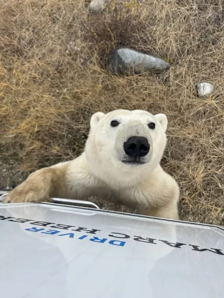
Slotted between Saskatchewan and Ontario, the interior province of Manitoba consists of forests, lakes, rivers and arctic tundra. With the frigid waters of Hudson’s Bay and frequent polar bear sightings in Churchill, perhaps Manitoba is best known for its winters, but summer is a treat for intrepid explorers with a keen eye for adventure. The province has a diversity of terrain to offer hikers, including over 80 provincial parks where fishing and wildflowers abound. Here are 25 amazing hiking trails not to miss on your next Manitoba visit.
1. Hunt Lake Trail

Distance: 12.6 km return
Time: 3 hours
Elevation Gain: 223 m
The Hunt Lake Trail is steep and difficult, but the views of the lake will be worth your efforts. The trail is best utilized between March and October.
How do I get to the trailhead? This trail is located within Whiteshell Provincial Park at the Border Reception Centre parking lot.
Read more: whiteshell.mb.ca
2. Brule Trail
Distance: 4.2 km loop
Time: 1 hour
Elevation Gain: 103 m
The Brule Trail is an excellent choice for all skill levels. The full loop will take you through lush green forest to Kinasao Lake. Sit and have a snack near the peaceful waters before looping back to the trailhead.
How do I get to the trailhead? This trail is located just off PTH 19, near Wasagaming.
Read more: manitobatrailsproject.ca
Blogger who have lived the adventure: brittanymthiessen.com
3. Whiteshell River Bridge Trail

Distance: 4.2 km one-way
Time: 2 hours
Elevation Gain: 158 m
This beautiful trail takes you along the edge of the Canadian Shield and over a scenic suspension bridge over the Whiteshell River. Be sure to bring your camera so you can capture all of the wildlife you’ll see, as well as your journey across the new suspension bridge.
How do I get to the trailhead? The trail is located in Nutimik Lake Campground.
Read more: alltrails.com
Bloggers who have lived the adventure: luneblog.com
4. McGillivray Falls and Lake Trail
Distance: 4.6 km loop
Time: 2 hours
Elevation Gain: 53 m
This trail starts with waterfalls and leads to McGillivray Lake. The trail follows a stream, which was formed when glaciers cut into the granite bedrock 10,000 years ago. The trail is best used from March to October and can be very wet, so wear waterproof footwear.
How do I get to the trailhead? The trail is located along PTH 44, beside McGillivray Lake.
Read more: gov.mb.ca
5. Gorge Creek Trail

Distance: 12.8 km return
Time: 3 hours
Elevation Gain: 277 m
The Gorge Creek Trail is located within Riding Mountain National Park and, although difficult, offers beautiful scenery that changes from hazel forest to shale slopes and trickling streams. The trail is best utilized from May to September. Keep your dog on leash and beware of the potential to see bears, especially in the autumn.
How do I get to the trailhead? The trail is located along PTH 19 in the Riding Mountain National Park, outside Norgate.
Read more: alltrails.com
Bloggers who have lived the adventure: hikebiketravel.com
6. Moon Lake Trail
Distance: 9.3 km loop
Time: 3 – 4 hours
Elevation Gain: 220 m
This trail takes you around Moon Lake and is rated as moderate based on the overall distance and the potential for muddy conditions. Be sure to bring your camera, because in addition to crossing several streams and passing a beautiful meadow, there’s also a good chance you’ll see bears, moose, deer and unique birds.
How do I get to the trailhead? The trail is located off PTH 10, not far from Dauphin.
Read more: pc.gc.ca
7. Spirit Sands & Devil’s Punch Bowl

Distance: 13 km total
Time: 3 hours
Elevation Gain: 130 m
This beautiful and unique hike offers sand dunes, plenty of wildlife and a view of the river, as well as a trip to the Devil’s Punch Bowl. Be sure to bring bug spray and extra water for the trip. The trail is best done from April to October.
How do I get to the trailhead? The trail is located within Spruce Woods Provincial Park, off PTH 5 along the Assiniboine River.
Read more: gov.mb.ca
Bloggers who have lived the adventure: brittanymthiessen.com & hikebiketravel.com
8. Kinosao Lake Trail
Distance: 7.2 km loop
Time: 2 – 3 hours
Elevation Gain: 167 m
The Kinosao Lake Trail is suitable for all skill levels, with enough hills and change in scenery to keep it interesting. It’s well-maintained and features wide paths. You’ll walk through forested areas and by beautiful Kinosao Lake. This trail is a great option for those looking to explore – you can take this trail all the way around, or branch off on other trails, such as the Grey Owl Trail or the Boreal Boardwalk Trail at the lake.
How do I get to the trailhead? The trail is located near Wasagaming, along PTH 19.
Read more: alltrails.com
Bloggers who have lived the adventure: brittanymthiessen.com
9. Pine Point Trail

Distance: 8.2 km loop
Time: 4 hours
Elevation Gain: 235 m
The Pine Point Trail is touted as a wonderful family hike offering beautiful scenery. You’ll see rapids, waterfalls and mixed-wood forest. If you’re lucky, you may even spot a white-tailed deer. When hiking in summer, you’ll likely encounter bugs, so come prepared.
How do I get to the trailhead? The Pine Point Trail is located north of Betula Lake on PR 307.
Read more: travelmanitoba.com
10. Seine River Greenway
Distance: 7 km (with shorter trail options)
Elevation Gain: Minimal
The Seine River Greenway offers various trails, so it is a great option for all skill levels. The scenery is beautiful, but the trail tends to get busy with its proximity to the city.
How do I get to the trailhead? The trail is located along Shorehill Drive in Winnipeg and travels along the Seine River.
Read more: saveourseine.com
11. Aspen and Bluestem Loop Trails

Distance: 6.5 km & 14 km loop
Elevation Gain: 68 m
Not too far from civilization but with all of the must-haves for a backwoods experience, this trail is located in Bird Hill Provincial Park. Walk around the lake, explore an old homestead and scale a viewing tower for a bird’s eye view of the area. If you want to extend your stay, there are a few other trails nearby.
How do I get to the trailhead? This trail is located not too far from Winnipeg, between PTH 59 and Provincial Road 206.
Read more: gov.mb.ca
12. Amisk/Inverness Falls Trail
Distance: 5.7 km total
Elevation Gain: Minimal
Combine the 4.2 Amisk Trail with the 1.5 km Inverness Falls Trail for the perfect family outing. Situated along Brereton Lake, this is a great spot for birdwatching.
How do I get to the trailhead? The trail is located in Whiteshell Provincial Park.
Read more: gov.mb.ca
13. Assiniboine Park Loop

Distance: 4 km return
Elevation Gain: Minimal
This trail is perfect for families or those who might have trouble with a traditional hike. This trail goes around Assiniboine Park. Polar bear live inside the zoo within the park. There’s also a pond, playground, manicured gardens and more. Part of the trail follows the Assiniboine River.
How do I get to the trailhead? The trail is located in Winnipeg, along Roblin Boulevard.
Read more: assiniboinepark.ca
14. Reeve’s Ravine Trail
Distance: 11.5 km
Elevation Gain: 165 m
This new multi-use trail is frequented by both hikers and mountain bikers. Follow the ravine’s edge for stunning views, especially from the top of Bald Hill.
How do I get to the trailhead? This trail is located between Wasagaming and Norgate, along PTH 19.
Read more: pc.gc.ca
15. Cedar Bog Trail

Distance: 3.5 km loop
Time: 1.5 hours
Elevation Gain: Minimal
This trail passes through a beautiful forested area. It’s a great trail for most skill levels. Be sure to bring your binoculars to look for birds while you’re here. Keep an eye out for poison ivy along the trail.
How do I get to the trailhead? The trail is located within Bird Hill Provincial Park, not far from Winnipeg. Travel down PTH 59 and then turn onto North Drive.
Read more: gov.mb.ca
16. Epinette Creek Trail System
Distance: 41.7 km return
Elevation Gain: 198 m
There are several trails to choose from within this area, ranging from the short 1.8-km Ojibwa Trail to the 24.3 km Newfoundland Trail. Hikers will enjoy trekking through mixed-grass prairie and sandhills. Amenities include backcountry campsites, washrooms and shelters.
How do I get to the trailhead? This trail is located in Spruce Woods Provincial Park, not far from Carberry, along PTH 5.
Read more: gov.mb.ca
17. Bur Oak Trail
Distance: 1 km loop
This self-guiding trail offers informative signs so visitors can learn about the park as they explore. Be sure to bring your camera along!
How do I get to the trailhead? Campground parking lot.
Read more: gov.mb.ca
18. Little Mountain Park Loop

Distance: 3.2 km loop
Elevation Gain: Minimal
Located on the outskirts of Winnipeg, this trail is a great option for all skill levels. You’ll see plenty of wildlife on your hike, and it’s accessible all year long for walking, hiking, biking, cross-country skiing, snowshoeing and more. There’s even an off-leash dog park.
How do I get to the trailhead? There are two parking lots: one off Farmer’s Ave and one off Klimpke Rd.
Read more: winnipegtrails.ca
19. Bead Lakes Trail
Distance: 4 km loop
Time: 2 hours
Elevation Gain: 105 m
Be sure to bring your camera on this scenic trail! Suitable for young, active families and most skill levels, this trail will take you past a chain of small lakes.
How do I get to the trailhead? The trail is located not far from Wasagaming in Riding Mountain National Park.
Read more: pc.gc.ca
20. Bannock Point Petroforms
Distance: 2.4 km out-and-back
Time: 1.5 hours
Elevation Gain: 67 m
The Bannock Point Petroforms are located near Betula Lake, and while the trail is suitable for most skill levels, it’s the petroforms that people go to see. Petroforms are stones laid out in the bedrock in shapes. They were made centuries ago by the area’s First Nations people in the likeness of animals and abstract patterns. Take a free tour with a Park Interpreter to learn more.
How do I get to the trailhead? The trail is located along La Verendrye Trail in Whiteshell Provincial Park.
Read more: gov.mb.ca
21. Arrowhead Trail

Distance: 3.4 km loop
Time: 1 – 2 hours.
Elevation Gain: 97 m
This trail doesn’t see a ton of traffic. It’ll take you through a beautiful forest on your way around the loop. The trail is located in Riding Mountain National Park.
How do I get to the trailhead? The trail is located just off PTH 19, beside Clear Lake and not far from Wasagaming.
Read more: pc.gc.ca
Bloggers who have lived the adventure: brittanymthiessen.com
22. White Tailed Deer Trail
Distance: 1.5 km loop
Time: 1 hour
Elevation Gain: Minimal
The White Tailed Deer Trail is located in Bird Hill Provincial Park and takes you through forest and grasslands. It’s suitable for most skill levels and offers an excellent adventure for families looking to explore the outdoors. Climb the viewing tower for the chance to spot the trail’s namesake, who come out at dawn and dusk.
How do I get to the trailhead? The trail is located just outside Winnipeg, along South Drive.
Read more: gov.mb.ca
23. Whiteshell River Trail

Distance: 2.8 km loop
Time: 2 hours
Elevation Gain: Minimal
This trail is well-marked, but may have some muddy or swampy areas and will challenge you with a few steep climbs. There are plenty of birds and wildflowers to see along the way.
How do I get to the trailhead? This trail is located beside Provincial Road 312, between Caddy Lake and West Hawk Lake.
Read more: gov.mb.ca
24. Walking On Ancient Mountains
Distance: 1.8 km out-and-back
Time: 1 – 2 hours
Elevation Gain: 59 m
This moderate trail is located in Nopiming Provincial Park. The trail features several steep inclines as well as stairs. The stunning panorama at the end is well-worth your efforts.
How do I get to the trailhead? The trail is situated just off Provincial Road 314.
Read more: gov.mb.ca
25. The Caves Trail
Distance: 0.8 km loop
Time: 45 minutes
Elevation Gain: Minimal
This trail offers a bit of false advertising, since there aren’t any actual caves along the route, but there are deep crevices that keep the landscape interesting. There are a few areas that offer a high vantage point, which makes for an excellent view of the beauty surrounding you. This trail is great for most skill levels, and offers families a new place to explore.
How do I get to the trailhead? This trail is located in Clearwater Provincial Park, right beside Clearwater Lake just off Provincial Road 287.
Read more: gov.mb.ca
Did you enjoy these 25 hikes in Manitoba?
Check out the best hikes in other provinces:
21 of the Best Hikes in Quebec
25 Incredible Hiking Trails in Nova Scotia
P.S. Want more adventure in your life?
Join over 3,000 subscribers across North America when you sign up for explore magazine’s “Live the Adventure” Club.
Click here to learn more.


