


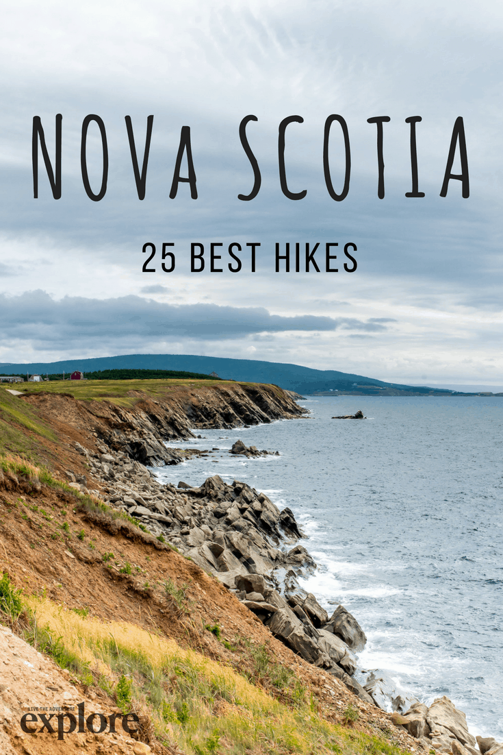
25 Incredible Hiking Trails in Nova Scotia


Trail suggestions made by David Webb
Seated on the Atlantic Ocean, the Maritime provinces exude a windswept beauty. From the Bay of Fundy to the Cape Breton Highlands, one of the best ways to explore Nova Scotia is on foot. Numerous trails line the ocean and meander up the rolling hills that cross the province. You’ll meet seals, puffins, and Celtic culture along the way.
Here are 25 of our favourites trails to tackle in Nova Scotia:
1. Cape Chignecto Coastal Loop
Distance: 53 km loop
Time: 3-4 days
Elevation: 150 m
Level of difficulty: Difficult
This wilderness park sees the world’s highest tides, making it an exciting and dangerous coastline to hike. The trail varies from peaceful parts through maple trees, to climbing some of the highest peaks in Nova Scotia. Deep coves, unique fauna and animal life are all staple features of this stunning coastal loop. Sleeping facilities include 47 wilderness camping sites, three cabins, and a bunkhouse.
How do I get to Cape Chingnecto? Cape Chingnecto Provincial Park is located on the Bay of Fundy; 45 km west of Parrsboro and 48 km from Joggins.
Read more about this trail: parks.novascotia.ca/cape-chignecto-hiking-trails
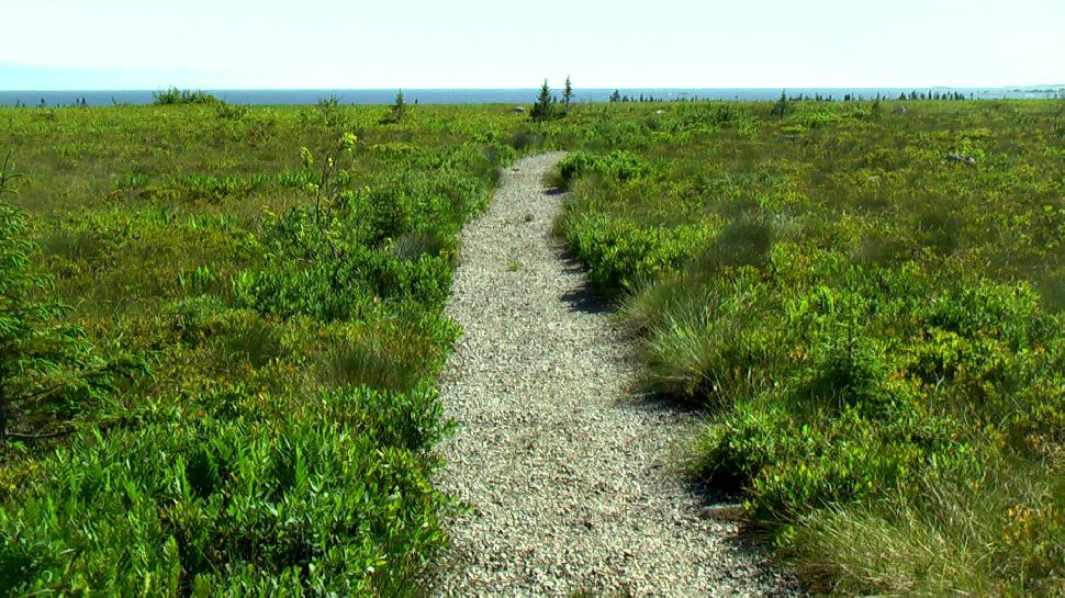
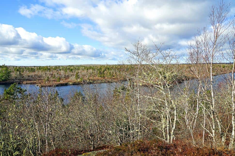
2. Port Joli Head
Kejimkujik National Park
 Flickr/Rick McCharles (CCby2.0)
Distance: 9 km return
Time: 2 hours
Level of difficulty: Easy
This trail traverses across a bog, through a forest and along the coast to Port Joli Head. The Atlantic Ocean is wild here; be wary of crashing tidal waves. The trail loops back around to the Harbour Rocks.
How do I get to Port Joli Head Trail? It’s located 25 km southwest of Liverpool, off of Highway 103.
Read more about this trail: novascotia.com/port-joli-head-kejimkujik-seaside
3. Liberty Lake Trail
Kejimkujik National Park
Distance: 60.5 km loop
Time: 4-5 days
Level of difficulty: Difficult
Kejimkujik is a gorgeous back-country park. Liberty Lake is the longest trail at 60.5 km. Hikers should expect rough footing, narrow, boggy paths and rustic camping sites.
How do I get to Liberty Lake? Take Highway 8 to Kejimkujik National Park. Begin at the Big Dam Lake Parking Lot and end at Lower Mersey River.
Read more about this trail: Official Park Website
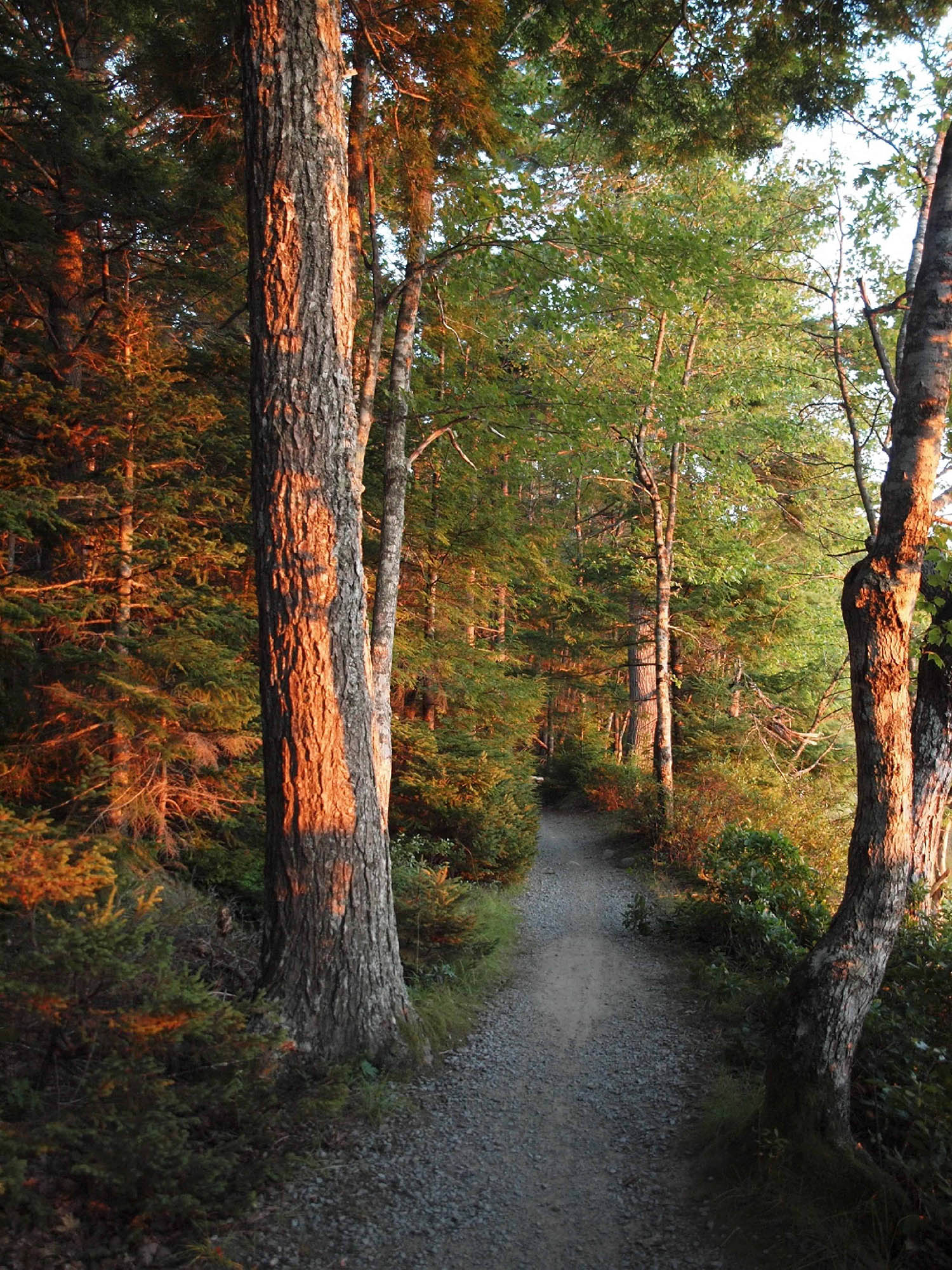
4. Slapfoot Trail
Kejimkujik National Park
 David Murray
Distance: 3.2 km one-way
Time: 45 minutes
Level of difficulty: Easy
This relaxed, meandering walk offers beautiful views of the lakeshore in every season. It’s a multi-use trail, so you may meet bikers or horse-back riders along the way.
How do I get to Slapfoot Trail? There are several ways to access the trail. You can merge onto Mersey trail or Merrymakedge from Meadow Beach, Jeremy’s Bay campground, or Jim Charles Point.
Read more about this trail: Click here
5. Cape Split Trail
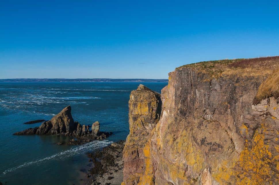 Flickr/Maciej (CC BY-SA 2.0)
Distance: 8 km one-way
Time: 4-5 hours
Level of difficulty: Moderate
Although we believe that the journey is the destination, the end of this hike is the real reason to do it. The trail ends with a magnificent view of the Spires: rock formations that burst out of the ocean in tall, cylindrical fashion. You can enjoy a picnic lunch and lay on the edge of the cliffs, testing your comfort with vertigo.
How do I get to Cape Split Trail? It’s just a 40-minute drive from Wolfville. Take Exit 11 off Highway 101 to Scott’s Bay and follow signs to Cape Split.
Read more about this trail: novatrails.com/cape-split-trail
6. The Bluff Wilderness Hiking Trail
 Flickr/Dennis Jarvis (CC BY-SA 2.0)
Distance: 32 km total
Time & Level of difficulty: dependent on the loop
Four stacked loops circle Upper Five Bridge Lake. The first, and easiest, is the 9 km, 3-hour return Pot Lake Loop. Mi’kmaq Hill Loop is 17.4 km return, the Buff Loop is 23.4 km, and the longest, most challenging loop is the 29 km Hay Marsh Loop.
How do I get to the Buff Wilderness Trail? Just off of St. Margaret’s Bay Road near Cranberry Lake; the trailhead is next to the BLT Trail.
Read more about this trail: novascotia.com/the-bluff-wilderness-hiking-trail
7. Polly’s Cove
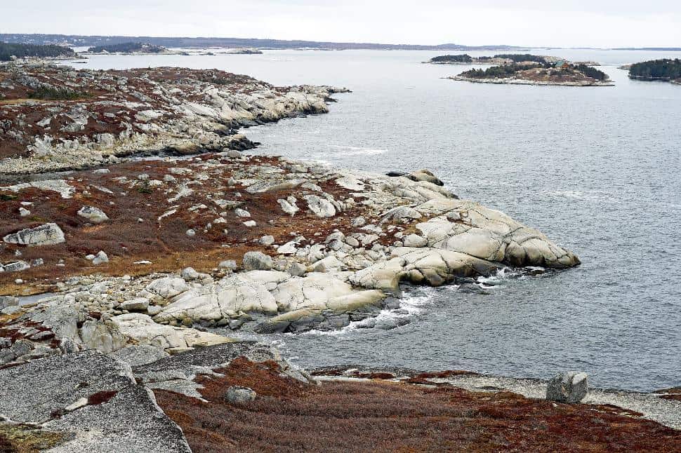 Flickr/Dennis Jarvis (CC BY-SA 2.0)
Distance: 2 km one-way
Time: 1 hour
Level of difficulty: Easy
Unlike nearby Peggy’s Cove, Polly’s Cove is still relatively unknown to tourists. This means stunning expanses of smooth grey rock and low green bush to explore, without the crowds.
How do I get to Polly’s Cove? The entrance to Polly’s Cove is a dirt parking lot 2 km from Peggy’s Cove.
Read more about this trail: trailpeak.com/trail-Pollys-Cove-near-Halifax-NS
8. Fishing Cove Trail
Cape Breton Highlands National Park
 Parks Canada
Distance: 12 km return
Time: 4-5 hours (or overnight)
Level of difficulty: Moderate
This backcountry hike can be completed in a full-day or enjoyed as an overnight hike. There are opportunities to fish (hence the name), roaming wildlife and amazing sunsets (if the weather cooperates). Overnight campers must purchase a permit from the Parks Canada booth at the entrance to the hike.
How do I get to Fishing Cove? Two trailheads merge from the Cabot Trail.
Read more about this trail: novascotia.com/fishing-cove-trail-cape-breton-highlands-national-park
9. Skyline Trail
Cape Breton Highlands National Park
 Flickr/Tony Webster (CC BY-SA 2.0)
Distance: 7.4 km return or 9.2 km loop
Time: 2-3 hours
Level of difficulty: Easy
This hike may lead to some of the best scenery in the entire province. Glimpse whales in the Gulf of St. Lawrence, trace the Cabot Trail and get an incredible view of the Atlantic Ocean from a headland cliff. The prevalence of moose and bear means dogs are not permitted on the trail.
How do I get to Skyline Trail? Access via French Mountain, about 15 km north of Cheticamp on the Cabot Trail.
Read more about this trail: Click here
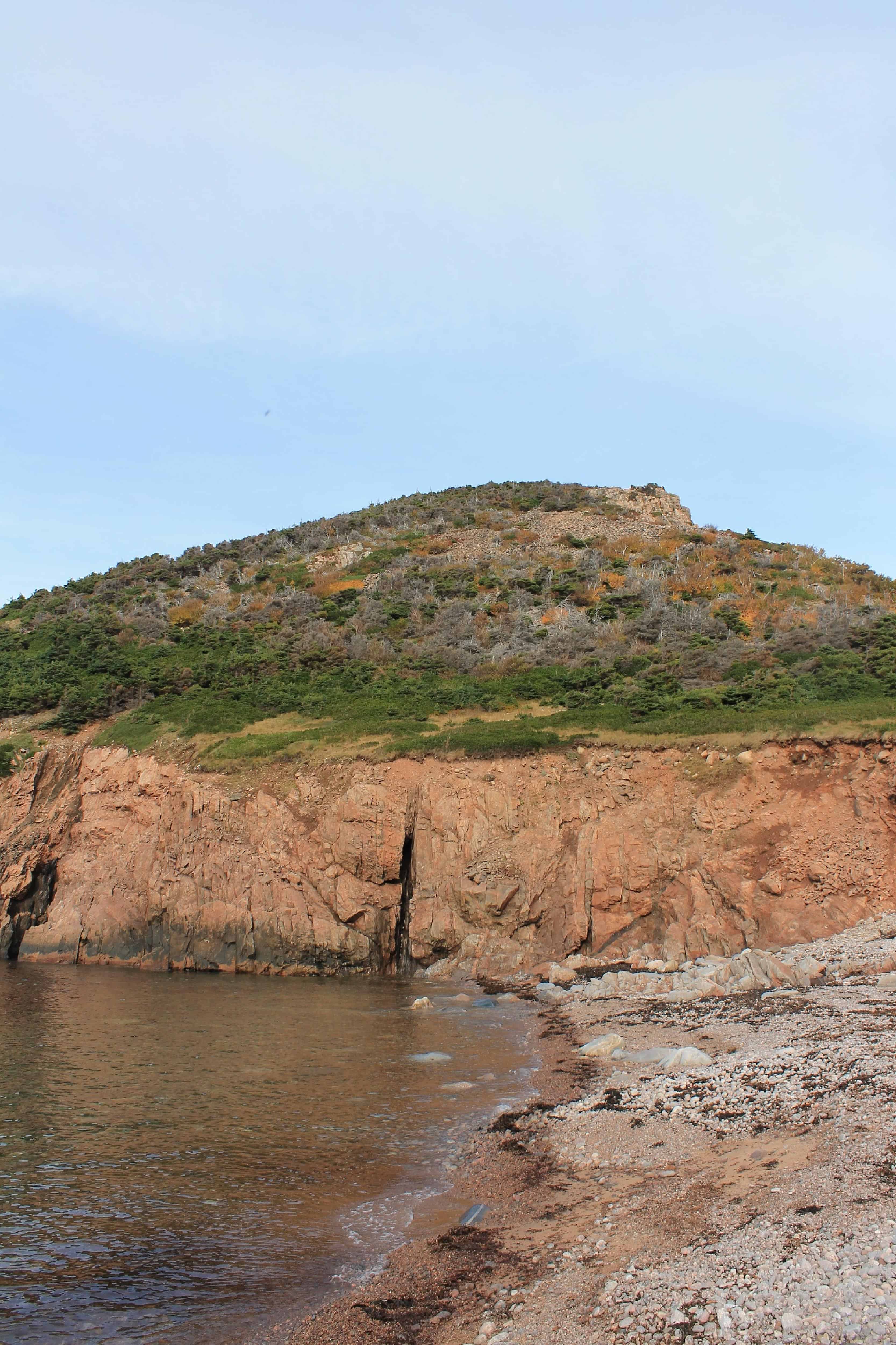
10. Franey Trail
Cape Breton Highlands National Park
 Parks Canada
Distance: 7.5 km loop
Time: 2-3 hours
Elevation: 95-430 m
Level of difficulty: Difficult
This incredibly steep, rugged trail is rewarded with panoramic views of Clyburn Brook Canyon. On a clear day, you can see out to the Atlantic Ocean from Cape Smokey to Ingonish.
How do I get to Franey Trail? Take the fire access road from the Cabot Trail. Franey Trail begins in a small parking lot off Franey Road.
Read more about this trail: Click here
11. Pennant Point Trail
Distance: 11 km loop
Time: 7-8 hours
Level of difficulty: Moderate
Yielding beach views along a breathtaking peninsula, this is a long, but not overly difficult, trek. Rock climbers will enjoy scrambling over the large granite boulders along the coast. If the entire loop is too daunting, it can be done as an out-and-back hike—just go as far as you feel comfortable before turning around.
How do I get to Pennant Point? Take Highway 349 to Sambro and follow signs for Crystal Crescent Beach.
Read more about this trail: ns-hiking.com/pennant-point-crystal-crescent-hiking-trail/
12. Jodrey Trail
Blomidon Provincial Park
 Flickr/Wendy Schotsmans (CC BY 2.0)
Distance: 5.6 km
Time: 2 hours
Level of difficulty: Moderate
Jodrey Trail is the easiest and longest route up Cape Blomidon. You may encounter foxes, skunks, raccoons and fairy shrimp along the way. This trail can be joined with others to make a 13 km loop.
How do I get to Jodrey Trail? This trail begins at the entrance to Blomidon Park.
Read more about this trail: parks.novascotia.ca/blomidon-hiking-trails
13. Headland Trail
Taylor Head Provincial Park
 Flickr/Chris M Morris (CC-BY-2.0)
Distance: 8 km loop
Time: 2-3 hours
Level of difficulty: Difficult
The Headland Trail forms a figure-eight with the Spry Bay Trail. It leads past Taylor Head Point, which is the highlight of the park.
How do I get to Taylor Head Provincial Park? Start at the fourth parking lot. Take the Spry Bay Trail to the trailhead of the Headland Trail.
Read more about this trail: https://friendsoftaylorhead.com/trails
14. Acadian Trail
 Ian McPhee
Distance: 8.4 km loop
Time: 3-4 hours
Level of difficulty: Moderate
Terrain, vistas, flora and fauna make this trail an exceptional trek. There are benches to rest on and plenty of picnic spots to enjoy with ocean and mountain scenery.
How do I get to Acadian Trail? This trail is above the Cheticamp River, opposite the Cheticamp Visitor Centre.
Read more about this trail: Click here
15. Louisbourg Lighthouse Trail
 Flickr/Dennis Jarvis (CC BY-SA 2.0)
Distance: 2 km one-way
Time: 1 hour
Level of difficulty: Easy
In 1734, Canada’s first lighthouse was built on this coast. Discover more about the country’s rich history by exploring the Louisbourg Lighthouse Trail. Wander through Gun Landing Cove, Brook Landing Cove and around Lorraine Head to Big Lorraine. Each step is steeped in history.
How do I get to Louisbourg Lighthouse Trail? The trail begins across the harbour from the Fortress of Louisbourg.
Read more about this trail: Click here
16. Musquodoboit Trailway
Distance: 15 km one-way
Time: 6-8 hours return
Level of difficulty: Moderate
Part of the TCT, this section is a non-motorized, gravel pathway from Musquodoit Harbour to Meagher’s Grant. The abandoned railroad is relatively flat, and has many sub-trails that branch off for longer adventures.
How do I get to Musquodoit Trailway? Take Highway 367 to Park Road. The trailhead is in a parking lot on the left.
Read more about this trail: novascotia.com/musquodoboit-trailway-trans-canada-trail
17. Duncan’s Cove
 Flickr/Dennis Jarvis (CC BY-SA 2.0)
Distance: 8 km return
Time: 2-3 hours
Level of difficulty: Easy
The history of Duncan’s Cove dates back to 1752, when it developed as a small fishing community. During WWII, bunkers were built here to protect the city of Halifax. The trail is relatively straightforward and yields nearly constant coastal views. Although the vegetation is quite barren, you can pick blueberries in the spring.
How do I get to Duncan’s Cove? Take Route 349 to the Chebucto Peninsula. The trail is just 20 km from Halifax.
Read more about this trail: halifaxtrails.ca/DuncansCove
18. Balancing Rock Trail
 Flickr/Dennis Jarvis (CC BY-SA 2.0)
Distance: 2.5 km one-way
Time: 1 hour
Level of difficulty: Easy
This trail weaves through the woods towards a staircase that descends to the water’s edge. From here, you have a spectacular view of “Nature’s Time Post,” a narrow basalt stack that protrudes from the ocean. It’s the most striking and most photographed column of basalt in the area.
How do I get to Balancing Rock? Take Exit 26 from High 101 and follow signs for Digby. From there, hop on Highway 217 until you see a trailhead and small parking lot.
Read more about this trail: novascotia.com/balancing-rock
19. Crowbar Lake Trails
Distance: 16.5 km total (trail system)
Time & Level of difficulty: varies depending on trail
Wild lakes, scenic vistas and granite ridges fill this collection of loop trails. Hikers can choose from Porters Lake Trail, Spriggs Brook Trail, West Lake Loop and Salmon River Loop.
How do I get to Crowbar Lake Trails? East of Halifax, at 1800 Myra Road, Porters Lake.
Read more about this trail: novascotia.com/crowbar-lake-hiking-trails
20. Annapolis Valley Trail System
Distance: 200 km of linear rail trail
Level of difficulty: Easy
Part of the TCT, this collection of multi-use trails stretches from Wolfville to Digby. There are 21 sections of trail, ranging from 7-km walks to serious 42-km treks.
How do I get to Annapolis Valley Trail System? The municipal buildings parking lot in Kentville or Exit 12 off of Highway 101 coming from New Minas.
Read more about this trail: novascotia.com/annapolis-valley-trail-system
21. Dingle Tower to Frog Pond Park Sir Sandford Fleming Park
 Flickr/meddygarnet (CC-BY-2.0)
Distance: 1.5 km
Time: 1 hour
Level of difficulty: Easy
Although it is only a gentle walk in the park, strolling from Dingle Tower to Frog Pond Park is a rich historical experience. Dingle Tower, donated by Sir Sandford Fleming to the people of Halifax in 1908, was formally recognized as a Historic Site in 2008. The peaceful scenery, straightforward signage and boat launch make Sir Sandford Fleming Park an attraction for young families and cyclists.
How do I get to Sir Sandford Flemming Park? Venture off of Purcell’s Cove Road, on the Northwest Arm.
Read more about this trail: novascotia.com/sir-sandford-fleming-park-the-dingle
22. Celtic Shores Trail System
Distance: 92 km total (trail system)
Level of difficulty: Easy
Celtic culture comes alive on this section of the TCT. Stretching from Port Hastings to Inverness, this multi-use path yields stunning views across Cape Breton Island. Along the way, you will encounter fishing villages, beaches, and Gaelic arts and music.
How do I get to the Celtic Shores? Over thirty different trailheads provide access to the trail system.
Read more about this trail: novascotia.com/celtic-shores-coastal-trail
23. Liscomb River Trail
 Flickr/Martin Cathrae (CC BY-SA 2.0)
Distance: 9.6 km
Time: 4 hours
Level of difficulty: Difficult
Liscomb River Wilderness area is comprised of 6,000 hectares, reserved to protect the natural environment of one of Nova Scotia’s most prominent rivers. The most difficult trail in the park travels over a suspension bridge that overlooks a waterfall and a 15-pool fish ladder, which was constructed to aid Atlantic salmon.
How do I get to Liscomb River Trail? Travel east on Highway 107. Turn onto Highway 7 and follow directions for Liscomb Lodge.
Read more about this trail: novascotia.com/liscomb-river-trail-system
24. Atlantic View Trail
Distance: 10 km one-way
Time: 3-4 hours return
Level of difficulty: Moderate
This coastal greenway is another part of the TCT. The trail travels over crusher dirt through Lawrencetown. The former railway bed is now a multi-use path that cyclists use frequently.
How do I get to Atlantic View Trail? There are several access points. Parking is available at Lawrencetown Beach.
Read more about this trail: novascotia.com/atlantic-view-trail-trans-canada-trail
25. Point Pleasant Trails
 Flickr/Dennis Jarvis (CC BY-SA 2.0)
Distance: Varies. (3.36 km perimeter loop)
Level of difficulty: Easy
Point Pleasant is a popular, dog-friendly municipal park. It is a hangout for locals and a magnet for outdoorsy tourists. Crumbling British fortifications, meandering gravel pathways and Black Rock Beach—where pirates were hung—makes this trail system a historical and eco-friendly experience.
How do I get to Point Pleasant? Located in the heart of Halifax.
Read more about this trail: halifax.ca/PointPleasantParkTrails

PS. Did these 25 hikes inspire you to get outside and explore more?
For the ultimate adventure inspiration, join explore magazine’s “Live the Adventure” Club.
With thousands of dollars’ worth in gear, prizes, exclusive interviews with experts, outdoors advice and a private Facebook community to share all your adventures, it’s no wonder explore’s LTA Club has over 1,000 subscribers across North America.
Click here to learn more.
More hikes by province:
25 of the Best Hiking Trails on Prince Edward Island
New Brunswick’s 25 Best Hiking Trails
When you purchase something via the links in our articles, we may earn a small affiliate commission. Read more about our policy.


