The Happy Camper: New-ish Ontario Canoe Maps


It’s that time of the year when paddlers become obsessed with looking over canoe route maps in search of the ultimate wilderness trip. As I write this, there are dozens of park maps spread out on my kitchen table and countless weathered topos carpeting the living room—some with squashed mosquitoes splattered in the creases. I also have a good number of new-ish maps ordered and I can’t wait to get them and pin them up on my office wall to get a better look at all the possibilities each one has to offer.
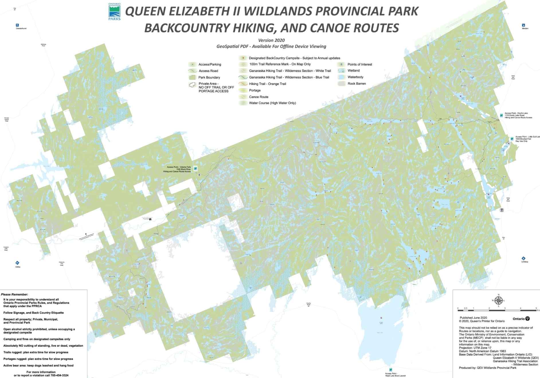
Ontario Park’s Queen Elizabeth II Wildlands Provincial Park Map
This semi-wild park is relatively new. It is situated just over an hour’s drive from the city of Toronto. And they now have a map for it. You can get the latest version of the Queen Elizabeth Wildlands Park map in paper form or download the digital format. It shows canoe routes, campsites, portages, access points, points of interest and the section of the Ganaraska Backpacking Trail that runs through the protected land.
According to Ontario Parks, the digital Geo-referenced map can follow your progress if used with an enabled app on your mobile devices. One hundred metre points have been built into the image to help manage distances while hiking and canoeing.
Download the latest version via the Ontario Parks website.
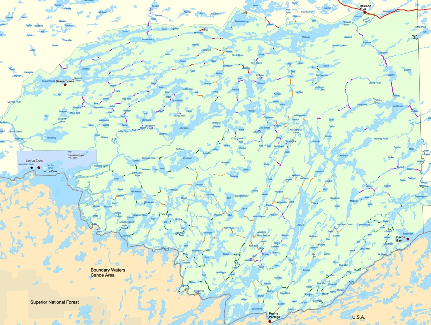
Quetico Provincial Park Portage Maintenance Map
In 2022, Quetico Provincial Park spent countless hours maintaining all the 587 portages that link the 2,000 lakes and five major rivers. It was needed after severe storms and forest fires made their mark across this wilderness canoe area. In addition to clearing the downed trees and building makeshift bridges over flooded areas, they produced a map reflecting their hard work.
Here it is in digital format.
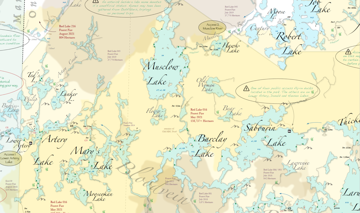
Woodland Caribou Provincial Park Map
Glen of Woodland Journeys came back from a canoe trip in Woodland Caribou Provincial Park in 2013 a little frustrated trying to find his way by just using topographical maps that didn’t mark the portages or campsites. So, after a six-year project and multiple trips back to this remote wilderness park in northwestern Ontario, he produced a canoe route map for the 4,500-square-kilometre area, offering almost 2,000 kilometres of maintained canoe routes.
There are no topographical lines or even a distinct yellow line marking the park’s borders. It has a more artsy look to it. But the map still has the details needed (i.e., portages, campsites, etc.). It also shows pictographs, waterfalls, important cautionary notices and suggested areas to explore.
You can purchase the large, printed format or get a free download.
French River & New Killarney Provincial Park Map
Ontario Parks has updated their French River map. It now includes canoe routes for Restoule and Grundy Lake Provincial Parks. It can be ordered through Friends of Killarney.
You can also now get the long-awaited new Backcountry Hiking and Canoe Route Map for Killarney Provincial Park featuring updated campsite numbers, which is good to have since the park has started a new reservation system where you book per site # rather than per lake.
Unlostify’s New Algonquin Provincial Park Map
Unlostify maps are great. The company was created by one of the original owners of Jeff’s Maps—which mysteriously disappeared under rumours of mismanagement from the other owner. Unlosify’s (Jeff’s) Algonquin Map has been long awaited by paddlers and it seems it might be out soon. Why do I say “might?” Well, the release date for it has been changed more than my socks during a backpacking trip along a muddy trail. Still, I can guarantee it will be one darn good map. Jeff’s work has always been exceptional.
Preorder it off the site or pick it up at any Ontario based outfitting store.