


10 of the Best Hiking Trails near Revelstoke, BC

Surrounded by national parks, provincial parks and protected areas, Revelstoke offers adventurers access to wilderness paradise. From flat forest walks to steep alpine routes, there’s a trail and a view for everyone in the area surrounding Revelstoke. Here are our top 10 picks.
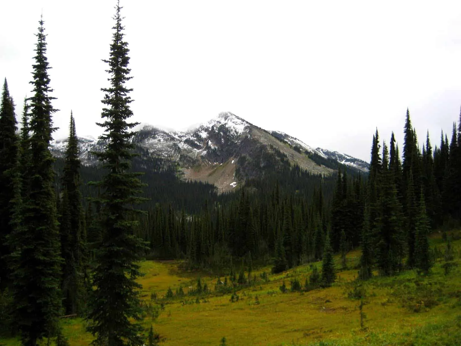
1. Eva Lake Trail
Mount Revelstoke National Park
Distance: 7.1 km one-way
Time: 2 – 3 hours one-way
Elevation Gain: 179 m
Why it’s awesome: All the subalpine beauty without the elevation gain.
While the length of the Eva Lake trail is contained in the upper subalpine of Mount Revelstoke National Park, thanks to Meadows in the Sky Parkway, the elevation gain is minimal. Pass along boulder-strewn slopes and through alpine wildflower meadows to reach glacial Eva Lake, which might be ice-free by July. The hike makes for a long day trip, but there are designated backcountry campsites at the lake if you want to split the trip over two days.
How do I get to the trailhead? The trailhead is on Meadows in the Sky Parkway at Heather Lake.
Read more: pc.gc.ca
Distance from Revelstoke: 26 km
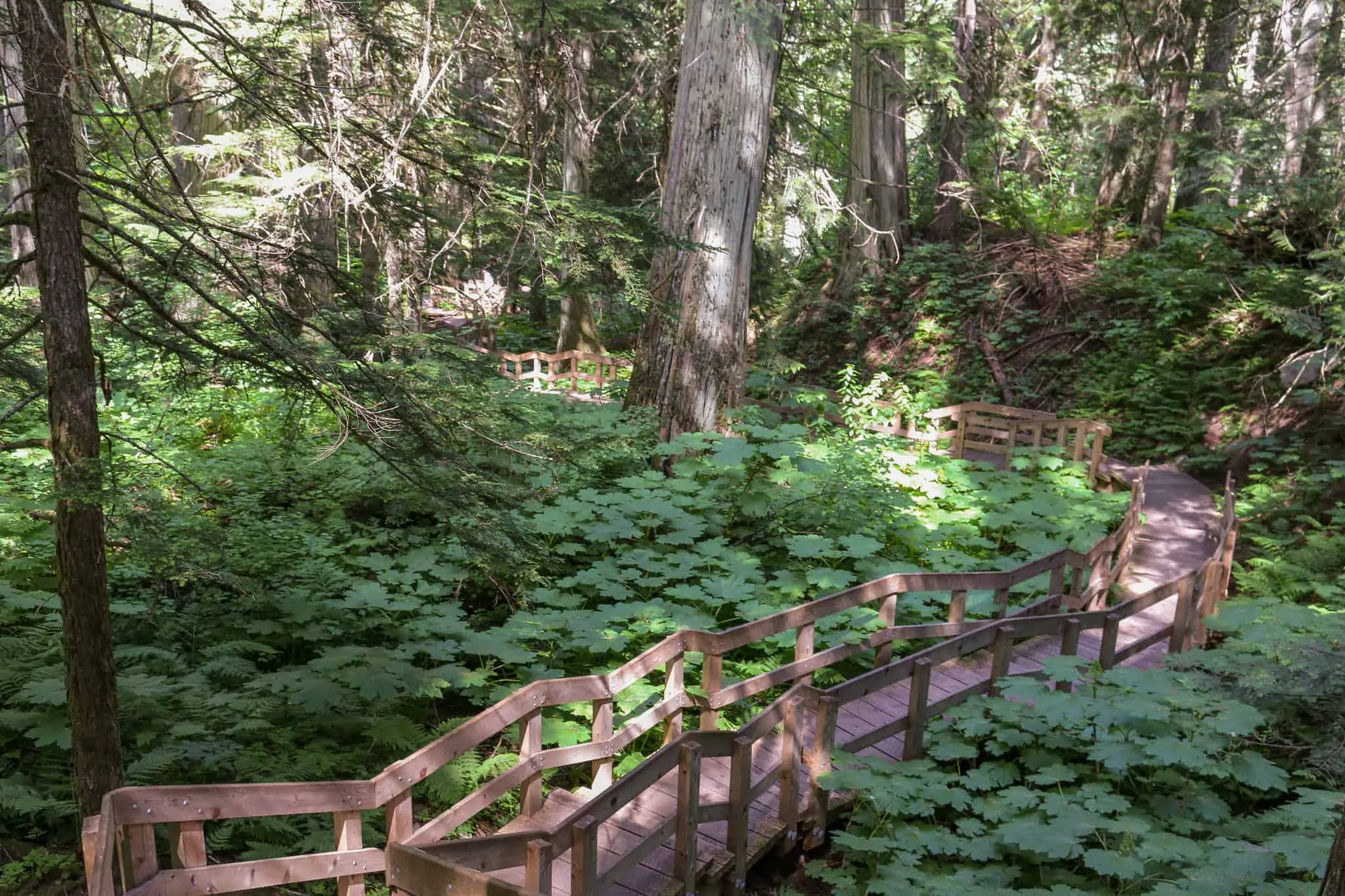
2. Giant Cedars Trail
Mount Revelstoke National Park
Distance: 0.5 km loop
Time: 30 minutes
Elevation Gain: Minimal
Why it’s awesome: Stand in the presence of giants and realize how small you are.
Stretch your legs on this quick boardwalk loop or take your time reading the interpretive signs and soaking in the serenity on one of the trail’s benches. The real draw of this trail is the 500-year-old cedar trees towering above.
How do I get to the trailhead? The trailhead is at the Giant Cedars picnic area east of Revelstoke on the Trans Canada Highway.
Read more: pc.gc.ca
Distance from Revelstoke: 28 km
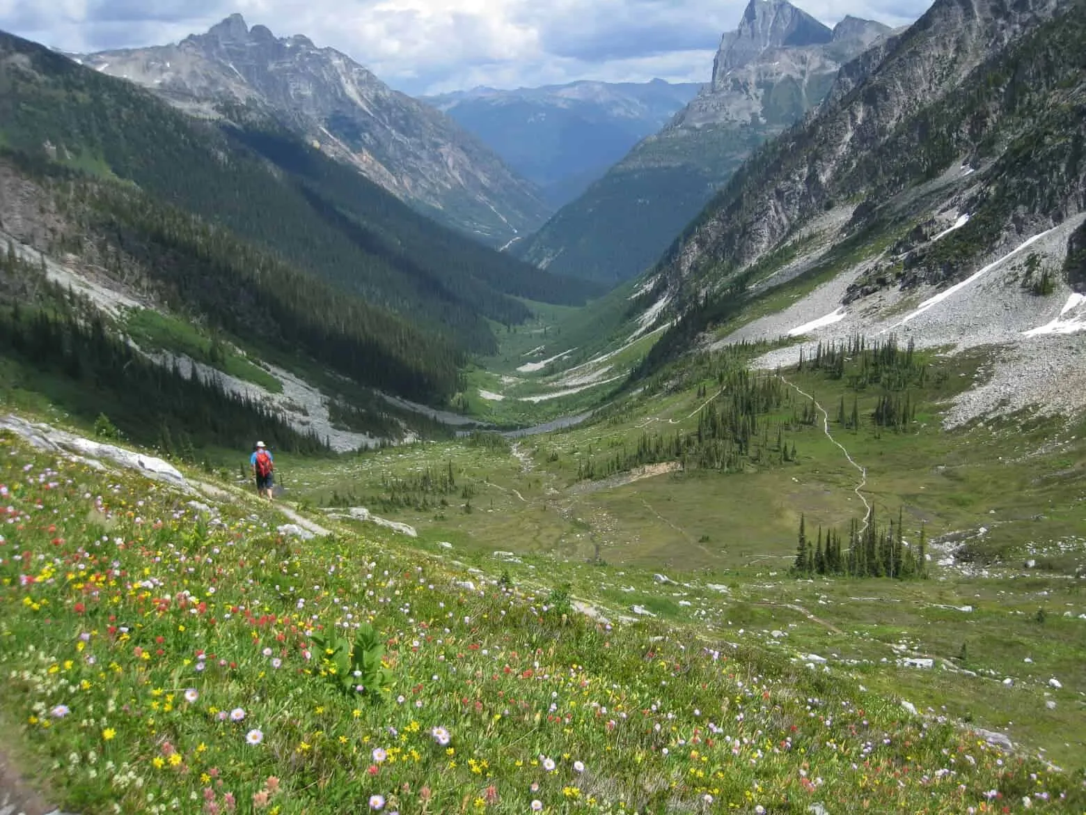
3. Abbott Ridge Trail
Glacier National Park

Distance: 10 km return
Time: 7 – 8 hours
Elevation Gain: approx. 1,000 m
Why it’s awesome: Despair followed by euphoria: the view from the top is well-worth the steep climb.
Beginning in the forest at Illecillewaet campground, this trail rises steeply past the tree line, passing through an alpine meadow to reach rocky Abbott Ridge. Stunning views sweep across Glacier National Park’s impressive topography, including mountain peaks, glaciers and the lakes and rivers in the valley far below.
How do I get to the trailhead? Trailhead is located in the Illecillewaet campground.
Read more: goldenhikes.ca
Distance from Revelstoke: 65 km
Bloggers who have lived the adventure: hikingwithbarry.com
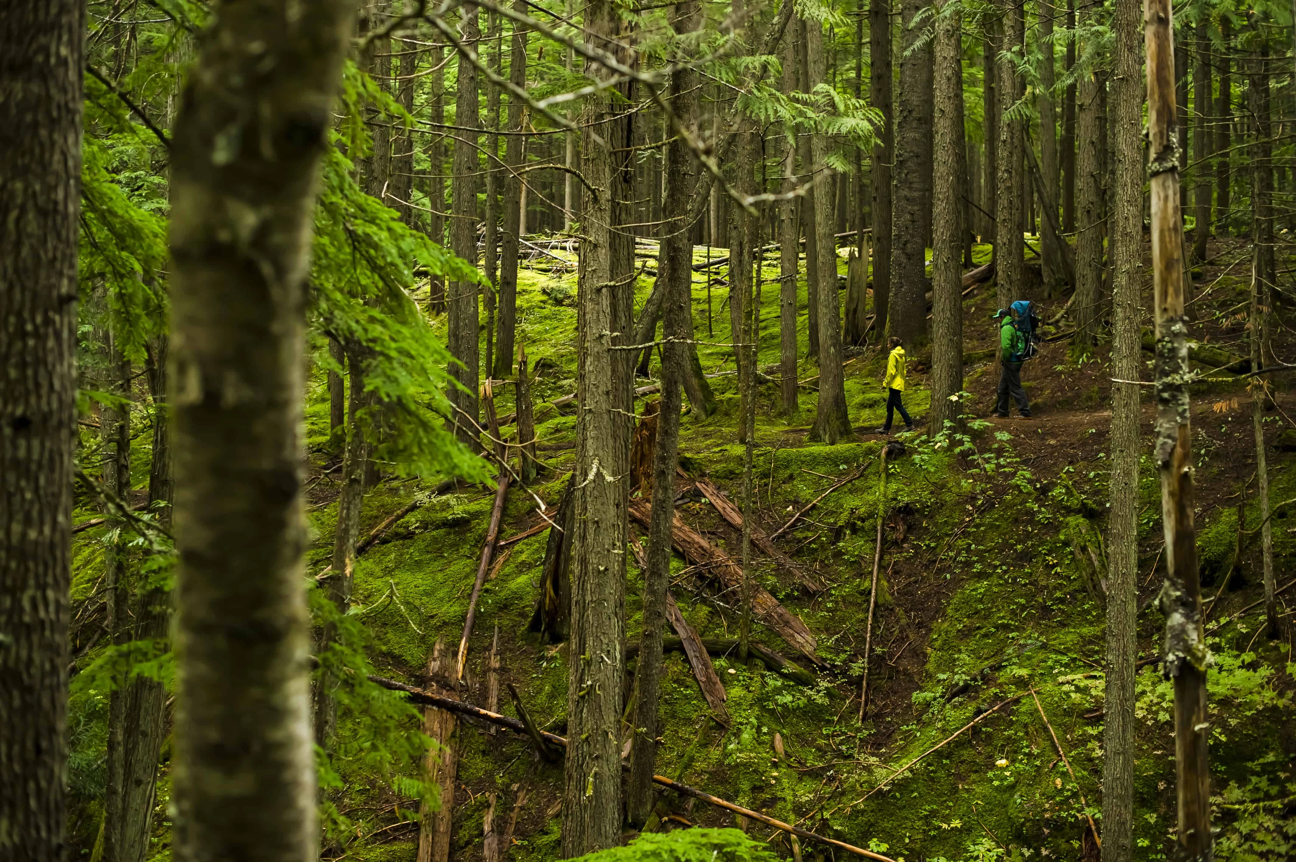
4. Inspiration Woods Trail
Mount Revelstoke National Park
Distance: 2.5 km loop
Time: 1 – 2 hours
Elevation Gain: 133 m
Why it’s awesome: This verdant forest might just be magical.
Old man’s beard drapes in soft, green tendrils from the branches of Douglas fir, Western Hemlock and White Pine, making this hike truly enchanting. Breathe in the clean air and soak up the green-hued serenity as you wander among spongy moss and burbling brooks.
How do I get to the trailhead? The trailhead is located 1.9 km along the Meadows in the Sky parkway.
Read more: pc.gc.ca
Distance from Revelstoke: 26 km
5. Bear Creek Falls
Glacier National Park
Distance: 1.6 km return
Time: 30 min
Elevation Gain: Minimal
Why it’s awesome: Misty majesty just a short walk from your car.
Whether you’re in need of a scenic break to stretch your legs or are in the mood for a quick dip into nature, the Bear Creek Falls trail features a lovely waterfall that will help you forget all your Trans Canada Highway cares. And the best part: it’s a downhill walk from the parking lot. Let that mist melt your troubles away.
How do I get to the trailhead? The trailhead is located at the east end of the parking area in Glacier National Park.
Read more: goldenhikes.ca
Distance from Revelstoke: 77 km
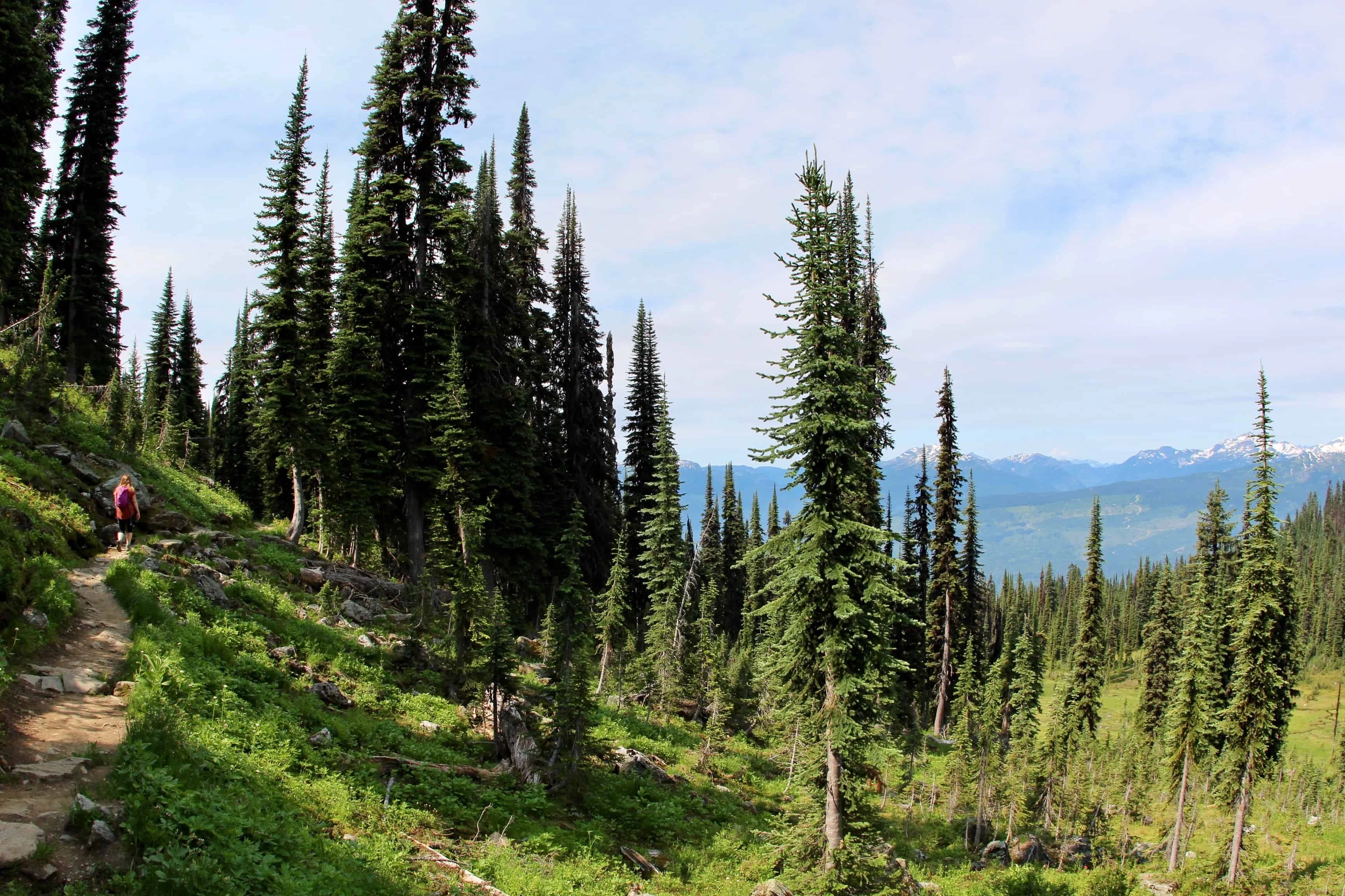
6. Mount Revelstoke Summit Trail
Mount Revelstoke National Park
Distance: 20 km out-and-back
Time: 8 – 10 hours
Elevation Gain: 1,353 m
Why it’s awesome: Why drive to the summit when you could hike there?
This well-marked route ascends from the base of Mount Revelstoke through subalpine meadows to just below the summit. Stop there and take in the glorious wildflowers (if they’re blooming) or follow the one-km Upper Summit trail to the top. For a shorter day, arrange transportation from either the bottom or top of the hike, cutting the distance in half.
How do I get to the trailhead? The trailhead is located at the Nels Nelson historic area parking lot.
Read more: pc.gc.ca
Distance from Revelstoke: 5.5 km
7. Balu Pass Trail
Glacier National Park
Distance: 12.8 km return
Time: 6 hours
Elevation Gain: 779 m
Why it’s awesome: Catch a glimpse of a grizzly bear in its natural habitat.
Climb through forest and up avalanche paths to arrive at the spectacular Balu Pass, named after the Hindi word “baloo,” which means bear. True to its name, the area is an active grizzly habitat. Views of glaciers, alpine meadows and peaks await.
How do I get to the trailhead? The trailhead is located at the Rogers Pass Discovery Centre.
Read more: pc.gc.ca
Distance from Revelstoke: 66 km
8. Mount Sir Donald
Glacier National Park
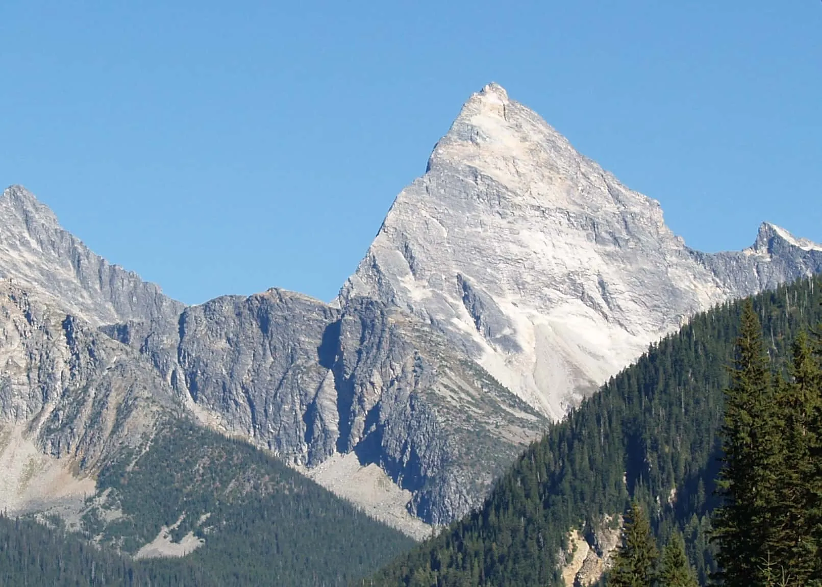
Distance: 8.8 km return
Time: 5 – 6 hours
Elevation Gain: 1,000 m
Why it’s awesome: Sweat all over this classic hike.
Although it takes ropes and rock climbing skills to summit Mount Sir Donald, the hike to the base of the face has a lot to offer in the way of authentic mountain experience. Rocky moraines, desolate-looking glaciers and tenuous footing are softened by rugged alpine greenery, mountain streams and gorgeous views.
How do I get to the trailhead? The trailhead is located at the Illecillewaet campground.
Read more: goldenhikes.ca
Distance from Revelstoke: 65 km
9. Mount Begbie Summit Trail
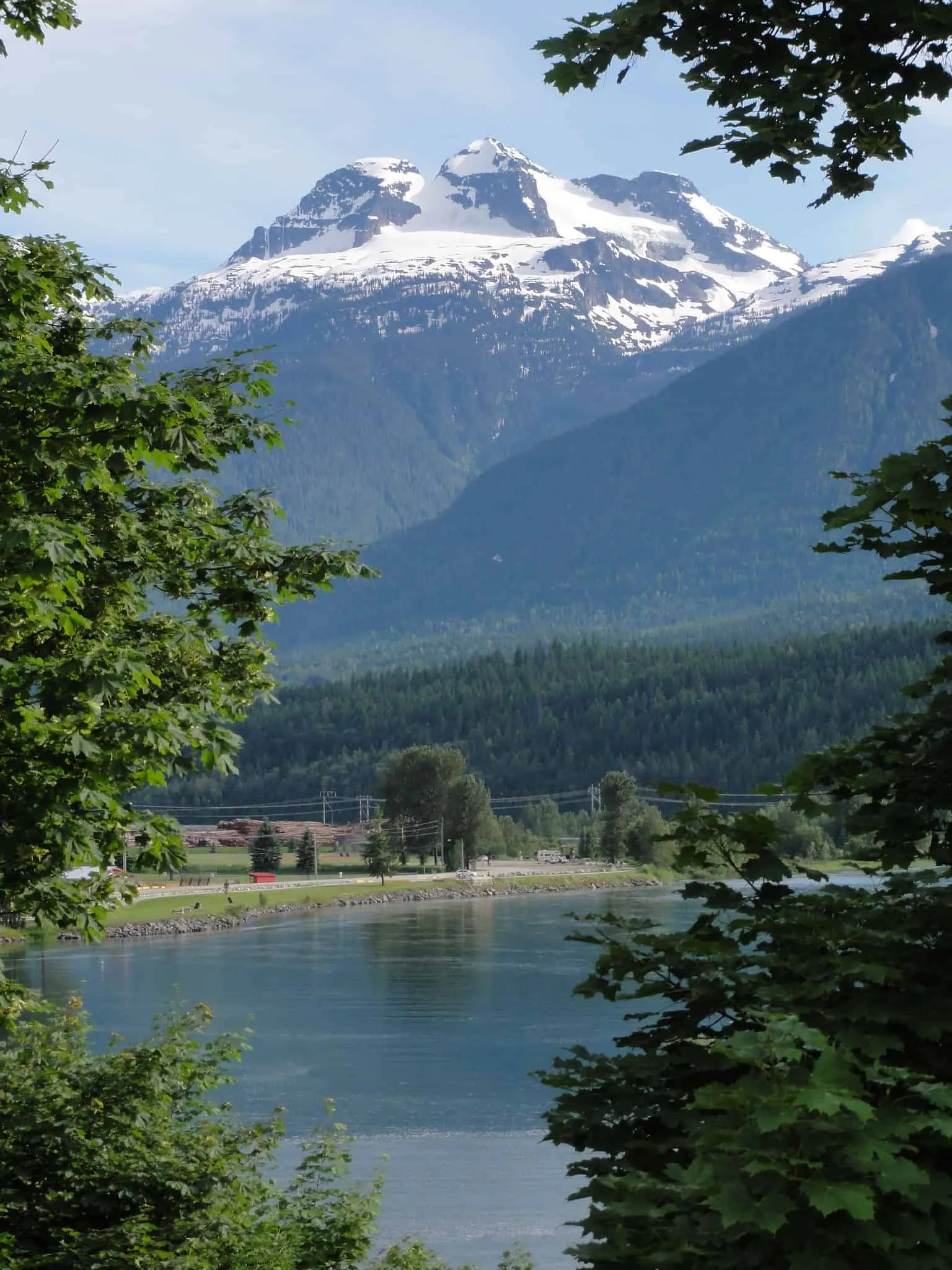
Distance: 12 km return (to glacier)
Time: 7 hours
Elevation Gain: 1,300 m
Why it’s awesome: Pack a tent—you might be tempted to stay.
A steep climb through deep forest emerges onto breezy subalpine terrain. Continue upwards to the foot of the glacier, where experienced climbers can venture onward to the summit. If you don’t have the right gear or experience for glacier travel, stop here and take in the view of Mount Begbie and the peaks and valleys below.
How do I get to the trailhead? The trailhead is located 2.5 km past the Mount Macpherson Cross Country Day Lodge on Highway 23.
Read more: revelstoketrails.com
Distance from Revelstoke: 28 km
Bloggers who have lived the adventure: stevensong.com
10. The Stoke Climb
Revelstoke Mountain Resort
Distance: 5.3 km
Time: 1.5 hours
Elevation Gain: approx. 500 m
Why it’s awesome: Gondola ride + alpine views + buffet breakfast = stoke.
This year, Revelstoke Mountain Resort is offering new hiking trails that start at the top of the Revelation gondola, including the Stoke Climb. From the gondola, hike through the subalpine zone above the trees and take in the views of mountaintops and the Columbia River valley below. Reward yourself with a buffet breakfast at Revelation Lodge.
How do I get to the trailhead? The trailhead is located along the Cupcake Loop from the Upper Gondola.
Read more: revelstokemountainresort.com
Distance from Reveltoke: 6 km
Have you been hiking near Revelstoke?
What’s your favourite trail?
Comment below!
Top picks for hiking gear to tackle these trails:
Hiking boots:
Backpacks:
When you purchase something via the links in our articles, we may earn a small affiliate commission. Read more about our policy.


