10 of the Best Hiking Trails Near Thunder Bay, Ontario
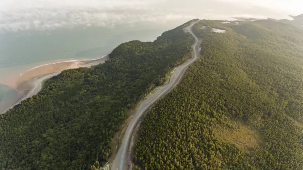
Northwestern Ontario offers hiking trails that lace beside great bodies of water, thread through thick forest and meander up mountains to scenic viewpoints. Keep an eye out for moose and wolves in Sleeping Giant Provincial Park and discover eagle-eye views over Lake Superior. Pack your hiking boots for these 10 awesome trails near Thunder Bay, ON:
Poplar Point Trail,
Kakabeka Falls Provincial Park

Length: 4 km round-trip
This accessible, multi-use trail is an easy, wide path that loops around the Whispering Hills Campsite. Poplar Point Trail. To extend your hike, continue onto Beaver Meadows Trail which intersects with Poplar Point Trail to add another 4.5 km.
More information: ontarioparks.com
Distance from Thunder Bay: 30 km
Mount McKay Trail
Length: 2 km round-trip
Elevation gain: 275 m
Trailhead: Mt McKay Lookout Drive / scenic lookout parking lot
Mount McKay sits just past Thunder Bay city limits and is an instantly recognizable landform to those who call the city home. It’s located on the Indian Reserve of the Fort William First Nation and was originally known as “Thunder Mountain.” Conquer it for sunset and a clear view of the Thunder Bay area. You’ll find a lookout point and a small memorial halfway up.
More information: ontariotravel.net
Distance from Thunder Bay: 18 km
Ouimet Canyon Trail,
Ouimet Canyon Provincial Park

Length: 1 km round-trip
Trailhead: Ouimet Canyon Provincial Park parking lot
From the parking lot, follow a one-kilometre loop through a forest to two viewing platforms that overlook the stunning Ouimet Canyon. One doesn’t hike this trail for the workout so much as to admire this interesting geographic feature. Interpretive signage highlights unique flora and fauna. Birders might keep their eyes peeled for Peregrine falcons, which sometimes nest on the cliffs of the gorge. Ouimet Canyon Provincial Park is day-use only (no camping permitted).
More information: ontarioparks.com
Distance from Thunder Bay: 75 km
Pines Hiking Trail,
Quetico Provincial Park

Length: 10 km round-trip
Trailhead: Dawson Trail Campground
You can hike this trail in one day or turn it into an overnight adventure. Paddle on Pickerel Lake, explore beautiful forest and soak in the serenity. Along the way, you’ll encounter some moderate-to-steep climbs. Pines Hiking Trail is an extension of the 2.5-km Whiskey Jack Trail.
More information: ontariotrails.on.ca
Distance from Thunder Bay: 166 km
Sawyer Bay Trail,
Sleeping Giant Provincial Park
Length: 12 km round-trip
Trailhead: Kabeyun Trail parking lot
This trail was once a logging road. Now, it takes hikers to the base of the Sleeping Giant. Expect stunning lake views and wild berries. You’ll have to share with fellow outdoor enthusiasts: mountain bikers and trail runners also frequent this trail.
More information: superiorhiking.com
Distance from Thunder Bay: 83 km
Talus Lake Trail,
Sleeping Giant Provincial Park

Length: 12 km round-trip
Elevation gain: approx 500 m
Trailhead: Kabeyun Trail at Tee Harbour
Hikers can follow this trail all the way to Thunder Mountain. Leading through forested areas and passing by lakes, meadows, cliffs and a small waterfall, this out-and-back route is home to assorted wildlife, especially deer and moose.
More information: alltrails.com
Distance from Thunder Bay: 85 km
Middlebrun Bay Trail,
Sleeping Giant Provincial Park

Length: 4.2 km round-trip
Trailhead: Sibley Creek Bridge
Middlebrun Bay Trail is a gentle out-and-back hike that follows the stony shoreline of Lake Superior to a secluded beach—nice for a chilly dip in the summer or admiring dramatic ice formations in the winter. Extend your outing by venturing to Finlay Bay at the end of the beach. Keep your eyes peeled for wildlife.
More information: ontariotrails.on.ca
Distance from Thunder Bay: 81 km
Top of the Giant,
Sleeping Giant Provincial Park

Length: 22 km round-trip
Elevation gain: 290 m
Trailhead: Via Kabeyun Trail
As the highest point in Ontario, no outdoor excursion in the Thunder Bay area is complete without attempting to tackle the giant. Top of the Giant Trail can be accessed via the Kabeyun Trail. At Tee Harbour take the Talus Lake Trail to reach the Top of the Giant Trail. From the pinnacle of Top of Giant, hikers will get panoramic views of the boreal forests and Lake Superior.
More information: ontarioparks.com
Bloggers who have lived the adventure: hikebiketravel.com
Distance from Thunder Bay: 85 km
Middle Falls Lookout Trail,
Pigeon River Provincial Park

Length: 4 km round-trip
Trailhead: Park at the old Visitor’s Centre off Highway 593
Lesser known than the parks accurately named High Falls, this trail climbs up to a striking view of six-metre-tall Middle Falls.
More information: northernontario.travel
Distance from Thunder Bay: 65 km
Sifting Lake Trail,
Sleeping Giant Provincial Park
Length: 4 km round-trip
Elevation gain: 77 m
Trailhead: Parking lot near sign marked Sifting Lake Trail
A gentle out-and-back hike that leads hikers through old-growth white pine and eastern white pine forest to the tranquil shores of Sifting Lake. Located on the southern tip of the peninsula, Sifting Lake Trail is one of the lesser-frequented hikes in the provincial park.
More information: visitnorthwestontario.com
Distance from Thunder Bay: 82 km
Are you an avid hiker in the Thunder Bay-area?
Let us know which trail is your favourite.
Comment below!
Canada’s Best Adventure Towns: Thunder Bay, Ontario
Great Hikes & Tasty Brews in Thunder Bay


