


25 of the Best Hikes in Canada’s North

Trail suggestions made by David Webb
It might possibly have been easier for our writer Doug O’Neill to complete the Cirque of the Unclimbables than assemble 25 of the Best Hikes in Canada’s North.
After all, these trails crisscross some of our nation’s most remote places, and up-to-date details can be infrequent and incomplete. And just when we thought we were on the right track, emails exchanged with Parks Canada employees would reveal that what we originally thought were trails, were technically unmarked routes. Well, we supposed that’s bound to happen in a tree-less alpine tundra…
Next, Explore readers will notice a diversion from our usual format. Typically, we dedicate 25 best to an entire province. We wondered, could Nunavut and the Northwest Territories support their own round-up?
Based on accessibility (some northern national parks receive less annual visitors than the summit of Mount Everest!) and the expedition-like demands of some of the included trails/routes, we opted to combine all three territories into one article…at least for now.
In assembling 25 of the Best Hiking Trails in Canada’s North, we’ve endeavored to provide the most accurate details we could get our hands on. However, we recognize that some trail descriptions may be incomplete. As greater numbers of intrepid hikers venture north, and more details come to light, we’ll aim to update this document.
As a final note, if you’re inspired to attempt these northern treks, Parks Canada has a wealth of invaluable information to offer rec users. Often times, in the form of PDF documents, park orientations and current conditions relayed from employees posted in the territories. Since this is some serious backcountry with unique Arctic demands, we’d advise you connect with Parks Canada or a local guide before setting out.
Last updated 8/8/2017
Want to see where these hikes rank against Canada’s greatest hikes?
Click here to download our free eBook:
Best hikes in the Yukon
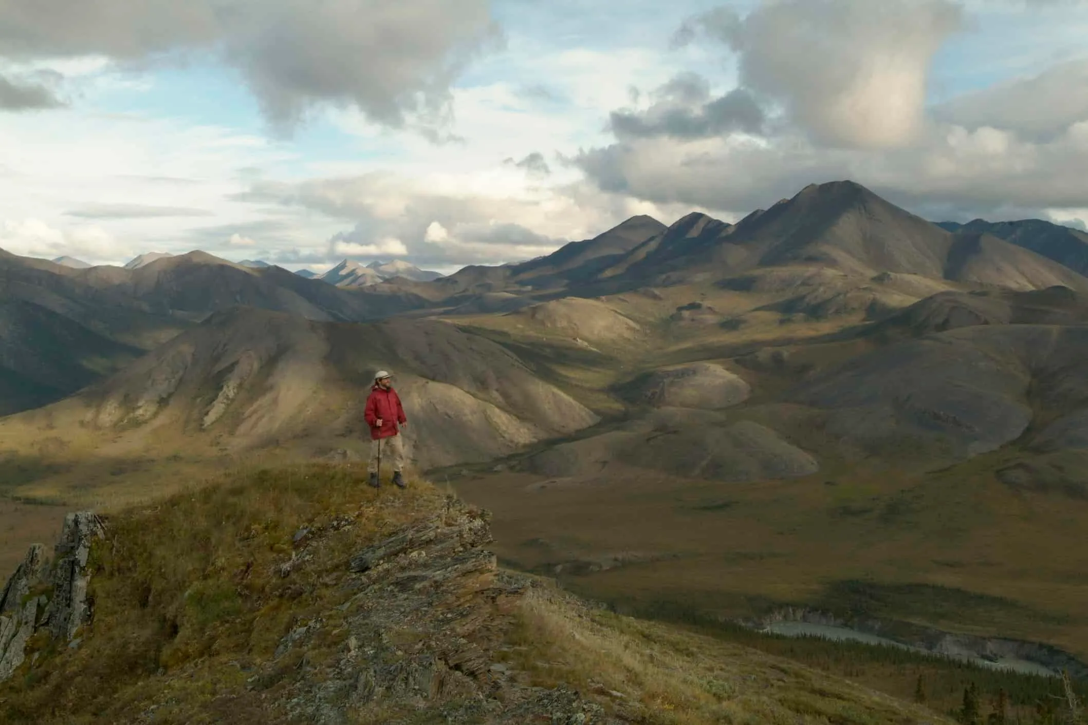
Grey Mountain
Closest city/town/village: Whitehorse
Total distance: 6 km (12 return)
Duration: 5 to 6 hours
Difficulty: Moderate to difficult
Details: This alpine hike is a mere 12-km drive from Whitehorse. Plan for ridgeline trekking and some steep climbs (200 metres up to the summit). Consider a vehicle with high clearance or four-wheel drive to reach the trailhead due to conditions of Grey Mountain Road. Great views of Whitehorse, Marsh Lake and Lake Laberge.
King’s Throne
Kluane National Park
Closest city/town/village: Haines Junction
Total distance: 15 km
Duration: 6 to 8 hours
Difficulty: Difficult
Details: This challenging hike, which begins at an old mining road at Kathleen Lake, switchbacks upwards (an elevation gain of 548 metres) over rocky terrain and narrow cliff-side trails. Views are staggering. Register at the Parks Canada Visitor Centre. Read more here.
Auriol Trail
Kluane National Park
Closest city/town/village: Haines Junction
Total distance: 15 km (loop)
Duration: 5 hours
Difficulty: Easy
Details: The Auriol Trail (ideal for day hikers or overnighters) is about seven kilometres southwest of Haines Junction and is considered an “easy intro” to Kluane National Park’s pristine wilderness. The subalpine path starts on an old wagon road. Enthusiasts can add on an extra hike to the peak (see below).
Auriol Peak path
Kluane National Park
Closest city/town/village: Haines Junction
Total distance: 9 km
Duration: 6 to 8 hours
Difficulty: Challenging
Details: Not an official trail, this unmaintained, unmarked offshoot of the Auriol Trail starts at the 8.2 km marker. It’s your chance to explore the sub-alpine terrain and climb to Auriol Peak. Payoff for the 400-m elevation gain? The views of Quill Peak and Mount Martha Black.
Ä’äy Chù (Slim’s River) East Route (*Route, not a trail*)
Kluane National Park
Closest city/town/village: Haines Junction
Total distance: 46 km
Duration: 3 to 5 days
Difficulty: Moderate to difficult
Details: Hike along the shores of Slim’s River and camp near the toe of Kaskawulsh Glacier. The first 22.5 km of trail, which starts at Thachäl Dhäl Visitor Centre, are marked but you’ll need to beef up route-finding skills after that point. Consider the climb up to Observation Mountain (see below).
Observation Mountain Plateau
Kluane National Park
Closest city/town/village: Haines Junction
Total distance: 22 km
Duration: 1 to 2 days
Difficulty: Difficult
Details: Head to the campsite at the 23-km mark of the Ä’äy Chù Trail (see above) to find the trailhead to Observation Mountain. Incredible views of Kaskawulsh Glacier are Mother Nature’s compensation for this energy-burning hike. Mountain goats hang out on the cliffs surrounding Columbia Creek, so do bears.
Sheep Creek Trail
Kluane National Park
Closest city/town/village: Haines Junction
Total distance: 10 km (plus an optional 6-km hike to the ridge)
Duration: 7 to 8 hours
Difficulty: Moderate
Details: Sheep Creek Trail is a 10 km return trip from the Thachäl Dhäl parking lot. Hikers can tack on a 6 km return trek (on an unmaintained and unmarked route) to the top of Thachäl Dhäl Ridge, which offers amazing views of Kluane Lake. Expect some steep climbs up ragged creek valleys.
Grizzly Ridge Trail
Tombstone Territorial Park
Closest city/town/village: Dawson City
Total distance: 5 km
Duration: 3 to 4 hours
Difficulty: Easy
Details: Note, there’s the main 11.5-km Grizzly Lake Trail, sometimes rocky and steep, plus various side trails. The Grizzly Ridge Trail rewards hikers with amazing views of Mount Monolith. To reach Grizzly Pass, follow the slightly more challenging 5-km side trail called the Twin Lakes and Mount Monolith Viewpoint.
Montana Mountain
Closest city/town/village: Carcross
Total distance: 9 km
Duration: 3 to 4 hours
Difficulty: Moderate
Details: Montana Mountain is a mecca for mountain bikers, which is important to know if you hike the historic Sam McGee Trail (marked by loose stone and steep tricky climbs) and decide to continue onto the shared Mountain Hero trail. Make room for the bikers – especially on the descent.
Halfway to Heaven
Ivvavik National Park
Closest city/town/village: Inuvik
Total distance: 5.7 km (11.4 km return)
Duration: 3 to 6 hours one way
Difficulty: Difficult
Details: Of the various unmarked routes in Ivvavik, the most challenging is the hike to the 800-m peak Halfway to Heaven, which is said to “rise toward the sky like the jagged spine of a dragon.” From base camp at Sheep Creek, visitors can trek to the pinnacle-shaped tors for 360 degree views of the park.
Wolf Tors
Ivvavik National Park
Closest city/town/village: Inuvik
Total distance: 7.2 km
Duration: 5 hours (each way)
Difficulty: Difficult
Details: Ivvavik National Park is a fly-in destination – there are no designated trails. Hikers follow recognizable landmarks such as lakes, creeks, eskers, rivers, valleys and hills. Start hiking at Inspiration Point and follow the ridge (elevation 422 metres) away from the Firth River towards the dramatic Wolf Tors. Caribou migration is late May to early June. Registration with Parks Canada is mandatory. See trail map here.
Fish Lake Trail
Closest city/town/village: Whitehorse
Total distance: 7 km (return)
Duration: 2 hours (max)
Difficulty: Easy
Details: This alpine ridge walk is do-able after work – when daylight cooperates – or on a weekend afternoon. You’ll be above the tree line (at 350 metres) in no time. Great views of Fish Lake on one side, Bonneville Lake on the other. Busy on weekends, well, Yukon kind of busy. Watch for horses.
Best hikes in the Northwest Territories
Cirque of the Unclimbables climb
Nahanni National Park Reserve
Closest city/town/village: Fort Simpson
Duration: 7 to 21 days, depending on the number of peaks one plans to climb and mode of travel (float plane, canoe, hiking).
Difficulty: Difficult
Details: The Cirque is a cluster of sheer granite peaks and cliffs in the MacKenzie Mountains best reached on day trips from the base camp at Fairy Meadows, which is a four to six-hour hike from Glacier Lake. The 600-metre Lotus Flower Tower, a one-hour hike from Fairy Meadows, can be climbed within 12 to 15 hours, or two to three days at a moderate pace.
Ram Plateau
Nahanni National Park
Closest city/town/village: Fort Simpson
Total distance: Depends on route
Duration: One day
Difficulty: Moderate with challenging accessibility
Details: A heli-hiking destination, the lure of Ram Plateau is the vista of massive dolomite canyons which run 1,200 to 1,800 deep. Dall sheep, caribou, grizzlies, and raptors can be spotted. Base camp, typically on the plateau, allows for great day hikes. Seasoned wilderness hikers can bushwhack from Nahanni Butte but it’s rare – not to mention challenging.
Canol Heritage Trail
Closest city/town/village: Norman Wells
Total distance: 355 kilometres
Duration: 14 to 22 days
Difficulty: Difficult
Details: This long-abandoned military road cuts through the taiga and tundra of the Mackenzie Mountains from Norman Wells to the Yukon border. Self-sufficiency is vital as there are no services or supply sources. River crossings can be challenging (especially with heavy packs). See the trail brochure here.
Salt River Trail
Wood Buffalo National Park
Closest city/town/village: Fort Smith
Total distance: A network of short hikes ranging from .5 km to 13 km
Duration: 4 to 5 hours
Difficulty: Easy
Details: This day outing encompasses a number of relatively easy hikes, including the Karstland Loop (750 m), the Salt River Meadows Loop (1.5 km) and Salt Plains Access (500 m). Expect karst terrain, active sinkholes, salt meadows and weirdly-shaped rocks eroded by salt and frost. Find trail details here.
Lane Lake Trail
Wood Buffalo National Park
Closest city/town/village: Fort Smith
Total distance: 13 km
Difficulty: Moderate
Details: One of the marked paths within the Pine Lake Campground, this winding trail (mostly through boreal forest), bypasses a chain of small sinkhole lakes. The trailhead is at Kettle Point Road.
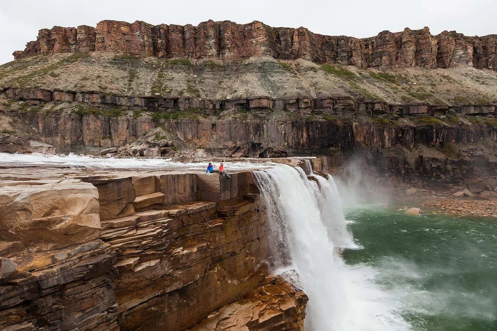
La Roncière Falls
Tuktut Nogait National Park
Closest city/town/village: Inuvik
Total distance: Depends on routes chosen
Duration: 10 to 17 km per day
Difficulty: Easy-to-difficult
Details: Expect tundra, barren rock plateaus, wild rivers, waterfalls, deep canyons and lakes – but very few named landscape features to follow. Float planes transport hikers from Paulatuk to the trailhead beside a small lake southeast of La Roncière Falls. Then it’s a 4-km hike west to set up camp on a creek near the 23-metre high falls. If weather conditions prevent float plane transport at the end of the trip, visitors must return to Paulatuk by foot. There’s a 107-km hike from Erly Lake to Paulatuk (Hornaday River Canyon West) that takes about 10 days.
Ranney Hill-Martin Lake Trail
Closest city/town/village: Yellowknife
Total distance: 2.5 km
Duration: One hour
Difficulty: easy
Details: This unmarked path, a 10-minute drive from downtown Yellowknife, is part of the Ingraham Trail network. Climb 200 metres to the summit of a pink-granite dome for a 360-degree panorama of the Yellowknife area. Take your post-hike breather at nearby Martin Lake.
Alexandra Falls to Louise Falls
Twin Falls Gorge Territorial Park
Closest city/town/village: Fort Smith
Total distance: 2.2 km
Duration: one hour (or less)
Difficulty: Easy
Details: The 2.2-km boardwalk connects the 32-metre-high Alexandra Falls to the three-tiered Louise Falls on the Hay River. Tackle the 138-step spiral staircase to the lip of Louise Falls. Picnic tables and kitchen shelters are located at both waterfalls. Bonus eye candy: 400-million-year-old limestone formations.
Best hikes in Nunavut
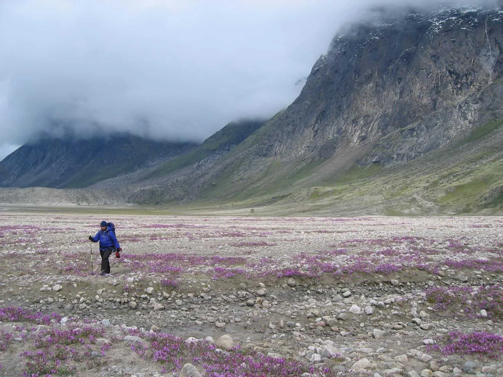
Akshayuk Pass
Auyuittuq National Park
Closest city/town/village: Pangnirtung
Total distance: 97
Duration: 10 days
Difficulty: Difficult
Details: To reach the park, visitors hop a boat from the hamlet of Pangnirtung. Auyuittuq means “the land that never melts,” so summer is best. Expect to hike along steep fjords and over glacier moraines and tundra in the shadow of the towering Overlord, Asgard and Thor mountains. Lots of river crossings.
Itijjagiaq Trail
Katannilik Territorial Park
Closest city/town/village: Iqaluit
Total distance: 120 km
Duration: 5 to 6 days
Difficulty: Difficult
Details: This traditional Inuit route – remote and challenging –between the towns of Kimmirut and Iqaluit on Baffin Island is best hiked in July and August. Varied terrain: deep gorges, rolling hills, waterfalls and boulder-strewn plateaus, which are home to wolves, foxes, caribou and polar bears. Park registration is mandatory. See trail handout here.
Northwest Passage Trail
Gjoa Haven
Closest city/town/village: The hamlet of Gjoa Haven is accessible by air from Cambridge Bay
Total distance: 1.47km
Duration: One hour
Difficulty: Easy
Details: This short, self-guided historical walking tour, managed by the hamlet of Gjoa Haven and Nunavut Parks and Special Places, chronicles the European quest for the Northwest Passage and the ill-fated Franklin Expedition. Start at the Heritage Centre.
Tanquary Fiord-Lake Hazen Pass
Quttinirpaaq National Park
Closest city/town/village: 70 kilometres
Duraton: 8 to 12 days
Difficulty: Difficult
Details: There are no designated trails in Quttinirpaaq National Park. Backpackers follow a route between Tanquary Fiord and Lake Hazen through the MacDonald River and Very River valleys. Expect challenging hiking over tundra (where muskoxen roam) and streams to cross. An orientation session (mid-May to August) with Parks Canada is mandatory.
Honourable Mention: Ancient Sea Bed*
Resolute Bay/Tupirvik Territorial Park
Closest city/town/village: Resolute
Difficulty: Easy
Details: Spend a couple hours exploring the ancient seabed terrain close to the shoreline near the Tupirvik Park campground and you will find fossils of fish 400 million years old. Signage from the airport leads to the campsite (outhouse facilities, tent pads and fire pits). *There are no dedicated trails.
Want to see where these hikes rank against Canada’s greatest hikes?
Click here to download our free eBook:
More hikes by province:
25 Incredible Hiking Trails in Nova Scotia


