


20 of the Best Hikes near Vancouver, British Columbia


Is this the best hiking city in Canada?
Oh, Vancouver. Hailed as one of Canada’s most livable cities (although certainly not the most affordable), it’s no wonder adventurous people strive to live here. The downtown core itself lies adjacent to a massive playground of greenery, flanked with sandy, swimmable beaches.
Vancouverites are known as outdoorsy people—cyclists and runners speckle the seawall year-round. But of all the adventurous pursuits to partake in, hiking is perhaps the most popular.

Depending on snowfall and spring weather, hiking season can be limited to June through October. In the late spring, trails may be partially covered with snow, making them slippery, mucky and dangerous.
It’s important to keep in mind that despite city views on the horizon, many of these trails are in the backcountry. In summer, approximately three to five rescue calls are made each weekend by lost, injured or stranded hikers. Proper precautions should be taken before you set out: research your hike, dress appropriately, tell someone where you are going and when you expect to return.
Learn more about staying safe on Vancouver’s trails from AdventureSmart.
Now that you’re adequately briefed, here are 20 of the best hiking trails near Vancouver, British Columbia.
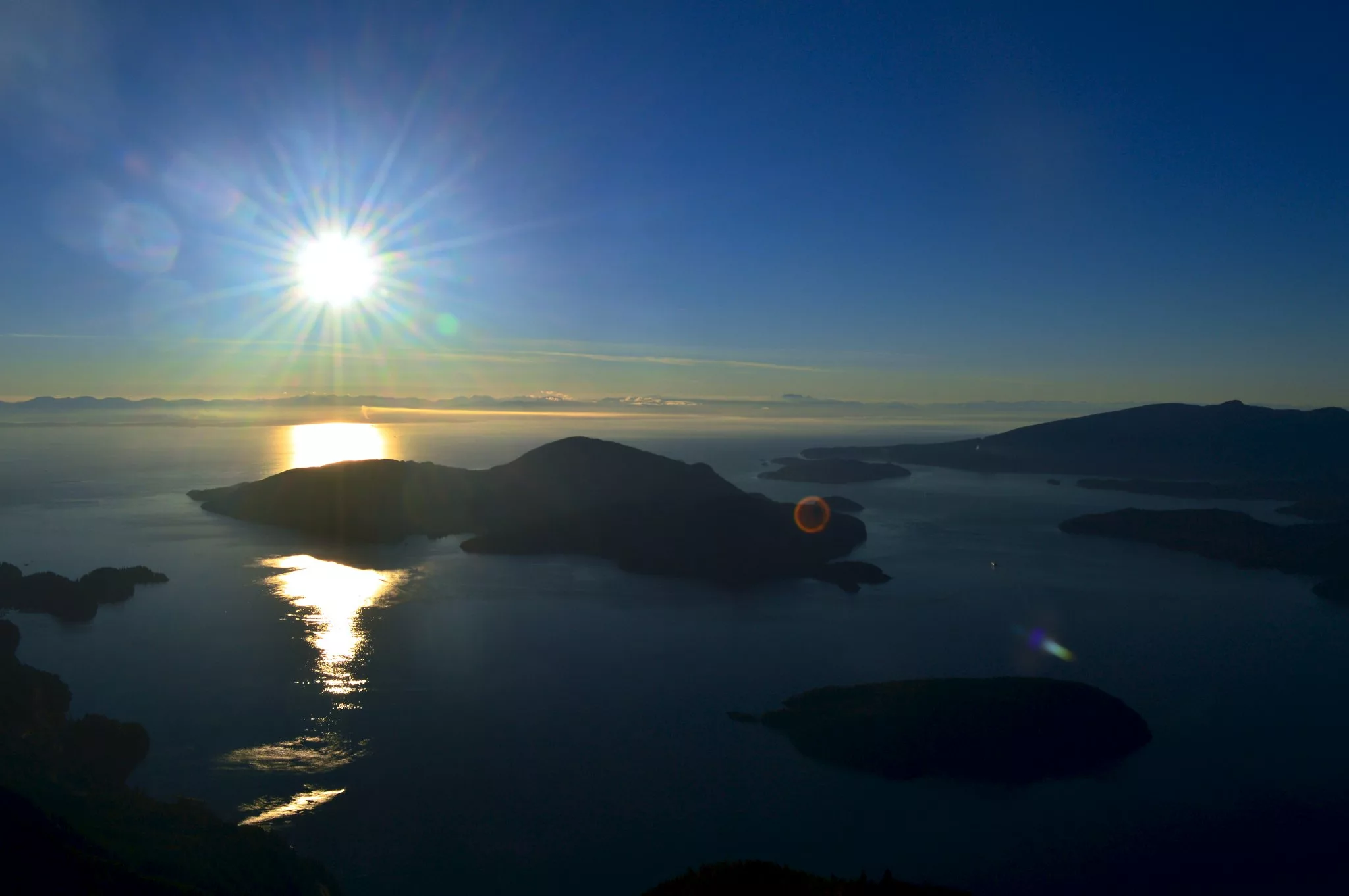
1. St. Mark’s Summit
Cypress Provincial Park
 Flickr/Harold Cecchetti (CCby-SA2.0)
Length: 11 km round-trip
Duration: 4-5 hours
Elevation gain: 460 m
Difficulty: Moderate
On clear days, the summit of this hike offers unparalleled views of Howe Sound. Even on overcast days, you’ll feel like a conqueror above the clouds. The trail first follows ski runs with steep and rocky sections, before heading into a pretty forest. Continue along before gaining some elevation over a steep set of switchbacks. The forest eventually thins out before you reach St. Mark’s Summit. Note: hikers will not find clear signage for St. Mark’s Summit; it is a lookout located along the Howe Sound Crest Trail. However, the Summit is marked with a sign post, so you won’t miss it.
How do I get to St. Mark’s Summit trailhead? This hike starts at the Cypress Mountain parking lot. From here, walk toward the Lion’s Express chairlift. Follow sign posts for Howe Sound Crest Trail. Shortly thereafter, you will encounter a sign post that says Howe Sound Crest Trail east and west. It does not matter which you take; these connector trails deposits you on a gravel road. At the junction, walk left; the road will narrow and you’ll enter the woods. Another 20 minutes or so later, you’ll reach an official Cypress Provincial Park map, which will point you in the right direction.
Day pass required: No
Read more: Click here
Distance from Vancouver: 27.2 km
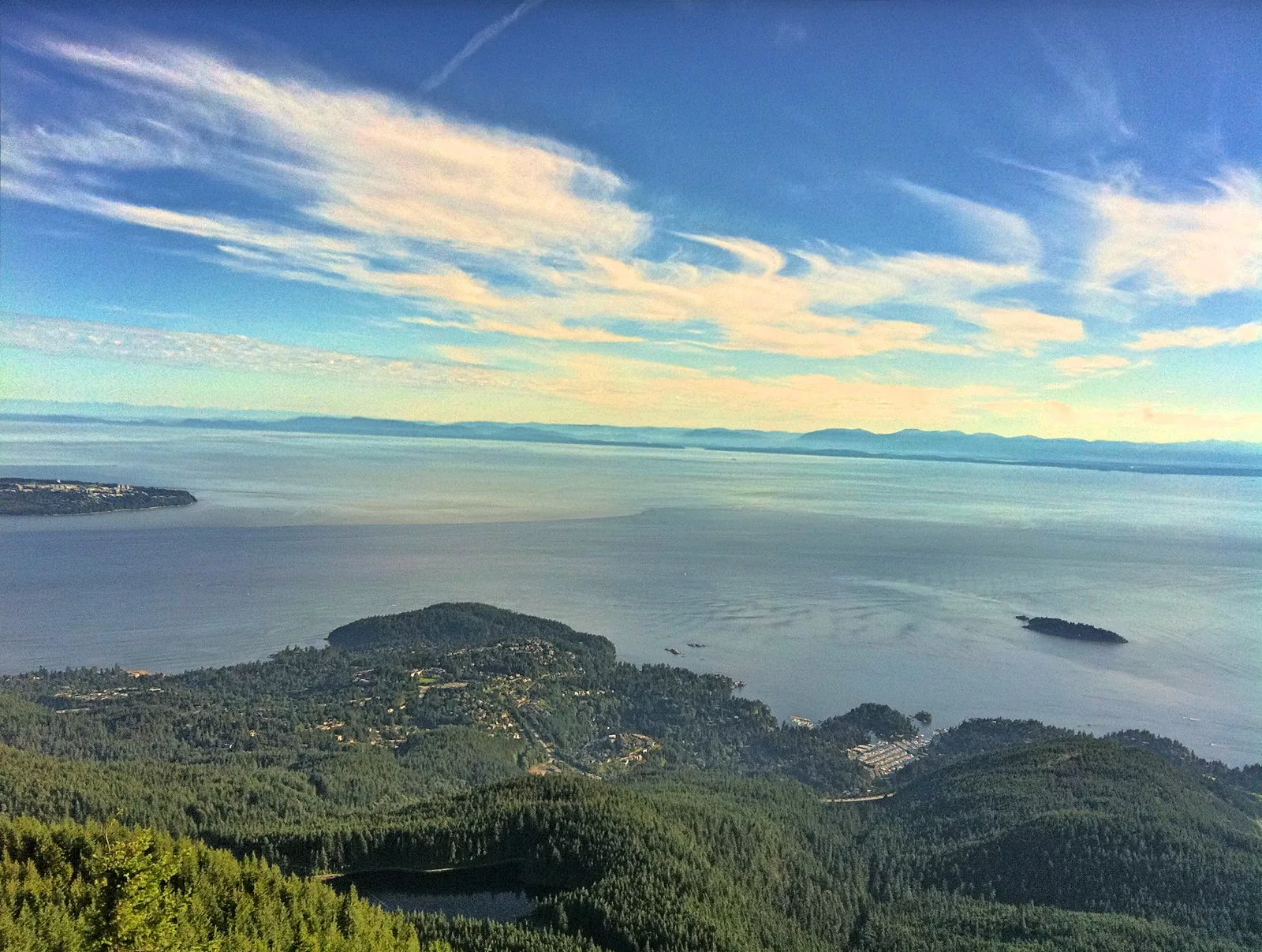
2. Eagle Bluffs
Cypress Provincial Park
 Flickr/Kyle Pearce (CCby-SA2.0)
Length: 8 km round-trip
Duration: 3-4 hours
Elevation gain: 350 m
Difficulty: Moderate
This trail begins with a gruelling ascent to Cabin Lake, which you can jump in to cool off. Continue along the Baden-Powell Trail to a rock scramble along the bluffs. Ensure you wear proper hiking attire and appropriate shoes.
How do I get to the Eagle Bluffs trailhead? Park in the unpaved lots and then make your way on foot to the downhill ski area. Pass the green Olympic rings and the lodge. Head to the Eagle Express Quad Chairlift and find the trailhead just a few paces away. Access the bluffs by climbing Black Mountain. A few metres down the trail you’ll find a BC Parks signpost. Go left and starting hiking up, up, up.
Day pass required: No
Read more: Click here
Distance from Vancouver: 28 km
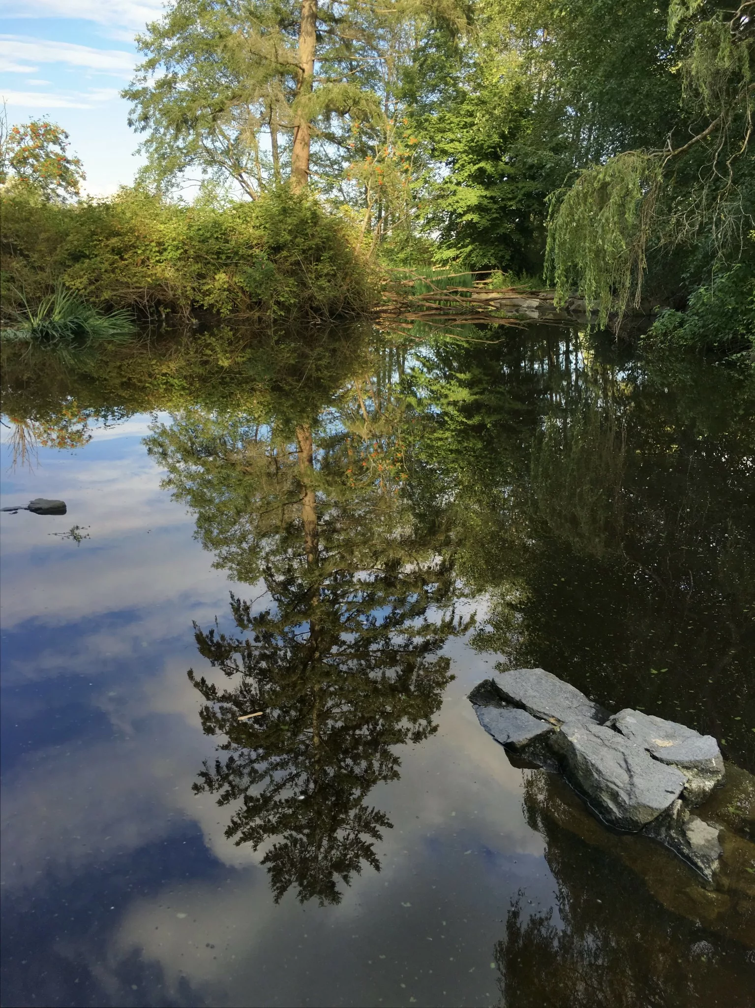
3. Stanley Park Inner Loop
Downtown Vancouver
 Flickr/Kyle Pearce (CCby-SA2.0)
Length: 8 km roundtrip
Duration: 2 hours
Elevation gain: approx. 100 m
Difficulty: Easy
Looking to get into nature without wandering far from the city? The Stanley Park Inner Loop is the perfect trail to check out when you want the greenery of the forest while staying close to downtown Vancouver. For maximum convenience, forgo your car and take the bus to the park.
How do I get to the Stanley Park Inner Loop trailhead? From Waterfront Station, you can head up Granville street to West Pender street and take the #19 bus into the park.
Read more: Click here
Distance from Vancouver: 3 km
4. Dog Mountain
Seymour Provincial Park
Length: 5 km round-trip
Duration: 1.5 – 2 hours
Elevation gain: 34 m
Difficulty: Easy
Although it’s a glorious sight any time of day, in our opinion, the sparkling city is most striking at sunrise, sunset or even during a moonlit night. However, the trail can be muddy, slippery, rocky and rooted, so if you do venture out for a night hike, don’t forget your headlamp! In winter, Dog Mountain can be done on snowshoes or with crampons. But in our opinion, it’s pretty miserable after rainfall or during spring melt.
How do I get to the Dog Mountain trailhead? This trail starts at the northern point of the Mount Seymour Ski Resort main parking lot.
Day pass required: No
Read more: Click here
Distance from Vancouver: 28.8 km
5. Mount Seymour
Seymour Provincial Park

Length: 9 km roundtrip
Duration: 4-5 hours
Elevation gain: 450 m
Difficulty: Moderate
This trail crosses three peaks that offer gorgeous views: First, Second and the final summit of Mount Seymour. This popular, dog-friendly trail can be crowded on weekends and sunny days, but the final panorama is worth sharing. It’s tiring but not too technical. Also worth noting: the trail may feature compact snow well into July.
How do I get to the Mount Seymour trailhead? From the end of the Mount Seymour Ski Resort parking lot. Follow the wide gravel service road that runs up beyond the chairlifts. The road will wind behind a large hill and if you follow it to its terminus, you’ll end up at the trailhead. Trail signage in the ski area is poor and no doubt, hikers will run into others looking for the trailhead. Just keep going!
Day pass required: No
Read more: Click here
Distance from Vancouver: 24.3 km
6. Baden Powell
Horseshoe Bay, Deep Cove
 Flickr/Guilhem Vellut (CCby2.0)
Length: 48 km
Duration: 20 hours
Elevation gain: over 1,000 m
Difficulty: Extreme
This long, rugged trail crosses the North Shore mountains and branches off in several spots. Although some extreme hikers and runners tackle the entire length in the Knee-Knacker Race, it’s more common to choose a section of the trail to complete, such as Lynn Canyon Suspension Bridges or Black Mountain.
How do I get to the Baden Powell trailhead? This trail stretches from Horseshoe Bay to Deep Cove. There are trailheads throughout.
Day pass required: No
Read more: Click here
Distance from Vancouver: 17.8 km
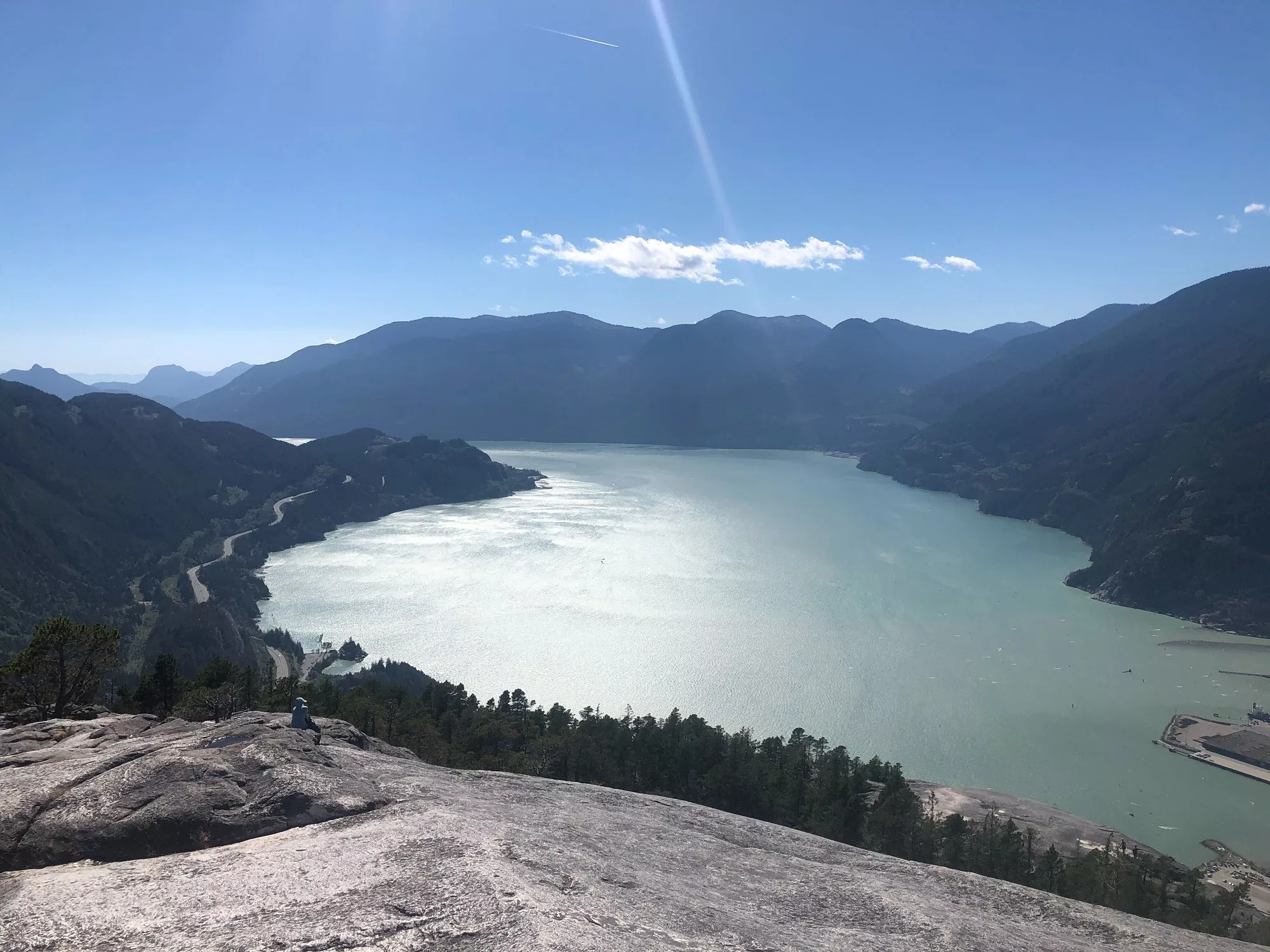
7. First Peak
Stawamus Chief
Length: 4.1 km (return)
Duration: 2-3 hours
Elevation gain: 541 metres
Difficulty: Moderate
Roots, rocks and a gruelling uphill climb make this short hike just outside of Squamish a true challenge. The granite playground and panoramic views of turquoise water at the top are well-worth the effort. Take a break from the (literal) staircase at the start of the hike to check out lower Shannon Falls. For a longer, less crowded adventure, follow the signs for the third peak instead.
How do I get to the Chief trailhead? The trailhead is at the Chief parking lot. On sunny weekends and any summer day, the lot can fill up quickly. Head out early to avoid taking multiple laps to find a spot.
Day pass required: No
Read more: Click here
Distance from Vancouver: 60.9 km
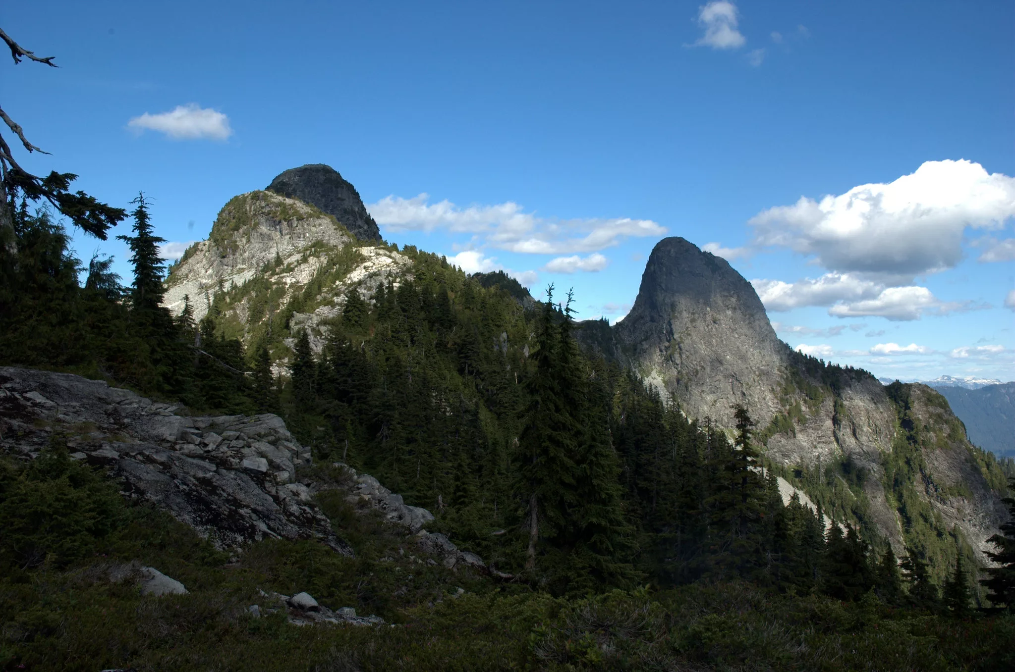
8. The Lions
West Vancouver
 Flickr/Gillicious (CCby-SA2.0)
Length: 16 km round-trip
Duration: 7 hours
Elevation gain: 1280 m
Difficulty: Difficult
If you’re looking to seriously stretch your legs, then let The Lions challenge you. These iconic twin peaks overlooking Vancouver are lovingly known as East and West Lion, and are probably on the bucket list of every North Shore hiker.
This is an in-and-out hike along the same route, which will deposit you back at your vehicle. Hikers without climbing skills need not reach the summit to enjoy hiking the Lions. Despite being a popular trail, be sure to wear or pack layers, plan for changing weather, and bring food and water.
How do I get to The Lions trailhead? Head for Sunset Drive, Lion’s Bay. Go early as the designated lot fills quickly. If the lot is full, turn around and backtrack to the elementary school. This area is patrolled and towed vehicles will be taken to North Vancouver!
Day pass required: No
Read more: Click here
Distance from Vancouver: 32 km
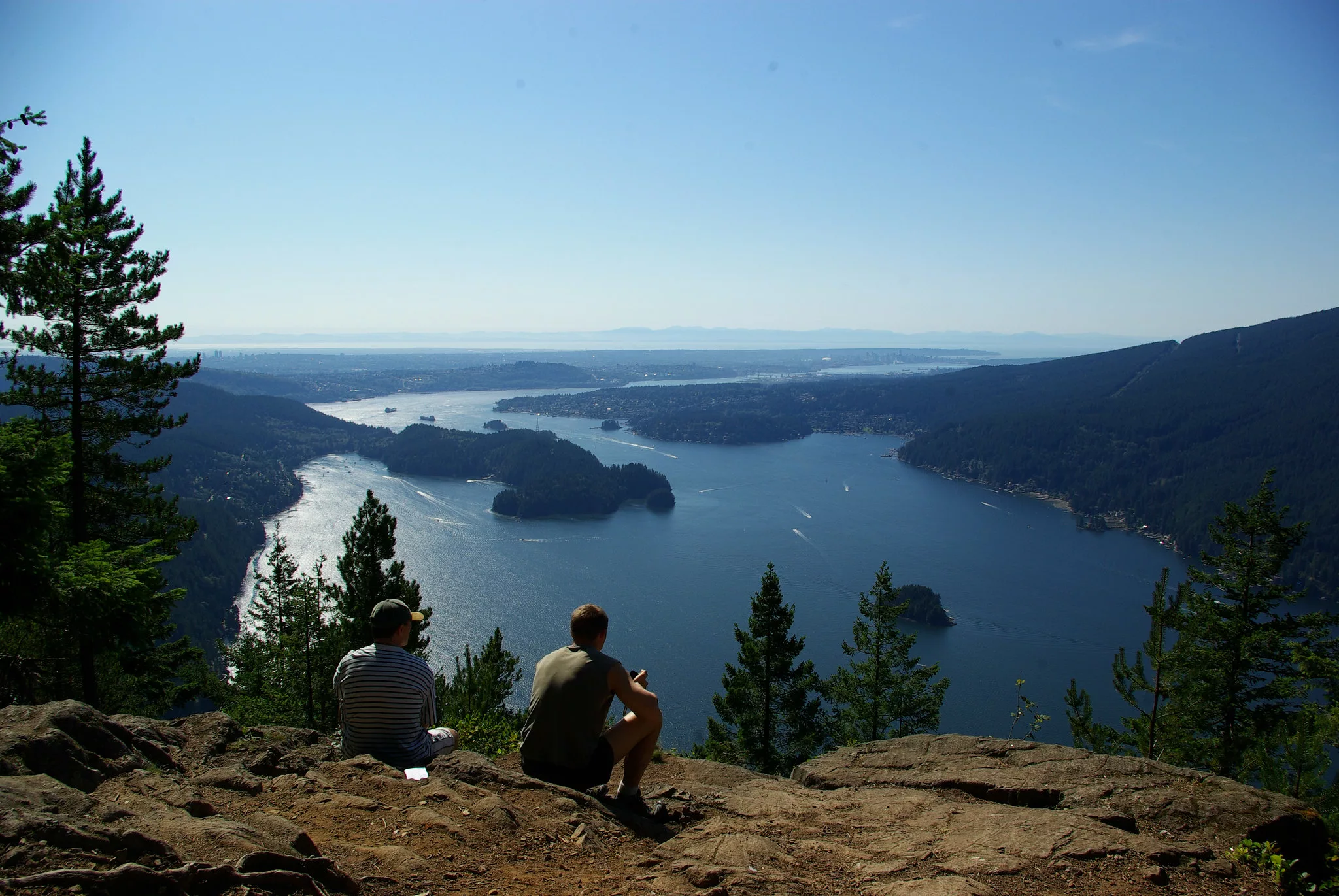
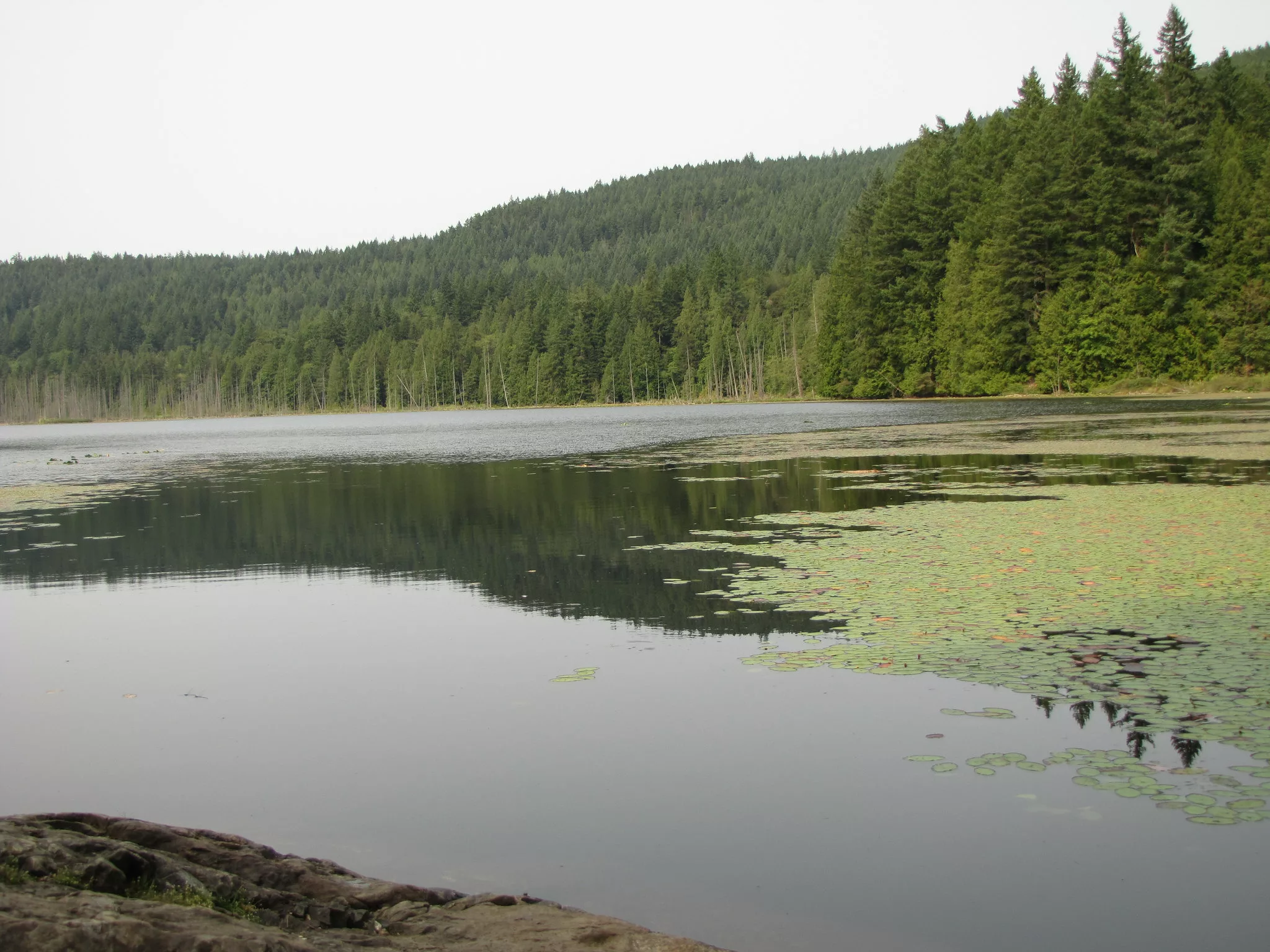
9. Sendero Diez Vistas
Buntzen Lake/Anmore
 Flickr/David J Laporte (CCby2.0)
Length: 15 km loop
Duration: 6-7 hours
Elevation gain: 460 m
Difficulty: Moderate
Diez Vistas means 10 Views, and that’s exactly what this hike offers. Tracing the shoreline of Buntzen Lake, the trail meanders through Indian Arm Provincial Park and overlooks Burrard Inlet and the North Shore. This area is maintained by BC Hydro.
How do I get to the Diez Vistas trailhead? Start walking along Buntzen Lake Trail and continue past the Diez Vistas sign.
Day pass required: Yes, register here.
Read more: Click here
Distance from Vancouver: 35.5 km
10. Elfin Lakes
Howe Sound
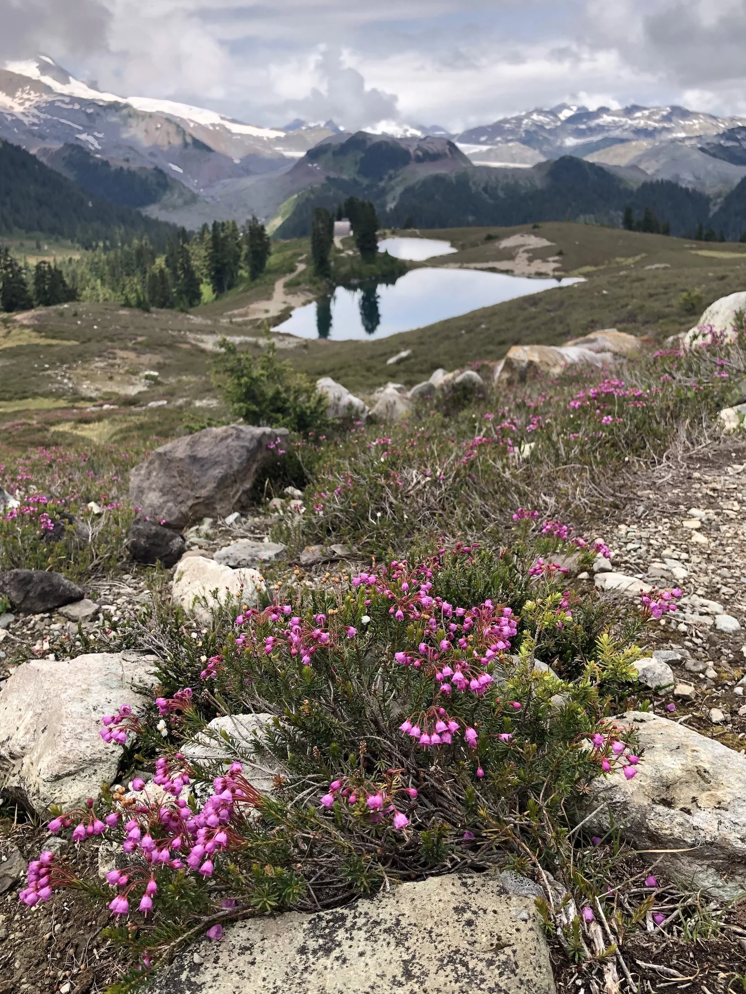
Length: 22 km
Duration: 5-7 hours
Elevation gain: 600 m
Difficulty: Moderate
Located in Garibaldi Provincial Park, Elfin Lakes are two small lakes that can be used for drinking (lower lake) or swimming (top lake). If accessing Elfin Lakes via the Diamond Head trailhead, you’ll need to book a free Day-Use Pass.
How do I get to the Elfin Lakes trailhead? From the parking lot, pass the yellow gate and head up the gravel road.
Day pass required: Yes, register here.
Read more: Click here
Distance from Vancouver: 81 km
11. Lynn Peak
Lynn Headwaters Regional Park
Length: 9 km roundtrip
Duration: 4-5 hours
Elevation gain: 720 m
Difficulty: Challenging
Climb through evergreen trees, stopping at several viewpoints to catch your breath. Only a 30-minute drive from Vancouver, this trail is quieter than nearby, more popular treks, but yields similarly stunning views on clear days.
How do I get to the Lynn Peak trailhead? Park in Lynn Headwaters Regional Park and begin the hike from the signboard near Lynn Creek.
Day pass required: No
Read more: Click here
Distance from Vancouver: 15.5 km
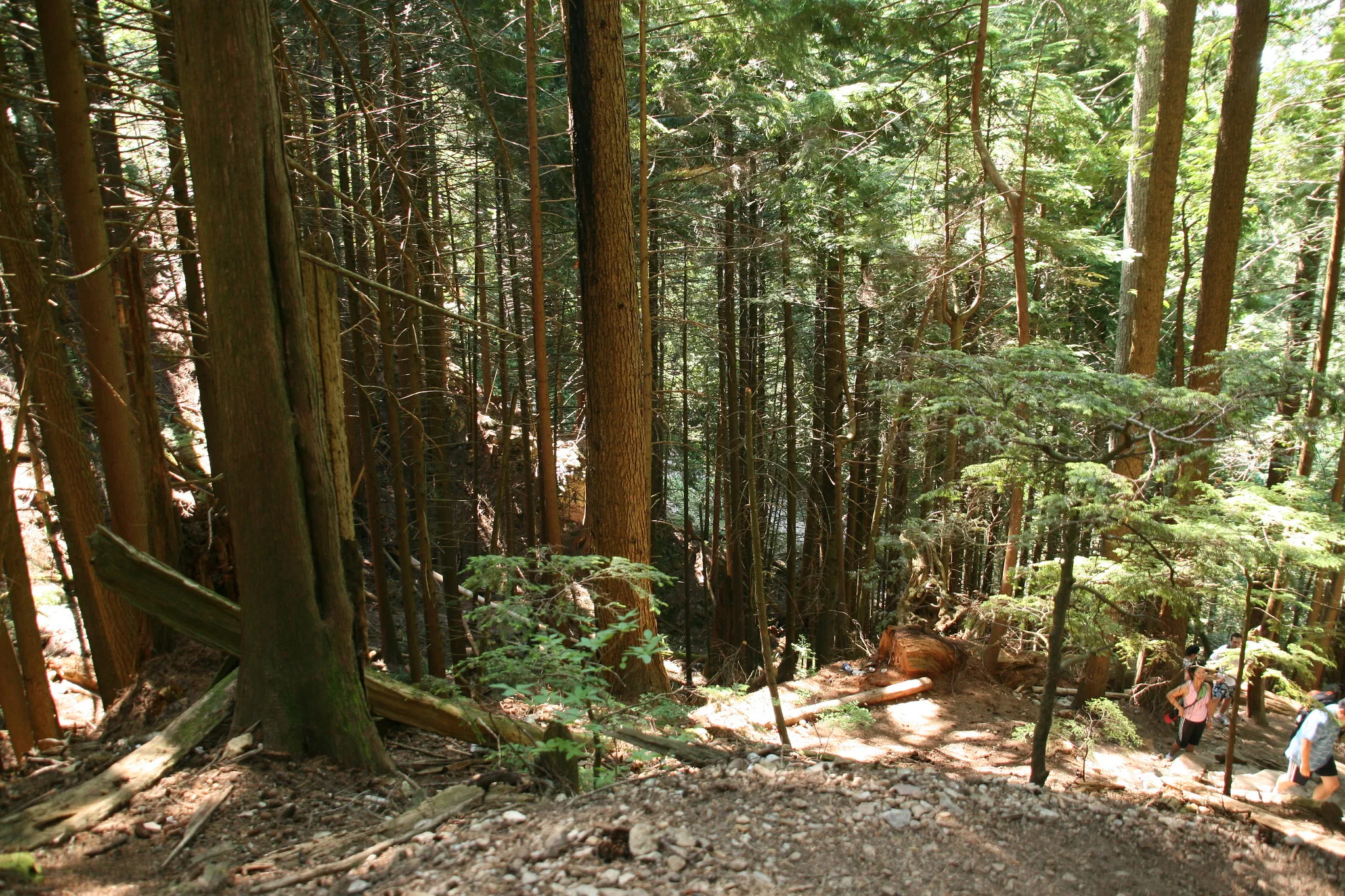
12. Lynn Loop
Lynn Headwaters Regional Park
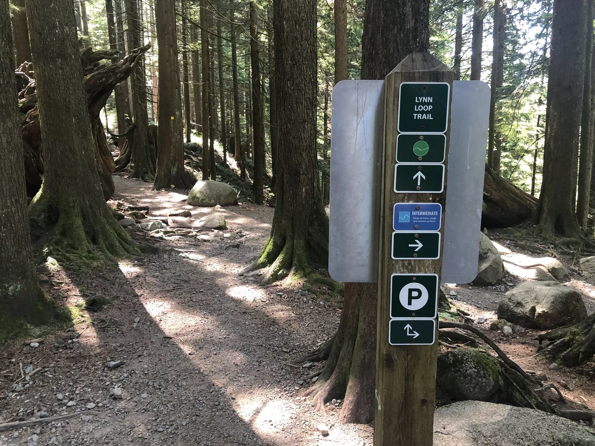 Brendan Sainsbury
Length: 5.1 km round-trip
Duration: 1.5 – 2 hours
Difficulty: Easy
Large cedar and hemlock trees, switchback trails and old logging equipment line the Lynn Loop trail. Hikers will cross Lynn Creek to complete this short, dog-friendly loop.
How do I get to the Lynn Loop trailhead? This trail begins at Lynn Headwaters parking lot.
Day pass required: No
Read more: Click here
Distance from Vancouver: 17.1 km
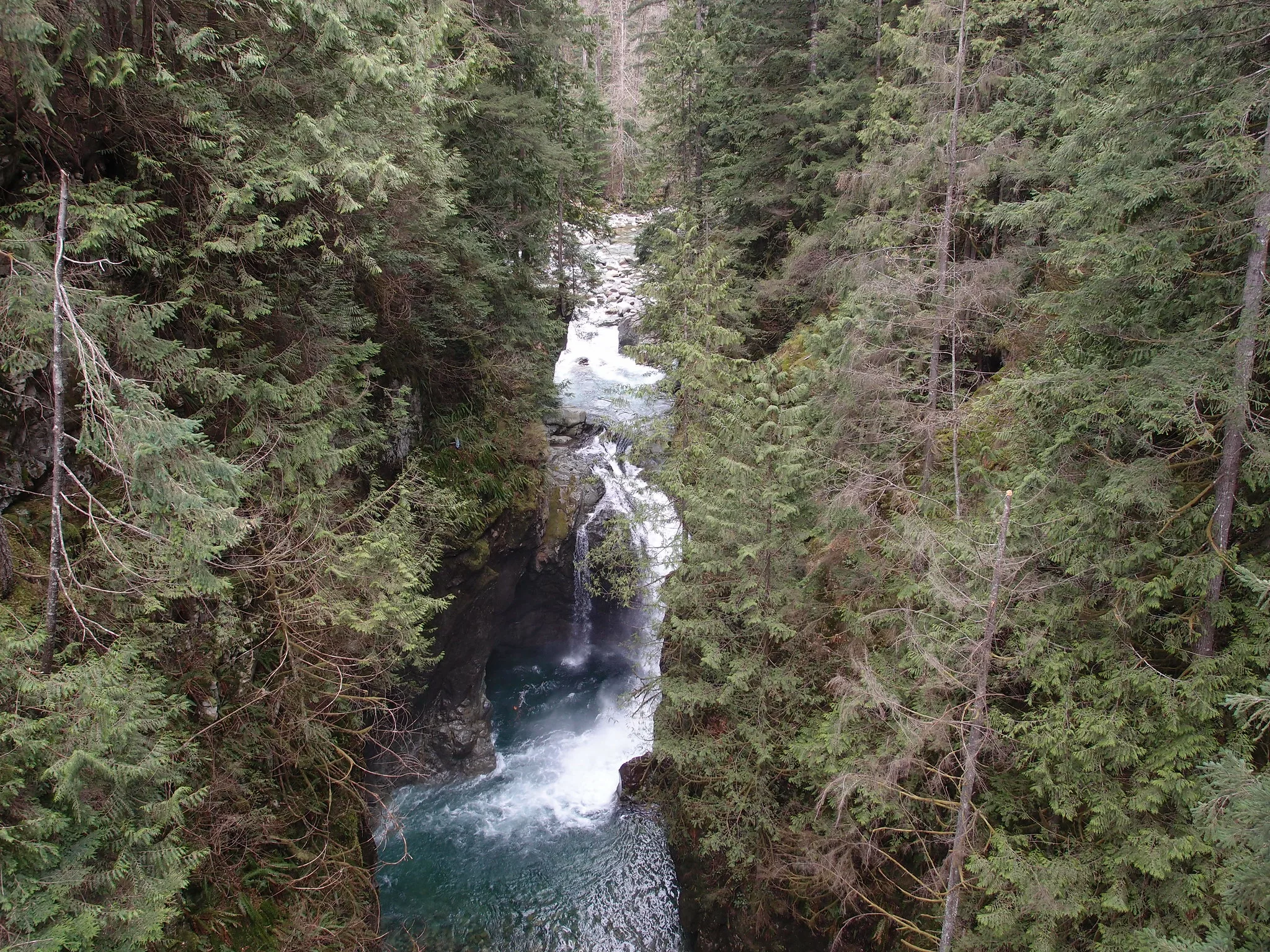
13. Norvan Falls
Lynn Headwaters Regional Park
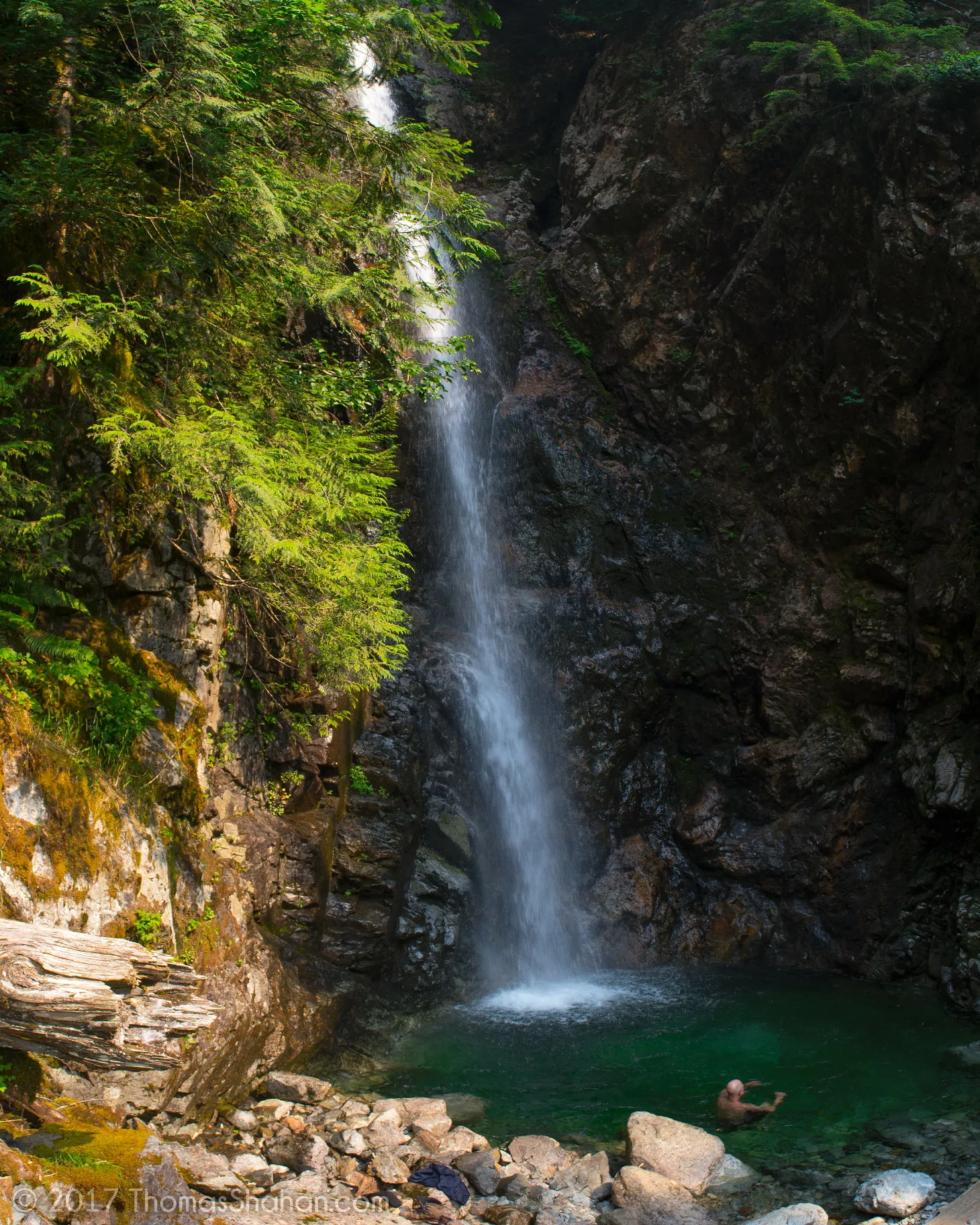 Flickr/Thomas Shahan (CCby2.0)
Length: 14 km round-trip
Duration: 5 hours
Elevation gain: 195 m
Difficulty: Moderate
If you like to chase waterfalls, this hike is for you. Branching off the lush Lynn Loop trail, this trail can often be wet and muddy, making it dangerous for unprepared hikers. When you hear rushing water, you know you’re close to the majestic waterfall.
How do I get to the Norvan Falls trailhead? This trail begins at Lynn Headwaters parking lot.
Day pass required: No
Read more: Click here
Distance from Vancouver: 17.1 km
14. Grouse Grind/BCMC
Grouse Mountain Regional Park
Length: 2.9 km
Duration: 1-2 hours
Elevation gain: 853 m
Difficulty: Challenging
One of the most classic Vancouver-area trails, the Grouse Grind is really just a staircase up a mountain. Over 2,800 steps lead to a panoramic view of the city, where you can visit a grizzly bear refuge and treat yourself to a Beavertail (you deserve it!). The Grind is a heavily trafficked one-way trail; you’ll have to take the gondola or the nearby dog-friendly BCMC back down.
How do I get to the Grouse Grind trailhead? From the parking lot at the base of Grouse Mountain, east of the gondola. There is an official Grind Timer if you’re hoping to beat the record: 25 minutes and one second.
Day pass required: No
Read more: Click here
Distance from Vancouver: 12.1 km
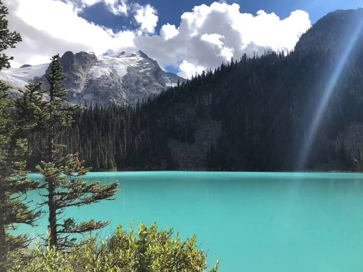
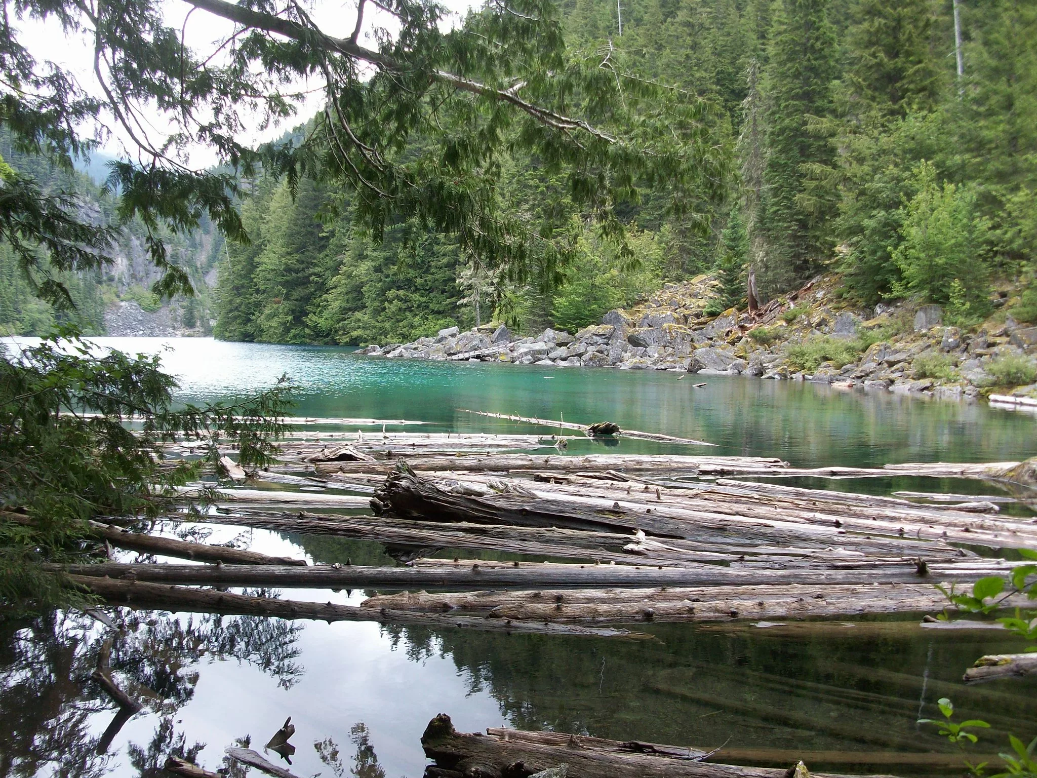
15. Joffre Lakes
Joffre Lakes Provincial Park
Length: 10 km roundtrip
Duration: 4-5 hours
Elevation gain: 370 m
Difficulty: Intermediate
Joffre Lakes offers incredible views for moderate effort. After rising to fame on Instagram, the turquoise water in these stunning lakes have become recognizable to hikers everywhere. There are three lakes along the trail. The first one, Lower Joffree Lake, is only a few hundred metres into the hike. Middle Joffre Lakes (pictured) takes more effort to reach and is the perfect spot to sit and have a snack. Here you’ll find the floating log many brave hikers walk out onto for surreal photos. Just a bit further down the trail, you’ll find a beautiful waterfall.
At the end of the hike, you’ll reach the final lake: Upper Joffre Lake. Behind it is the Matier Glacier. There is a urine diversion toilet, bear lockers and designated area for tents.
How do I get to the Joffre Lakes trailhead? A solid two-and-a-half-hour drive from Vancouver (depending on traffic), you’ll want to leave bright and early for this hike. There’s a dedicated parking lot plus overflow you can’t miss.
Day pass required: Yes, register here.
Read more: Click here
Distance from Vancouver: 183 km
16. Abby Grind
Abbotsford

Length: 4 km roundtrip
Duration: 2 – 3 hours
Elevation gain: 320 m
Difficulty: Moderate
Significantly less steep and crowded than its counterpart in North Vancouver, the Abby Grind is a short, steep and sweet trail that leads to an open rock face and gorgeous views over nearby farmland. Quarter-mile markers encourage you on your way up the dirt path (no stairs!). The only thing that will break the rustic tranquillity is boom‘s from the nearby gun range.
How do I get to the Abby Grind trailhead? You’ll find a well-marked dirt parking lot east of Abbotsford just off Highway #1.
Day pass required: No
Read more: Click here
Distance from Vancouver: 86.6 km
17. Mount Cheam
Fraser Valley
Length: 9.5 km
Duration: 4-5 hours
Elevation gain: 700 m
Difficulty: Moderate
Hike above the clouds as you ascend Mount Cheam, near Chilliwack in the Fraser Valley. You’ll be treated to gorgeous views the entire way, including a fresh look at massive Mount Baker, panoramic views of Lady Peak and unfolding fields of stunning wildflowers in the summer.
How do I get to the Mount Cheam trailhead? Follow Google maps directions to the small parking lot located along Chilliwack Lake Road. It’s a rough and bumpy, so a four-wheel drive is recommended.
Day pass required: No
Read more: Click here
Distance from Vancouver: 125 km
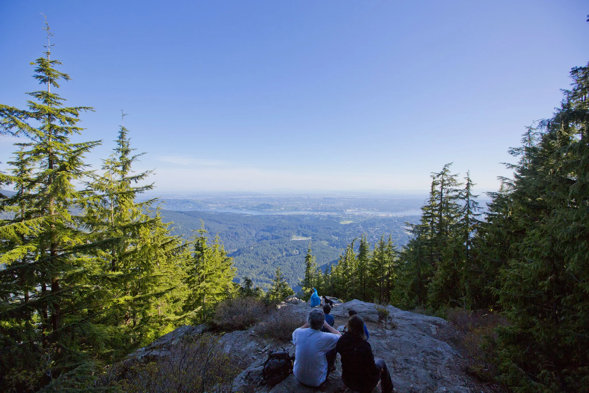
18. Quarry Rock
Deep Cove
Length: 3.8 km
Duration: 1-2 hours
Elevation gain: 100 m
Difficulty: Easy
Arguably one of the most popular hikes near Vancouver, Quarry Rock is located in North Vancouver. The rock is the perfect place to sit and enjoy the view, before heading back down to Deep Cove and grabbing a treat from Honey Doughnuts.
How do I get to the Quarry Rock trailhead? From Panorama Drive, follow the Baden Powell Trail.
Day pass required: No
Read more: Click here
Distance from Vancouver: 24 km
19. Killarney Lake Loop
Bowen Island
 Flickr/Shriram Rajagopalan (CCby2.0)
Length: 4 km
Duration: 1-2 hours
Elevation gain: Minimal
Difficulty: Easy
Take the ferry from Horseshoe Bay to Bowen Island for a taste of island life. You don’t need a car for this hike: bus to the ferry and walk from the dock to the tranquil trail that circles Killarney Lake.
How do I get to the Killarney Lake trailhead? Starting from the ferry terminal, turn right onto Cardena Road and continue onto Killarney Creek Trail.
Day pass required: No
Read more: Click here
Distance from Vancouver: 29.6 km
20. Lindeman Lake
Chilliwack Lake Provincial Park
Length: 3.4 km roundtrip
Duration: 2 hours
Elevation gain: 200 m
Difficulty: Moderate
This gorgeous, short trail is a favourite for overnight hikers and day trekkers alike. But don’t be fooled by the km’s: it’s still a tough trail. Lazing next to Lindeman Lake’s stunning turquoise waters is so worth the effort.
How do I get to the Lindeman Lake trailhead? Park in the Post Creek parking lot. Caution: smashed windows and break-ins have been reported by hikers who parked in this area.
Day pass required: No
Read more: Click here
Distance from Vancouver: 139 km


