


The Happy Camper: Prettiest Paddle Day of Canada’s Mississippi


The Happy Camper continues his adventure paddling the Mississippi River! Read Part 1 here and Part 2 here.
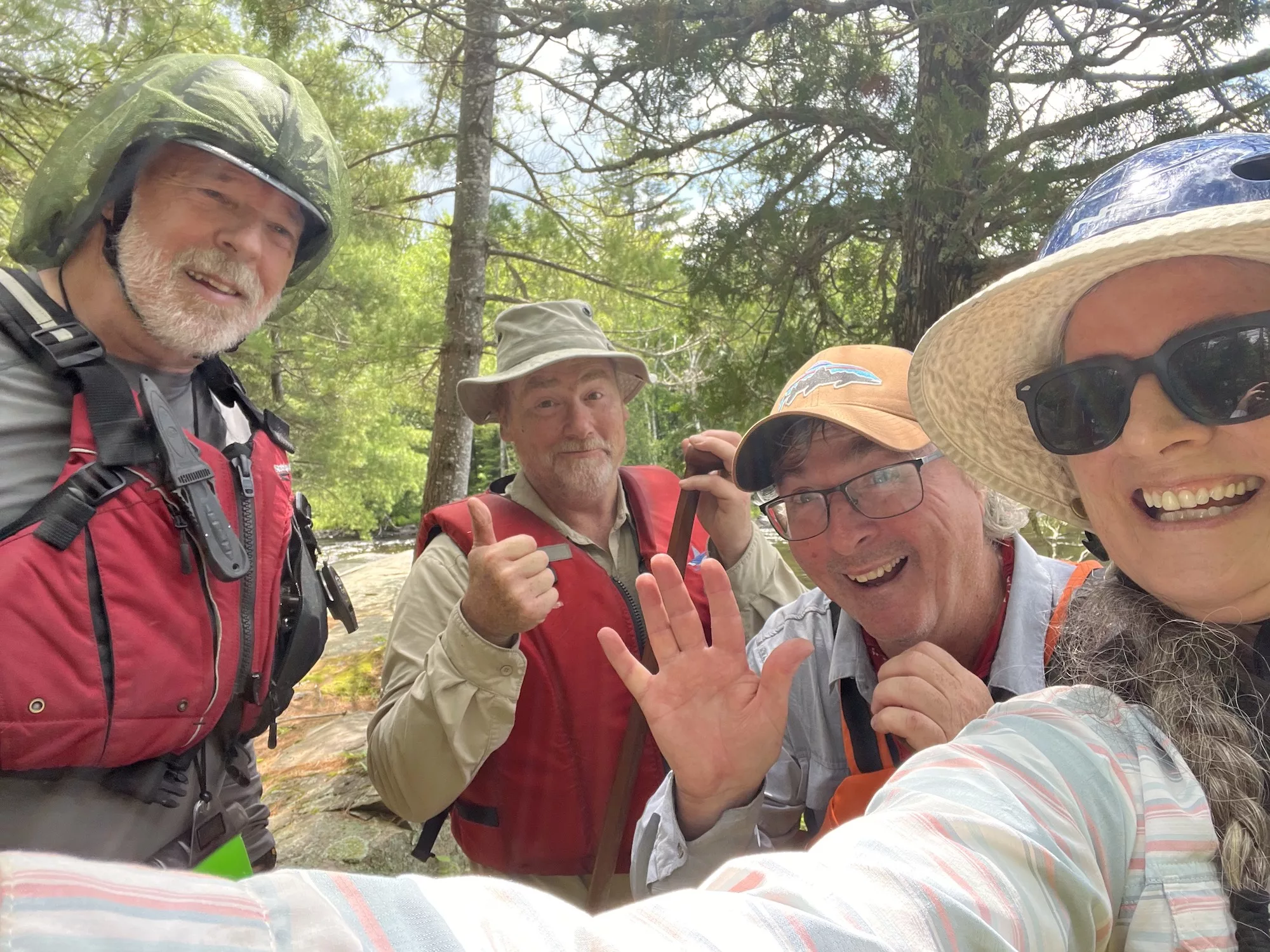
We expected company the morning of the third day. Paddlers David Skinner and Mary Hagerman wanted to meet up with us to paddle the next section of river, from King’s Falls to Miller Lake. It was the only section of the river they hadn’t done a day trip on. Dave suffered an injury last time they tried and was evacuated out.
The lake was rough. I wasn’t sure if our guests would arrive. Not having cell service on our Crotch Lake campsite didn’t help. Andy suggested we have a second cup of coffee while we waited. Just after 8 a.m., we saw a red canoe bouncing through the troughs of Crotch Lake’s Warners Bay. Dave and Mary had arrived. They were equipped with a whitewater boat, neoprene gloves, extra puffy PFDs and Tilley hats under their helmets. Andy and I adorned ourselves with our regular river running outfits: stinky shirts and pants that hadn’t yet dried from the day before, sodden socks and boots, pre-dampened rain jackets and wet PFDs. We joined them on the water in our scratched up but lightweight TuffStuff Nova Craft prospector.
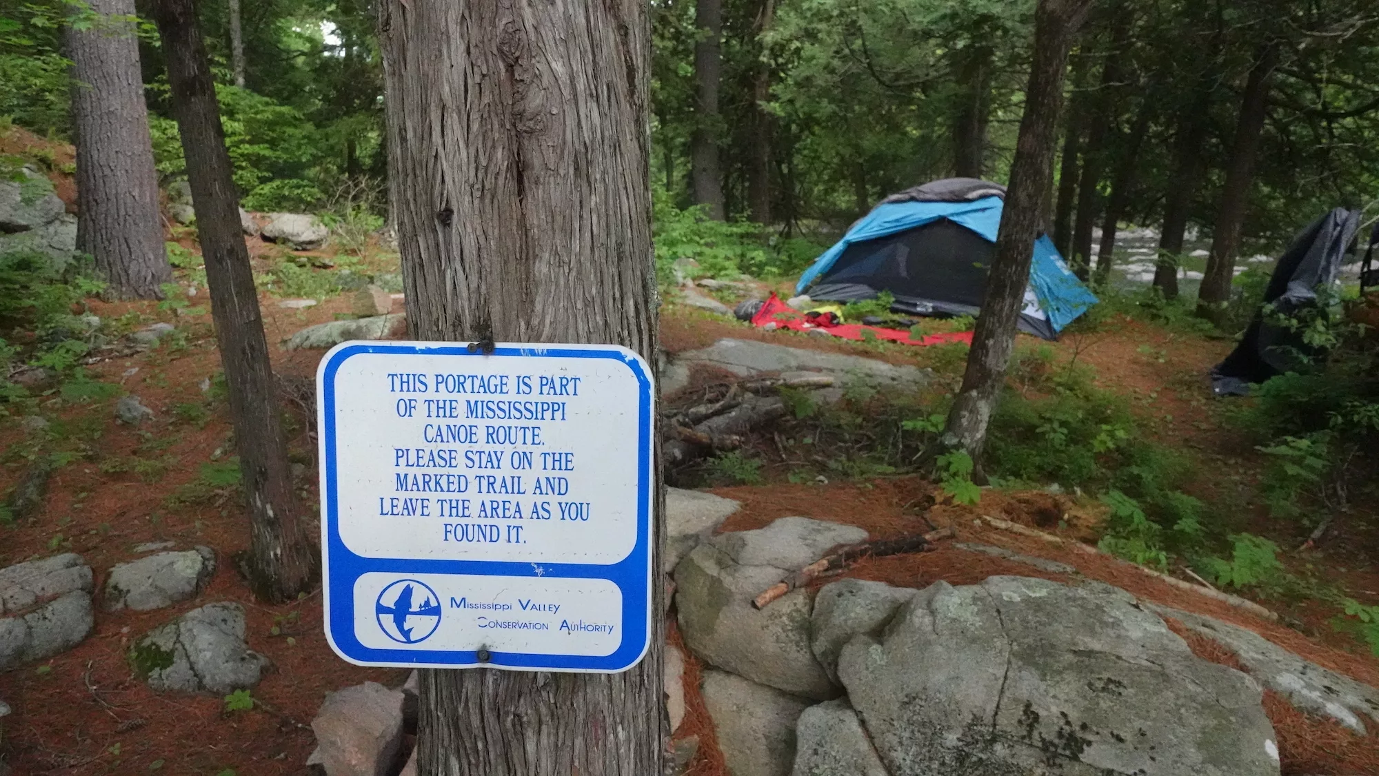
King’s Falls was an easy 95-metre portage to the left of the dam, between some rustic cabins and a “No Trespassing” sign. The paddle across King’s Lake was extraordinary. Pine-clad granite outcrops stood over weedy bays. It looked like there was a perfect campsite at every point, but the area was all private land. We wondered if the owner allowed camping there. A Mississippi Valley Conservation Authority portage sign, the first we had seen on the trip so far, gave a suggested answer.
I’m sure a few idiot campers who left their trash and broken beer bottles behind would ruin a good thing for all the other paddlers passing through here.
Andy and I kept to our routine when we came upon the next stretch of whitewater—King’s Chute. We walked the portage first and scouted what was ahead. The portage (500 metres and on the right) was rugged and less used than the ones we had done upriver, but to us it was necessary. The initial drop was a slanted fall, the second was a stunted ledge and the third looked like a giant had thrown his bag of marbles into the river. Dave and Mary had different plans. We noticed they were lining the entire stretch. They were geared up for extreme whitewater and were in the mindset of running as much as they could that day. Andy and I were in trip mode and just wanted to keep it simple and safe with the gear we had.
The next set—Otter Rapids—had similar terrain. The 335-metre portage started on the right, but we could tell that it was less used than the second take-out halfway down the set. Again, Andy and I scouted it all. Even though we agreed the first and second drop were doable, there was a sweeper blocking one of the deeper troughs around the bend. The third drop was definitely not runnable. So, we took out at the beginning of Otter Rapids, found our way up a steep and slippery slope to get around the second and then followed a more obvious trail around the third. Dave and Mary tried a shallower channel to the far left away from the sweeper, but low water had them stuck for a bit. Mary had her foot wedged between some rocks while they waded out of the situation, which she later said was the scariest time she’s ever had in whitewater.
Mary Hagerman
The Ragged Chutes were next. There are two side trails off to the right of the main 800-metre portage. If you’re in the area, make sure to check them out. They lead to remnants of the old log sluices dating back to the late 1880s. Dave and Mary wanted to make good use of their whitewater gear and put-in at the first side trail. Andy and I guessed it wasn’t doable when we met up with them while returning for our second load on the portage. They were dragging their boat up a steep slope and onto the main trail. We were all thankful they had a boat with an indestructible and somewhat slippery bottom.
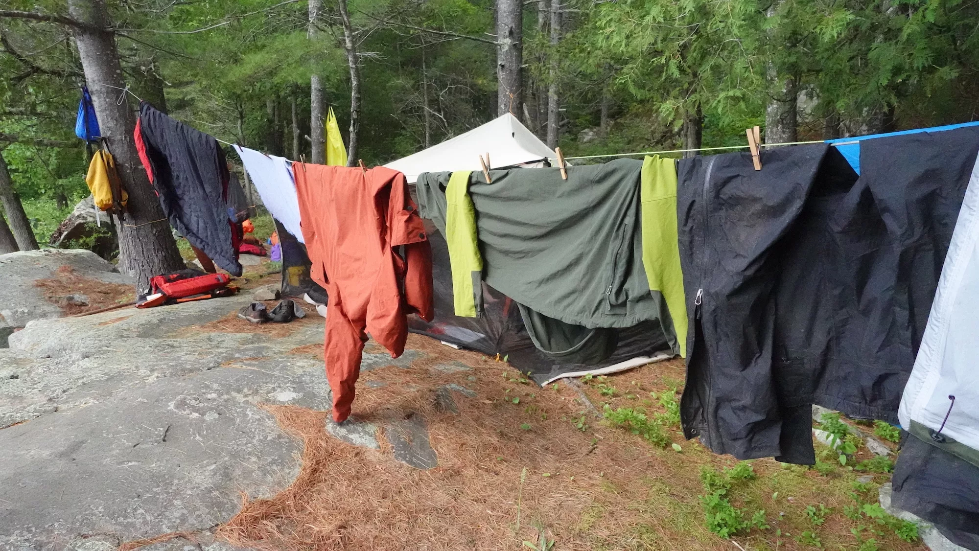
Three nice swifts kept us on the move while continuing downriver until Miller Rapids. Andy and I were told by various sources that there was a Crown land campsite at the end of the portage (375 metres to the left). My research on Ontario’s Crown Land Atlas showed that Crown land existed right to the end of the portage. So, it should exist. However, after that, no Crown land can be found until the Ottawa River. Andy and I had initially planned on taking advantage of this last public refuge, but by the time we reached the take-out at Miller Rapids, we took what was available—a knob of rock to erect the bug shelter, a slightly sloped spot to pitch the tent and lots of trees to hang our gear to dry it out. Sold! Dave and Mary moved on, running Miller Rapids and taking out at a public launch on road 509 where their car was parked.
 Mary Hagerman
It was a true bush site but also one of our fondest memories of the river. After a dinner of curry, couscous and some mint tea to cool us down, we sat in silence and watched the rich diversity of the birds and mammals making this place their home. A beaver gathered twigs and a variety of bird species fed on the emerging mayfly and dobsonfly. We heard another rare Least Bittern make its coo-coo-coo sound amongst the thick sedge shoreline.
Andy and I had now reached peace with this river journey. We were living life on the Mississippi, settling in and looking forward to what was to come.
Read more from The Happy Camper:
The Happy Camper: A Wet Paddle to Mississippi’s Crotch Lake
The Happy Camper: Canoeing Canada’s Mississippi River, Part 1
The Happy Camper: Show Me Your Paddle


