10 of the Best Hikes Near Smithers, BC


The small town of Smithers in the Bulkley Valley punches above its weight with incredible outdoor adventure opportunities showcasing the natural beauty of its mountains, glaciers, lakes and even an ancient fossil bed. The terrain is vast and wild, and people few and far between. Explore wide open spaces with these 10 best hikes in and around Smithers.
Lyon Creek Trail
Length: 11 km
Elevation gain: 683 m
A steady climb leads hikers into the sub-alpine meadows of this trail in Babine Mountains Provincial Park. The trail is well defined, and boardwalks span several swampy sections. The grade eases once you’ve reached the sub-alpine, which offer spectacular views of the Bulkley Valley and the Telkwa Range. The trail crosses Lyon Creek and several alpine lakes, leading hikers to “The Summit,” the divide of the Ganokwa, Driftwood and Little Joe watersheds.
Read more: Click here
Silver King Basin Trail
Length: 18 km
Elevation gain: 627 m
Also located in Babine Mountains Provincial Park, this trail follows an old mining road that is an extension of the Driftwood Creek Road. It follows an easy grade for most of the way, rising towards the basin and scenic mountain views after seven kilometres. The sub-alpine meadows of Silver King Basin are at peak bloom in mid-July. The Joe L’Orsa Cabin and abandoned Silver King Mine are about two kilometres further along the trail.
Read more: Click here
Driftwood Canyon Fossils Trail
Length: 0.8 km
Elevation gain: Minimal
An easy loop trail that’s great for families and anyone interested in dinosaurs. Driftwood Canyon is recognized as one of the world’s most significant fossil beds. The short hike includes interpretive signage with graphics depicting ancient shale formations that contained the fossilized remains of plants, animals and insects from more than 50 million years ago.
Read more: Click here
McCabe Trail
Length: 10 km
Elevation gain: 668 m
A great out-and-back hike for families and novice hikers, the McCabe Trail offers fairly easy access to the alpine. The trail veers away from the Silver King Trail just before Sunny Point. After climbing a steep mining road for 100 metres, the route narrows and travels along the north slopes of Harvey and Pyramid mountains, offering beautiful forest and mountain views.
Read more: Click here
Silvern Lake Trail
Length: 15 km
Elevation Gain: 963 m
This long and steady climb through pine forests has some steep sections, but the roundtrip trail is particularly lovely in the summer during the alpine wildflower season when mountain daisies, Castilleja coccinea and lupines are in bloom. Be on the lookout for birds, wildlife and beautiful mountain views as you near the small Silvern Lake.
Read more: Click here
Crater Lake Trail
Length: 5.8 km
Elevation gain: 305 m
This out-and-back trail is a great choice for families wanting a bit of a challenge with the reward of a lake and mountain views at the top. There are rocky sections so good footwear is important. The trail continues another 10 kilometres on a steep incline to the Hudson Bay summit, passing alpine wildflowers in summer on the way to beautiful mountain views.
Read more: Click here
Seymour Lake Loop
Length: 5 km
Elevation Gain: 288 m
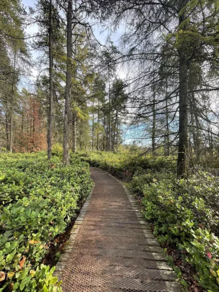
Part of a larger trail system within the Smithers Community Forest, this lovely loop trail is easily accessible from town. The nature trail includes boardwalks over spongy patches of skunk cabbage, and the ridge above contains cracks, called ‘sackungen,’ interesting geological formations in the ridge bedrock that form as it spreads under its own weight.
Read more: Click here
Call Lake Trail
Length: 4.7 km
Elevation gain: Minimal
This easy loop trail can get a bit muddy, especially after a rainfall, but the lake and mountain views make it a pleasant walk. Watch for birdlife in the lake and as you wander through the forested sections and past Saskatoon berry bushes in season.
Read more: Click here
Malkow Lookout
Length: 5.5 km
Elevation gain: 248 m
An easy out-and-back walk with the promise of scenic mountain views from the lookout, this hike passes through a lovely green forest setting opening onto sections of grassland. The trail can be muddy in spring or after a rainfall; wear footwear with good treads, and stay on the trail to avoid stepping on delicate alpine wildflowers.
Read more: Click here
Glacier Gulch and Twin Falls
Length: 4.5 km
Elevation gain: 835 m
This short, steep trail offers the dual option of a shorter hike to the deck and viewpoint of Twin Falls waterfall, as well as a longer, rockier hike to the base of the Hudson Bay glacier. Here, you may find evidence of earlier mining activity, great views and some large crevasses visible on the glacier.
Read more: Click here
More BC-Based Adventures:
10 of the Best Hikes Near Nanaimo, BC
10 of the Best Hikes near Courtenay, BC
10 of the Best Hikes near Victoria, British Columbia