10 of the Best Hiking Trails near Salt Lake City, Utah

Salt Lake City’s backyard bursts with mountains. Nearby hiking trails lace through forests, meadows and alpine ridges that yield stunning views of the city skyline. In autumn, fall leaves set the slopes ablaze in an explosion of vibrant hues. In summer, alpine meadows are blanketed with wildflowers. Hikers in the Salt Lake City area are spoiled for choice. Here are ten trails that’ll have you lacing up your boots:
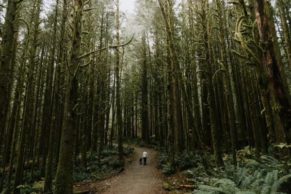
Ensign Peak,
Salt Lake City

Length: 0.8 miles round-trip (1.3 km)
Elevation gain: 374 ft (114 m)
Distance from downtown Salt Lake City: 2.5 miles
Trailhead: Ensign Vista Drive
One doesn’t hike Ensign Peak for the workout so much as its historical significance and city views. It was from this vantage point that Brigham Young and fellow pioneers surveyed the valley and planned the city they would establish. Today, a monument marks the spot. Beyond the city, hikers catch views of The Great Salt Lake and Salt Lake Valley. Since the trail is well maintained, there’s no harm in a sundown or sunrise visit.
More information: alltrails.com/ensign-peak-trail
The Living Room,
Red Butte Ridge

Length: 2.5 miles round-trip (4 km)
Elevation gain: 980 ft (299 m)
Distance from Salt Lake City: 4 miles
Trailhead: Located at 383 Colorow Road, near the Natural History Museum of Utah.
Hiking boots in the living room? Only on this trail!
This steep out-and-back hike that winds through Red Butte Canyon will challenge hikers before inviting them to kick up their feet on slabs of sandstone that have been arranged as “furniture.” (Surprisingly more comfortable than it sounds!) Once you’re there, drink in the expansive views of Salt Lake City.
More information: visitsaltlake.com/The-Living-Room-Hike
Mount Olympus

Length: 7 miles round-trip (11.2 km)
Elevation gain: 4,060 ft (1,237 m)
Distance from Salt Lake City: 13 miles
Trailhead: 5789 Wasatch Blvd
Mount Olympus is the premier hiking trail in the Salt Lake City area. Prepare for some dizzying heights atop the peak; its summit (at 9,026 feet) towers nearly one mile above the valley floor below. Despite a 4,000-plus foot ascent, this out-and-back, exposed trail is popular with hikers. (Don’t worry, the grade is forgiving!) The last portion of the trail has hikers scrambling over boulders – a mini adventure in itself.
More information: visitsaltlake.com/Mount-Olympus
Desolation Lake,
Big Cottonwood Canyon

Length: 7.4 miles round-trip (11.9 km)
Elevation gain: approx. 2,000 ft (609 m)
Distance from Salt Lake City: 15 miles
Trailhead: Mill D North near Mill Creek Inn
This well-defined and easy to follow out-and-back trail leads to a pretty emerald-coloured lake. Despite some serious elevation gain, the grade is forgiving. Hikers will pass through gorgeous Wasatch scenery: meadows, pine, spruce and aspen trees, and wildflowers in summer. Once you arrive at Desolation Lake, you can opt to push up the ridge which offers views of Park City and the Desolation Lake basin. Bring an extra layer, this trail can be quite shaded.
More information: katiewanders.com/desolation-lake-trail-and-overlook-fall
Bell’s Canyon Trail,
Little Cottonwood Canyon

Length: 2.5 miles round-trip (4 km)
Elevation gain: 423 ft (129 m)
Distance from Salt Lake City: 18 miles
Trailhead: 3470 E. Little Cottonwood Road
Bell’s Canyon Trail is a popular hike that starts in a SLC neighbourhood. Park in the lot off Wasatch Blvd and then make your way into the mouth of Little Cottonwood Canyon. Thanks to its accessibility, length and relatively low net elevation gain, Bell’s Canyon is a popularly trafficked hike. From the trail, drink in views of Lone Peak Wilderness, the Wasatch Mountains and Salt Lake City.
More information: visitsaltlake.com/Bell-s-Canyon-Trail-Hike
Lake Blanche Trail,
Twin Peaks Wilderness Area

Length: 5.6 miles round-trip (9 km)
Elevation gain: 2,600 ft (792 m)
Distance from Salt Lake City: 22 miles
Trailhead: Mill B South Picnic Area off Big Cottonwood Canyon Road
Here’s an out-and-back trail with enough elevation gain to make your calves burn, but gorgeous views that will distract you the whole way. Hikers pass through shady scrub oak and aspen forest. Admire quartzite mountains, views of the Great Salt Lake, Sundial Peak, and of course, Lake Blanche itself. If attempting in the summer months, go early in the day; exposed portions of the trail and steep sections will have you reaching for your water bottle.
More information: visitsaltlake.com/Lake-Blanche-Trail
Donut Falls,
Big Cottonwood Canyon

Length: 1.5 miles round-trip (2.4 km)
Elevation gain: 337 ft (103 m)
Distance from Salt Lake City: 26 miles
Trailhead: Near North Fork Trailhead (FR019) of Big Cottonwood Canyon Road
Get bang for your buck on this short, easy, wide trail. Hikers are led through a pretty spruce-aspen forest and meadowland before venturing into a narrow drainage below Donut Falls. The cascade is picturesque in that it tumbles through a hole in the rock and into a small cave. The trail can be hiked year-round (bring crampons in winter) but is especially pretty in mid-July when wildflowers bloom. Donut Falls Trail can be quite busy – especially on summer weekends.
More information: visitsaltlake.com/Donut-Falls
White Pine Lake,
Little Cottonwood Canyon

Length: 9 miles round-trip (14.4 km)
Elevation gain: 2,693 feet (820 m)
Distance from Salt Lake City: 27 miles
Trailhead: 5.5 miles up Little Cottonwood Road; 0.7 miles below Snowbird Ski & Summer Resort
This out-and-back trail in Little Cottonwood Canyon offers gorgeous views and a fine workout, though describing it as a trail is a bit of a misnomer; the hike to White Pine Lake follows an old service road. The upside: it’s less technical a hike. The downside: it’s not traditionally rustic. But hey, invite a friend for a social hike as the route is wide enough to walk side-by-side. Leashed dogs are welcome.
More information: visitsaltlake.com/White-Pine-Overlook-Lake
Cecret Lake,
Alta Ski Area

Length: 1.6 miles round-trip (2.6 km)
Elevation gain: 350 ft (107 m)
Distance from Salt Lake City: 30 miles
Trailhead: Albion Basin Campground parking area (just right of the gate)
Despite its name (pronounced “secret”), this trail is one of the more popular hikes in the Wasatch Mountains. Why? A pretty alpine lake, accessible trailhead, short in duration and relatively low elevation gain. Even with the crowds, Cecret Lake is definitely worth doing. Enjoy a picnic at the lake or push up to Sugarloaf Peak, an additional 2 miles round-trip.
More information: visitsaltlake.com/Cecret-Lake-Trail-Hike
Brighton Lakes,
Uinta-Wasatch-Cache National Forest

Length: 3.5 miles round-trip (5.6 km)
Elevation gain: 1,200 ft (365 m)
Distance from Salt Lake City: 31 miles
Trailhead: Brighton Ski Resort parking lot (east end)
Get three for the price of one on this hike. Brighton Lakes trail brings hikers to three lakes: Mary, Martha and Catherine. The hike starts at Brighton Ski Resort and quickly leads hikers by the Dog Lake spur trail, and Mary and Martha lakes. Tackle some elevation before arriving at postcard-perfect Lake Catherine. Keep your eyes peeled for wildlife; moose are well known to frequent this area.
More information: theoutbound.com/brighton-lakes
Are you an avid hiker in the Salt Lake City-area?
Let us know which trail is your favourite.
Comment below!
Related content on Explore:
Go Here: Hiking in Southern Utah
5 Reasons You Should Visit Park City, Utah This Winter