25 of the Best Hiking Trails on Prince Edward Island
If you haven’t been to Prince Edward Island yet, you really need to go.
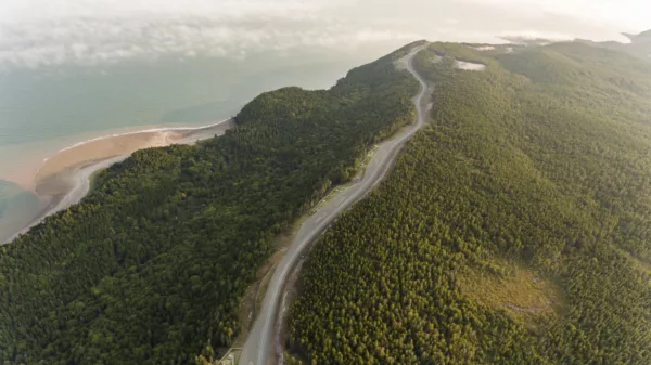
With shocking red cliffs, beige sand beaches, a lush green interior and some of the friendliest Canadians you’ll ever meet, this gentle island offers inclusive hikes for all levels of adventurers.
P.E.I. may not be large or mountainous, but it is laced with a multitude of enjoyable trails. Here are 25 of the best:
Want to see where these hikes rank
against Canada’s greatest hikes?
Click here to download our free eBook
Canada’s 35 Greatest Hikes
Confederation Trail

Distance: 435 km (total)
Time: Varies from a few hours to weeks
Elevation: Gradient never exceeds 2%
Level of difficulty: Easy-moderate
This tip-to-tip trail coasts across the entire island for 273 km, with a multitude of spur trails that branch off the main route. Built on an abandoned railroad, the Confederation Trail is part of the epic Trans Canada Trail (TCT).
Read more about this trail: tourismpei.com/pei-confederation-trail
Farmlands Trail
Distance: 2.7 km loop
Time: 60 minutes
Level of difficulty: Easy
Follow farmland and mixed forest as you wander this trail near the Stanhope Cemetery. You’ll also pass an archaeological site.
How do I get to the Farmlands Trail trailhead? The trailhead is off the Gulf Shore Parkway between Stanhope and Dalvay.
Read more about this trail: Click here
Bubbling Springs
Distance: 2.2 km loop
Time: 60 minutes
Level of difficulty: Easy
Birdwatchers flock to this trail to spot waterfowl in Long Pond. Halfway along this hike, you’ll find Bubbling Springs—a unique spot where water appears to bubble out of the ground.
How do I get to Bubbling Springs trailhead? This trail shares a trailhead with the Farmlands Trail.
Read more about this trail: Click here
Greenwich Dunes Trail

Distance: 4.8 km round-trip
Time: 60-90 minutes
Level of difficulty: Easy
The Dunes Trail passes through old farmland, thick forest and across Bowley Pond on a floating boardwalk. This popular trail brings hikers to the tip of the Atlantic Ocean, with two red Canada Parks chairs and a view of the continuously changing dunes to enjoy.
How do I get to the Greenwich Dunes trailhead? Start at the parking lot just past the Greenwich Interpretation Centre.
Read more about this trail: Click here
Gulf Shore Way East
Distance: 12 km one-way
Time: 2-3 hours
Level of difficulty: Easy
Smooth, asphalt surface makes this a wheelchair-accessible walk. You’ll pass salt marshes, sand dunes and woodlands.
How do I get to the Gulf Shore Way East trailhead? This trail can be accessed at Brackley Beach Complex trailhead and Dalvay Gate trailhead.
Read more about this trail: Click here
Gulf Shore Way West
Distance:5 km one-way
Time: 1-2 hours
Level of difficulty: Easy
This paved, multi-use trail traces the edges of red sandstone cliffs, yielding stunning views across the Gulf of St. Lawrence.
How do I get to Gulf Shore Way West trailhead? The trailhead is at Oceanview Lookoff, Cavendish.
Read more about this trail: Click here
Cavendish Beach Trail
Distance: 1.1 km one-way
Time: 30 minutes
Level of difficulty: Easy
This short trail passes through a sugar maple grove on the way to Cavendish Beach. From here, continue on the Cavendish Dunelands Trail.
How do I get to the Cavendish Beach trailhead? This trail can be found at 8780 Cavendish Road, Route 6.
Read more about this trail: Click here
Cavendish Dunelands

Distance: 2.3 km one-way
Time: 60 minutes
Level of difficulty: Easy
View sand dunes and freshwater ponds as you traverse this trail, which links to the Homestead Trail and Gulf Shore Way West.
How do I get to the Cavendish Dunelands trailhead? The trailhead is located at 590 Grahams Lane, Cavendish.
Read more about this trail: Click here
Robinsons Island Trail System (R.I.T.S.)
Distance: 5 km loop
Time: Varies
Level of difficulty: Easy-moderate
Stacked loops offer 12 trail options, ranging from beginner to intermediate. There is a picnic area, observation stations and beach access.
How do I access Robinsons Island Trail System? The trailhead is located at 740 Robinsons Island Road, Brackley Beach.
Read more about this trail: Click here
Trout River Nature Trail
Distance: 2.5 km one-way
Time: 60 minutes
Level of difficulty: Easy
Anglers flock to this trail for the abundance of trout, while hikers enjoy it for its natural beauty. Baneberries, songbirds, wooden benches and footbridges can be found along the trail. Keep a wary eye out for stinging nettle.
How do I get to Trout River Nature trailhead? The trailhead is located on Route 2 in Coleman.
Read more about this trail: Click here
Sir Andrew MacPhail Streamside Trail
Distance: 0.8 km
Time: 30 minutes
Elevation: Steep sections
Level of difficulty: Easy
Sheltered by yellow birch, white pine and maple, this forest trail leads into a deep valley. It’s a short, but lovely walk that leads over three bridges across a stream and through unique, luscious florae.
How do I get to the Sir Andrew MacPhail Streamside trailhead? This trail is located in Machphail Woods, Orwell.
Read more about this trail: Click here
Bonshaw Hills Provincial Park

Distance: 18 km
Time: Varies
Elevation: Varies
Level of difficulty: Moderate
Mountain bikers and hikers share the trails that weave alongside the Bonshaw River. Amenities include picnic tables and an adventure playground. Dogs are permitted on leash.
How do I get to Bonshaw Hills Provincial Park? Located on the Trans-Canada Highway in Red Sand Shores region, there is a parking lot and entrance after the Bonshaw Bridge Underpass.
Read more about this trail: tourismpei.com/provincial-park/bonshaw
Wildflower Nature Trail
Distance: 0.5 km
Time: 30 minutes
Level of difficulty: Easy
This trail blooms with an abundance of native wildflowers. Wander past bluebead lily, stemless lady’s slipper and painted trillium, among others.
How do I get to the Wildflower Nature trailhead? This trail is next to the native plant garden in Macphail Woods, Orwell.
Read more about this trail: Click here
Homestead Trail

Distance: 6.3 km/8.4 km loop
Time: 1-2 hours
Level of difficulty: Moderate
Hike through farmland and forest as you trace the shores of New London Bay. Note: you may share the trails with mountain bikers.
How do I get to the Homestead trailhead? This trail can be accessed at 355 Grahams Lane, Cavendish.
Read more about this trail: Click here
Woodland Nature Trail
Distance: 1.5 km
Time:60 minutes
Elevation: Short climb
Level of difficulty: Easy
Rich in woodland wildlife, this trail leads through forests and fields. The red-backed salamander is one of the most common animals you’ll encounter on this trail, along with wood frogs and toads.
How do I get to the Woodland Nature trailhead? Head up the hill from the pond in Macphail Woods, Orwell.
Read more about this trail: Click here
Pigot’s Trail
Distance: 3 km
Time: 1-2 hours
Level of difficulty: Easy
Stroll through farmland, wetland and forest towards an eagle feeding station and the old lagoon. Keep an eye out for waterfowl and fauna that call this habitat home.
How do I get to the Pigot’s trailhead? The trailhead is at the Confederation Trail in Mount Stewart.
Read more about this trail: Click here
Havre Saint Pierre

Distance: 1.1 km loop
Time: 15-30 minutes
Level of difficulty: Easy
Stroll the stunning shores of St. Peter’s Bay along a flat, natural-surface path. This tranquil trail is partly wheelchair accessible.
How do I get to Havre Saint Pierre trailhead? The trailhead is at 61 Greenwich Road, Greenwich.
Read more about this trail: Click here
Beck Hiking and Mountain Biking Trail
Distance: 4.6 km/5.4 km
Time: 2-3 hours
Level of difficulty: Moderate
The Beck Trail consists of the slightly shorter Red loop and the more challenging Blue loop. Mountain bikers, dog-walkers, snow-shoers and hikers share this trail, which is peppered with antique farm equipment, boardwalks and bridges.
How do I get to the Beck Hiking and Mountain Biking trailhead? Located off Route 4 near Murray River.
Read more about this trail: Click here
Mooney’s Pond Trail
Distance: 1.9 km
Time: 60 minutes
Level of difficulty: Easy
This trek loops around the pond, which has evolved from a semi-natural Atlantic salmon rearing facility into a restoration watershed group. Approximately one kilometre is wheelchair accessible and features five accessible fishing platforms.
How do I get to the Mooney’s Pond trailheaed? The trailhead is located just outside of Peakes.
Read more about this trail: Click here
Palmyra Trail
Distance: 2.5 km
Time: 60 minutes
Level of difficulty: Easy
This trail twists through Tyne Valley alongside streams, hills and the quaint community. Look for interpretive signs that tell the shipbuilding history of the area.
How do I get to the Palmyra trailhead? This trail is located just off the Confederation Trail near Tyne Valley.
Read more about this trail: Click here
Haunted Wood/Balsam Hallow Trail

Distance: 0.9 km/0.8 km
Time: 45 minutes
Level of difficulty: Easy
These two meandering trails appear in Lucy Maud Montgomery’s famous story, Anne of Green Gables. Start at Lover’s Lane and follow the brook through the forest. Then, wander towards the cemetery where L.M. Montgomery is buried.
How do I get to the trailhead? These trails are located on site at Green Gables Heritage Place. Site fees apply.
Read more about this trail: Click here
Green Park Nature Trail
Distance: 2.5 km
Time: 1-2 hours
Level of difficulty: Easy
A thread of trails weaves through Green Park Provincial Park. Follow the beach for a short walk or extend your hike to fill an afternoon. The marshlands are home to abundant mosquitos, so bring long-sleeved clothing and extra bug spray.
How do I get to the Green Park Nature trailhead? Green Park Provincial Park is located in Port Hill, within the North Cape Coastal Drive touring region.
Read more about this trail: Click here
Devil’s Punchbowl
Distance: 2 km
Time:1 hour
Level of difficulty: Easy
This hike follows a historic ox sled road. Originally called the Old Princetown Road, it was built to connect Charlottetown to Princetown.
How do I get to Devil’s Punchbowl trrailhead? The trailhead is located between Route 254 (Rattenbury Road) and South Granville.
Read more about this trail:Click here
Strathgartney Nature Trail

Distance: 1.5 km
Time: 60 minutes
Elevation: Steep climbs in places
Level of difficulty: Easy
This leisurely, well-maintained hike is punctuated with steep sections and beautiful natural features. Pick up a trail brochure to learn more about the history and culture of the area.
How do I get to Strathgartney Nature trailhead? The trailhead is 20 km west of Charlottetown on the Trans Canada Highway.
Read more about this trail: Click here
Woodlands Trails
Distance: 3.1 km/4 km/4.7 km loops
Time: 2-2.5 hours
Level of difficulty: Moderate
This trail passes through a 50-year-old Red Pine plantation. The rugged foundation demands sturdy hiking boots, but all three loops can be completed in an afternoon.
How do I get to Woodlands Trails? This trail is located between Route 6 and Dalvay Beach in Stanhope.
Read more about this trail: Click here
Want to see where these hikes rank
against Canada’s greatest hikes?
Click here to download our free eBook
Canada’s 35 Greatest Hikes
More hikes by province:
25 Incredible Hiking Trails in Nova Scotia
Canada’s Best Hikes Province by Province


