Go Here: Parc national d’Aiguebelle, Quebec
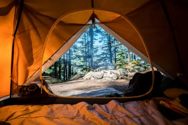
The rustic shelter, la Cigale—our backcountry accommodation for the night—is only a four-kilometre snowshoe from the Discovery & Visitors Centre in Parc national d’Aiguebelle.
It’s a crisp day, somewhere in the minus-teens; the ideal temperature for exploring this sprawling park in Quebec’s Abitibi-Temiscamingue region. I’d arrived in nearby Rouyn-Noranda via a red-eye from Vancouver and met my Francophone friends—France Lemire, Mario Minguez and Diane Moreau—just a couple of hours before starting this trek. For the jet-lagged and sleep-deprived, four kilometres, including a stout climb, are more than enough.
Abitibi-Temiscamingue had been on my radar for a few years. It’s a little-visited area of la belle province, occupying a chunk of Quebec’s southwest. The region is known for serene lakes, boreal forests, moose hunting, sport fishing and some of the purest drinking water on Earth. Ask anyone west of the Great Lakes about it, however, and they’ll look as though you’re speaking Sanskrit. Which makes it even more appealing; particularly in winter and particularly for a resident of a city that hadn’t (at the time) seen sea-level snowfall in two years.

With an afternoon departure, we make haste through a forest thick with paper-barked birch trees and dotted with spindly aspens and dense spruce. A short distance from the visitor centre, the forest is marred by a tornado that had flattened a stand of trees the summer previous. A pair of fallen birches make for an obstacle course, which has us on our hands-and-knees in the powdery snow. It’s easy to be agile with only light daypacks. As an added bonus to booking a rustic shelter in d’Aiguebelle, park staff will scoot your overnight gear to-and-from the cabin via snowmobile. You’re free to explore unencumbered.
Beyond laziness, the benefits of this service become more apparent when we arrive at la Cigale. Quebeckers love food and without the burden of carrying what we eat, my new friends have brought luxuries like wild game, sumptuous cheese and chocolate fondue, Coureur de bois liqueur and a couple bottles of ale from a local craft brewery. It’s as welcome as the roaring woodstove and comfy bunks.
Night falls and a storm picks up while we methodically move through our backcountry buffet. The temps outside dip into the -20s. The stove fills the small shelter thick with woodsy warmth. We all snooze with sleeping bags wide open.
Fresh snow has recreated the world around us. Yesterday’s footsteps are gone, as are any traces of snowmobile tracks. Every branch on every tree is crystalline. Snowfall dampens sound waves, creating a silence as thick as the ice-fog on the horizon—visible from our cabin’s vantage at the peak of one of the park’s highest points.
Leaving our heavy gear for the park-crew to pick up, we stomp into the snowy trails again, weaving through trees towards Lac La Haie. Encased in cliffs of Precambrian era rock, the sinewy frozen lake seems more like a river. We pause below a 22-metre-high suspension bridge and edge around signs ominously reading: “glace mince.” A gust of wind sends spirals of snowflakes cascading from cliffs marked with glacial striations from the recession of the Wisconsin Glaciation 100,000 years ago—the definitive event that shaped this land. It’s a trek back through geologic history, France explains, wistfully adding, “I feel deeply moved by this magnitude.”

Just as we’re feeling like the sole adventurers in this 268-square-kilometre expanse of taiga and Canadian Shield, we stumble across a couple enjoying a romantic weekend at la Guepe shelter on the north end of Lac La Haie. But they’d be the last people we’d see in this park; we bid au revoir and stomp back into the woods towards a sign that reads “Abbittibbi.” An Algonquin word, it describes the point where watersheds divide. Every river north of this sign drains into the Arctic Ocean, via James Bay; every river south drains into the Atlantic, via the St. Lawrence River. The region of Quebec, for some reason, officially chose to drop two b’s and one t, but it too gets its name from the Algonquin, residents of the area for 4,000 years.
From the signpost, we ply onto Lac Sault, this time probing the ice for thickness below two feet of fresh snow. (Safety first. Sorta.) My partners are used to adventure. France and Mario have climbed Aconcagua, in Argentina, among other tall peaks, and Diane once canoed from Montreal to Winnipeg using only 18th century Voyageur-style equipment. I’m feeling like the tenderfoot of the group. It’s no wonder they all choose to live in this area—vast tracts of backcountry are mere minutes’ drive from local towns. And there’s almost no one here.
“The territory is huge and little-frequented… I have the feeling that I’m the one opening the trails for the first time, and this gives me a sense of freedom,” muses France.

Halfway along Lac Sault, we cut west and scramble upslope to le Dytique shelter for a rest. Asking about the names, I discover our shelter last night translates to “cicada,” the next one we passed means “wasp,” and dytique means “beetle.” No such bugs on this snowy day, but I can imagine it would be a different story midsummer. Ahead, we pass l’Alucite (moth) shelter before entering a thick stand of aspen trees, all snow-caked and standing uniformly like sculptures.
Fourteen kilometres on snowshoes, much of which involved breaking trail, is tiring even for seasoned adventurers like my friends. It has also warmed up to barely below zero, unseasonable for an area that sees -20 almost as surely as the sun rises. The final few kilometres are punctuated only by the sound of snowshoes against packed trail, now that we’ve picked up a groomed track leading to the parking lot. A pair of skate-skis would be a nice addition. Next time.
Abitibi-Temiscamingue might soon draw crowds as Canada’s next big adventure destination. For now, though, I’m happy with two days of joie de vivre and winter serenity in Quebec’s off-radar Parc national d’Aiguebelle.
If You Go
Other Activities
Anyone can pilot their own dogsled at Husky Aventure Harricana—though some French language skills would be a bonus. (I barely speak a word and was still mushing in no time.) Located near Val d’Or. From $55; huskyaventure.com
In Val d’Or, head to the trails of Foret Recreative for cross-country skiing on 50 kilometres of track, ice-skating through a forested trail or the latest venture, fat-biking, on a delightfully twisty track. abitibi-temiscamingue-tourism.org
Located near Amos, take a tour through Refuge Pageau to view animals from wolves, to moose, to owls, to porcupines and more—all lovingly stewarded and, ideally, rehabilitated for reintroduction to the wild. $15.50; en.refugepageau.ca
Trip Planner
Parc national d’Aiguebelle is located about 60 kilometres northeast of Rouyn-Noranda, in Quebec’s Abitibi-Temiscamingue region. More than 40 kilometres of marked snowshoe trails and 30 kilometres of ski trails crisscross the park. Rustic shelter accommodation starts at $54 per night. sepaq.com
In Rouyn-Noranda, book a stay at the stylish Hotel Gouvernuer le Noranda, soothing tired muscles at the steamy Le Jardin Spa. From $109; rouyn-noranda.gouverneur.com


