


Walk or Pedal Canada’s Best Urban Trails

Another great article brought to you by:

Are you craving fresh air and forests, but can’t get out of the city? Don’t worry —we’ve got you covered. With rivers and forests, waterfalls and ocean views, Canadian cities have their share of natural beauty, and we know where to find it. We’ve compiled a list of the best urban paths and walkways in Canada, from west to east, so that you can get away from it all, without skipping town.
1. Galloping Goose Trail
Victoria, BC

Distance: 8 km out-and-back (55 km total)
Sugested Route: Johnson Street Bridge to Switch Bridge and back.
Time: 1.5-2 hours
Parking: There are several free parking areas along the trail.
Description: Built along an old railway line, Galloping Goose is a 55 km long, multi-use trail that runs between urban Victoria and rural Sooke. It’s a scenic route, passing lakes, forests and ocean viewpoints along the way.
Starting from the historic Johnson Street Bridge, the trail crosses Selkirk Trestle — a 300-metre bridge spanning an ocean inlet— before ducking in amongst lush vegetation and leafy deciduous trees. Turn around at the switch bridge if you want to stick with the suggested route, or continue on towards Sooke and the unpaved portion of the trail.
Read more about Galloping Goose: victoriahiatus.com/galloping-goose-regional-trail
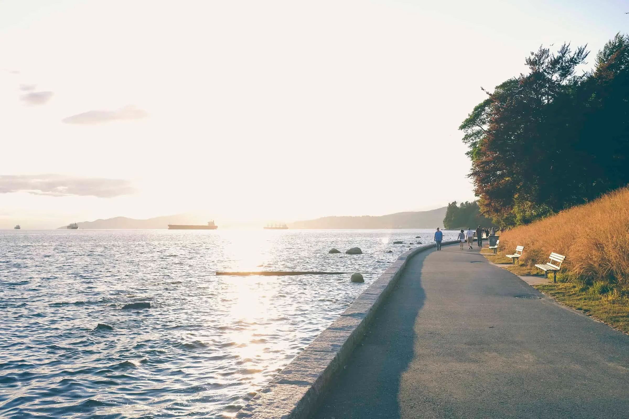
2. Stanley Park Seawall
Vancouver, BC
Distance: The Stanley Park portion measures 9 km (total 22 km)
Suggested Route: Begin at Second Beach and complete the loop.
Time: 2-3 hours
Parking: Pay parking is available within Stanley Park, at Coal Harbour or Beach Ave. Or better yet, leave the car at home and access via city buses.
Description: Officially opened in 1888, Stanley Park boasts quiet forest trails, beautiful beaches, a variety of restaurants and a world-class aquarium. The Seawall is a flat, paved route that traces the perimeter of the park. It offers stunning views of the city, the hubbub of Vancouver Harbour, tankers anchored in English Bay and the North Shore mountains. Keep an eye out for totem poles, a historic lighthouse, and the famous “Girl In a Wetsuit” statue as you follow this oceanside path.
Read more about the Seawall: vancouver.ca/seawall
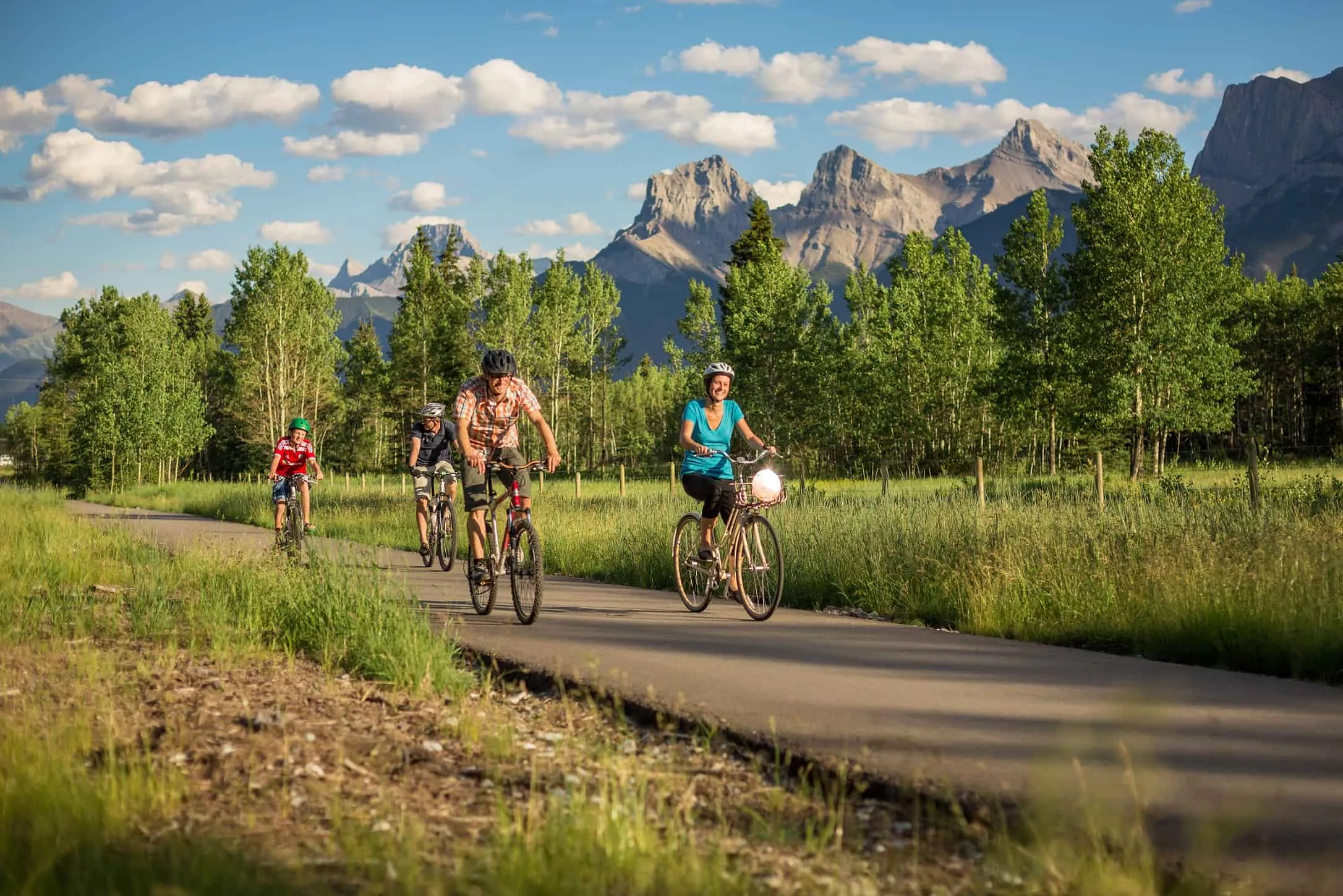
3. Rocky Mountain Legacy Trail
Banff-Canmore, AB
Distance: 22 km
Suggested Route: Start at the Travel Alberta Visitor’s Centre in Canmore, and walk through to the town of Banff.
Time: 4.5 hours
Parking: Parking is available in both Canmore and Banff. A bus runs between the two towns.
Description: The Rocky Mountain Legacy trail links the town of Banff with the less-famous but equally-beautiful town of Canmore. Heading west from Canmore this paved, gently undulating trail winds its way into Banff National Park, running parallel to the Trans-Canada Highway. The imposing beauty of the Rocky Mountains makes for stunning views in either direction, so you might want to allow extra time for photography breaks.
Read more about the Rocky Mountain Legacy Trail: tourismcanmore.com/legacy-trail
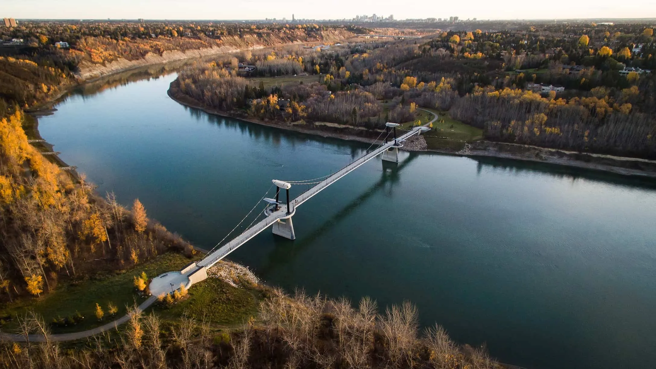
4. River Loop Trail
Edmonton, AB
Distance: 3.5 km
Suggested Route: Start and finish at the John Janzen Nature Centre.
Time: 45 minutes
Parking: Free parking at the nature centre.
Description: This short-but-sweet path circumnavigates Fort Edmonton Park, passing through a wooded area populated with aspen, paper birch and other local vegetation. The unpaved section of the trail follows the Edmonton River, before veering uphill, towards a paved section that passes around the other side of the park. If you are looking for a longer adventure, cross the Fort Edmonton Footbridge and continue your walk along the other side of the river, through Sir Wilfred Laurier Park.
Read more about River Loop Trail: edmonton.ca/JJNC_Trail_Maps
5. Assiniboine Riverwalk
Winnipeg, MB

Distance: 5.5 km (out-and-back)
Suggested Route: Manitoba Legislative Building to Esplanade Riel, and back.
Time: 1 −1.5 hours
Parking: Free and paid parking is available at the Forks.
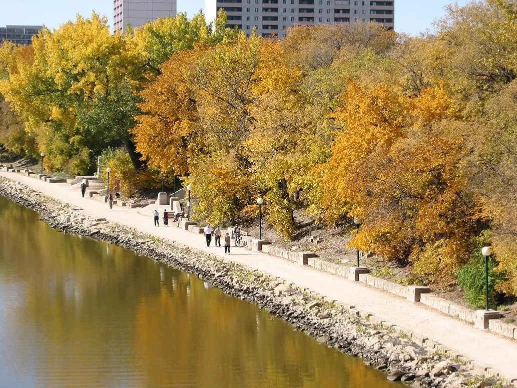
Description: Beginning at the Manitoba Legislative Building, this trail follows the tree-lined riverbanks of the Assiniboine through Bonnycastle Park, and The Forks National Historic Site, ending at the foot of the Esplanade Riel. Interpretive plaques provide quick, local, outdoor history lessons, which might be the best kind of history lesson, and side paths through both parks offer the opportunity to explore further.
Read more about Assiniboine Riverwalk: theforks.com/riverwalk
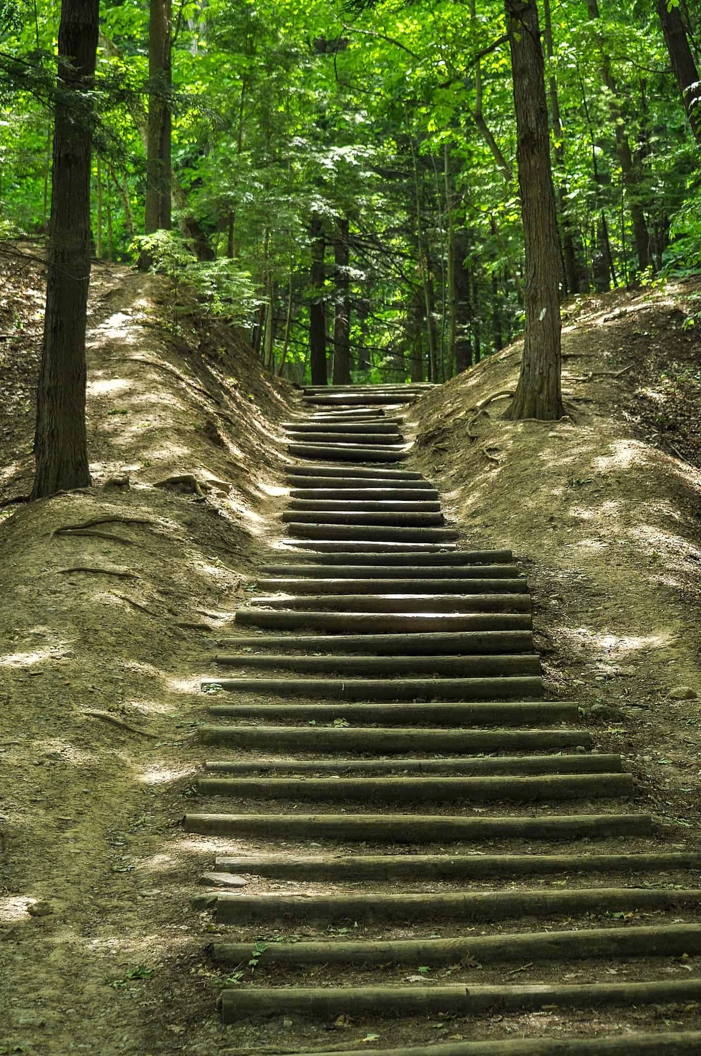
6. Rouge National Urban Park (Mast Trail)
Toronto, ON
Distance: 4.5 km (out-and-back)
Suggested Route: Begin at Glen Rouge Campground, and turn around at North Twyn Towers Drive, or link with Riverside Trail to make a loop.
Time: 1-2 hours
Parking: Limited parking is available at Glen Rouge Campground.
Description: Toronto’s Rouge National Urban Park is home to pristine beaches, rare ecosystems and the only campground Toronto. The Mast Trail offers an exceptional experience of the park.
Following a 200-year-old logging route, this challenging hike climbs up and along the “hog’s back” ridge, before heading back down again. If you’re looking for a little extra guidance or local interpretation, Parks Canada offers guided walks along this trail.
Read more about Mast Trail: rougepark.com/mast
7. Rideau Trail
Ottawa, ON

Distance: 5 km out-and-back (327 km total)
Suggested Route: Begin at the Ottawa Lockstation, and continue east along the Rideau Trail to the Canadian War Museum. Return via the same route.
Time: 1-2 hours
Parking: Parking is limited but can be found nearby at the National Arts Centre.
Description: Rideau Trail is a 327 km hiking route that runs between Kingston and Ottawa. If a multi-day through-hike isn’t your cup of tea, the portion of the trail starting directly beneath Parliament Hill offers a piece of nature, as well as a history lesson.
Starting at the historic Ottawa Locks the tree-shaded trail passes Bytown Museum before following the Ottawa River to the foot of Parliament Hill. It then heads past the Supreme Court of Canada towards the Canadian War Museum. Supplement your fresh air outing with a museum visit to brush up on your Canadian history.
Read more about Rideau Trail: rideautrail.org/discover-the-trail
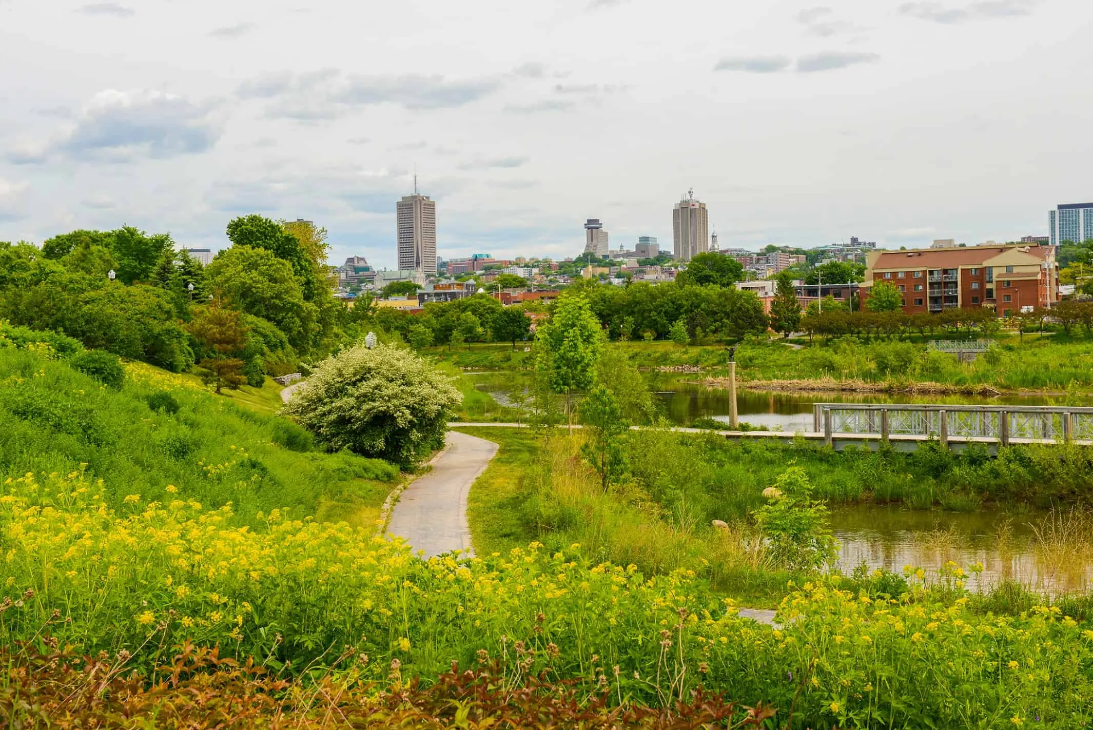
8. Parc linéaire de la rivière St-Charles (St. Charles River Linear Park)
Quebec City, QC
Distance: 5.5 km out-and-back (32 km total)
Suggested Route: Begin at the Chateau d’eau and head south, past the Kabir Kouba waterfall, and take a break at the viewpoint by the Johnny-Parent Boulevard bridge before turning around.
Time: 1-2 hours
Parking: Parking is available at multiple locations along the trail.
Description: This 32 km trail was created as part of an award-winning restoration project along the St. Charles River. The trail, divided into 13 distinct sections, runs from Old Quebec City to the river’s mouth at St. Charles Lake. It then passes by sculptures, leads across the Cartier-Brébeuf National Historic Site, and through several smaller parks and recreational areas.
Read more: quebecregion.com/parc-lineaire-riviere-saint-charles
Are you an urban hiker?
Which cities do you love walking in?
Let us know: tweet us or show us
on Instagram (tag @exploremagazine)

This article was brought to us by our friends at Merrell. This lightweight and breathable commuter sneaker balances comfort and performance with bike-specific technology for pedaling efficiency.
Related content on Explore
The Happy Camper: Walking is a Good Thing
Day trips near Toronto, Vancouver and Calgary


